River Erme

River Erme

Infobox_River
river_name = Erme


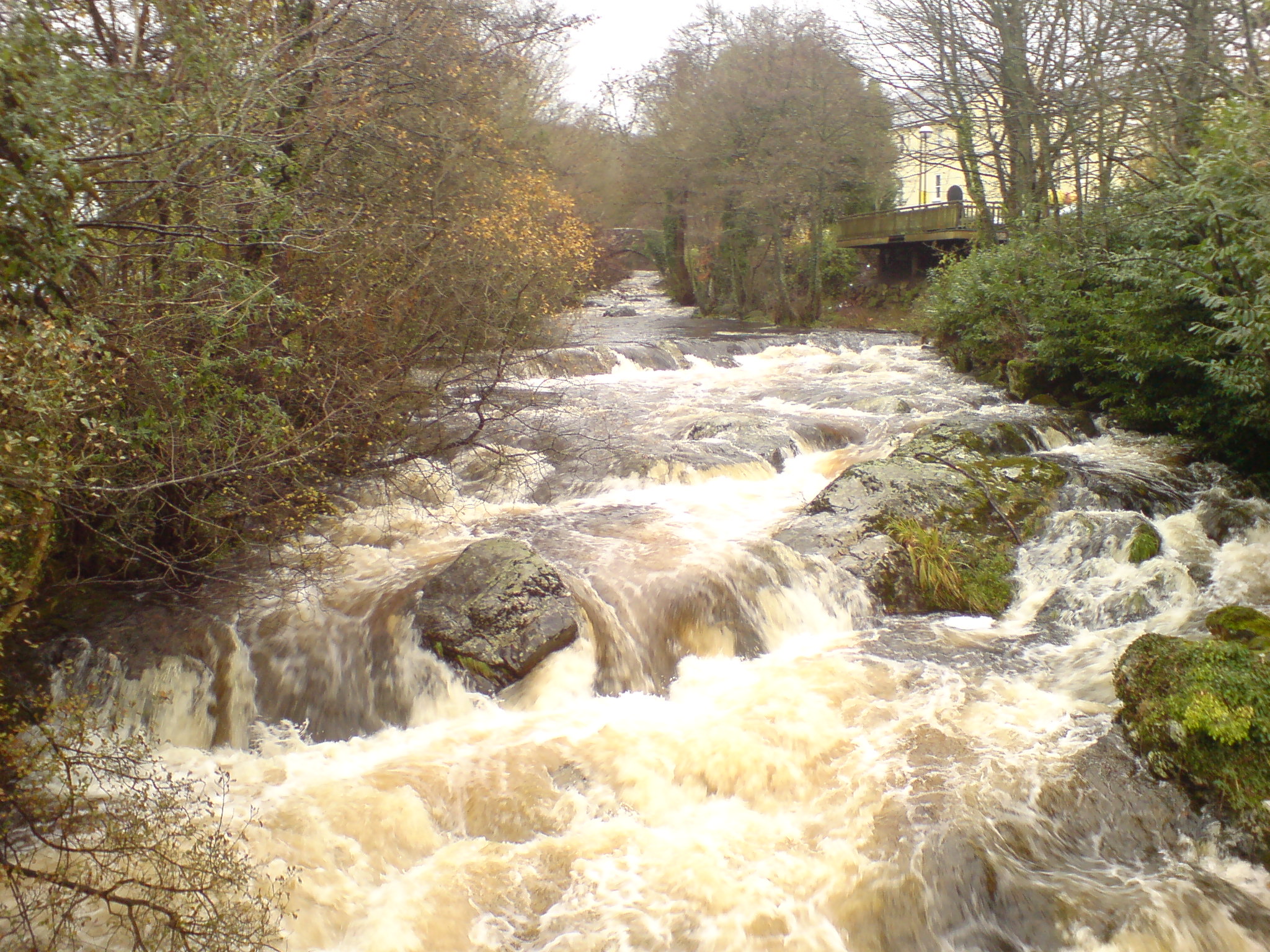
caption = The Erme flowing through the town of Ivybridge
origin = Dartmoor
mouth = English Channel
basin_countries = England
length =
elevation =
mouth_elevation =
discharge =
watershed =
The Erme is a river on Dartmoor, Devon, England. It rises in southern Dartmoor on the Abbot's Way near the source of the Plym. Near its source is an area of extensive early tin mining workings. In places the works are over 15 metres deep showing what was done by hand in those days. The river flows in a generally southerly direction past Erme Pound and then through a gorge where it passes Piles Copse, one of the few areas of ancient woodland on Dartmoor. The river continues southward, passes through the town of Ivybridge and becomes a ria shortly downstream near Ermington and Modbury, entering the English Channel near Kingston. At the mouth lie the beaches Wonwell and Mothercombe.

There are many good places to swim in the River Erme, there is a great spot around a 1/4 of the way into Long Timber Woods where there are rocks that you can jump off and a big deep pool where you can swim. Another place, locally known as 'The Travel Museum', due to the numerous trolleys and bikes on the River Bed, is near the Tennis Courts next to a grassy field, and this is good to swim in also - but there is nowhere to jump.

ee also

*Rivers of the United Kingdom

External links

* [http://www.ukriversguidebook.co.uk/erme.htm River Erme guide on the UK Rivers Guide Book site]
* [http://www.environment-agency.gov.uk/subjects/flood/floodwarning/2A0a Flood warnings on the River Erme] from the Environment Agency


Wikimedia Foundation. 2010.

Игры ⚽ Поможем сделать НИР

Look at other dictionaries:

  • River Culm — Old stone bridge with pedestrian refuges over River Culm at Culmstock The River Culm flows through Devon, England. It rises in the Blackdown Hills at a spring see OS map near Culmhead and flows west through Hemyock …   Wikipedia

  • Ivybridge — infobox UK place latitude= 50.389 longitude= 3.921 country = England official name= Ivybridge population= 12,581 (2006 est.)cite web |url=http://www.devon.gov.uk/index/democracycommunities/improving our services/facts figures and statistics/facts …   Wikipedia

  • Dartmoor — For the pony, see Dartmoor Pony; for the prison, see Dartmoor (HM Prison); for the Victorian hamlet in Australia, see Dartmoor, Victoria Coordinates: 50°34′N 4°0′W / 50.567° …   Wikipedia

  • South West Coast Path — The starting point at Minehead Length 630 miles (1,014 km) Location England: Somerset, Devon, Cornwall …   Wikipedia

  • Ivybridge — Ivybridge …   Wikipédia en Français

  • Mining in Cornwall and Devon — Ruin of Cornish tin mine …   Wikipedia

  • Duck's Pool, Dartmoor — View over Duck s Pool looking south east Duck s Pool is a small depression set in a remote location in the southern half of Dartmoor, Devon, England at grid reference SX624678 …   Wikipedia

  • Dartmoor tin-mining — The wheelpit at Huntingdon mine The Dartmoor tin mining industry is thought to have originated in pre Roman times,[1] and continued right through to the 20th century. From the 12th century onwards tin mining was regulated by a Stannary Parliament …   Wikipedia

  • Challaborough — The beach Challaborough is a villag …   Wikipedia

  • Kingston, Devon — Kingston is a small scattered village in the South Hams, three miles south west of Modbury, in Devon and about a mile from the mouth of the River Erme at Wonwell. It has a small village hall the Reading Room that is used regularly for village… …   Wikipedia

Share the article and excerpts

Direct link
Do a right-click on the link above
and select “Copy Link”