- Monkton, Kent
-
For other places with the same name, see Monkton (disambiguation).
Coordinates: 51°20′16″N 1°16′54″E / 51.3379°N 1.2817°E
Monkton 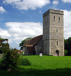
Church of St. Mary Magdelene, Monkton
 Monkton
Monkton shown within KentOS grid reference TR286649 Parish Monkton District Thanet Shire county Kent Region South East Country England Sovereign state United Kingdom Post town RAMSGATE Postcode district CT12 Dialling code 01843 Police Kent Fire Kent Ambulance South East Coast EU Parliament South East England UK Parliament South Thanet List of places: UK • England • Kent Monkton is a village and civil parish in the Thanet District of Kent, England. The village is located at the south-western edge of the Isle of Thanet and is situated mainly along the B2047 road, leading off the A263 road between Canterbury and Ramsgate. The civil parish stretches south to the River Stour and northwards towards Acol.[1] The hamlet of Gore Street is included in the parish.
The 13th century church is dedicated to St Mary Madgalene.[2]
Contents
Explosion
Monkton suffered an explosion during 2007, and was largely evacuated as a result. The Fire and Rescue service says that crews were faced with "a well developed fire in a large single-storey building", which was among the largest in the village.[3]
School
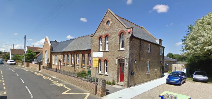
Monkton has a small joint junior and infant school. The Monkton Church of England Primary School is situated in the village of Monkton which is in Thanet, Kent. The school was purpose built in 1872 and was extended and modernised in 2007. It currently caters for 109 pupils ranging from 4 to 11 years.[4]
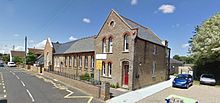 MonktonSchool
In 2007 Monkton Church of England Primary School celebrated a very successful Ofsted Inspection achieving a "very good" grading.[5] The registered inspector reported that "Monkton Church of England Primary is a good school with a number of outstanding features. Despite the upheaval of a major rebuilding program and much energy having to be directed to this, good leadership and management have ensured that pupils have continued to benefit from a good quality curriculum, good teaching and exceptionally high levels of care, support and guidance". The Inspector also noted that "the pupils personal development and well-being are outstanding. Their behaviour is exemplary."
The school provides a unique place to work and learn, and combines values in a modern and welcoming building. The staff and Headteacher have high expectations for all children who attend Monkton Church of England Primary School. The staff have a breadth and depth of professional knowledge and experience. The School works together with the community to provide the best education and to develop successful learners and confident individuals for the local population.
Nature reserve
Monkton has a nature reserve, situated on chalk hills to the north of the village. The reserve is set in a 16-acre (65,000 m2) abandoned chalk quarry which has been reclaimed by nature. It is notable for its geology and many important habitats, a pond and rare orchids. It also houses the Thanet Astronomical Observatory and the first artificial bat cave built in the UK. Facilities include a well equipped field centre with a museum, large reference library, bookshop and picnic site. The site is called Monkton Nature Reserve and is run by the environmental charity, Thanet Countryside Trust.[6]
References
- ^ Map of civil parish
- ^ Historic notes on the parish
- ^ Gas explosion in workshop blaze; BBC news; [2007,11,26]; retrieved on [2007-11-30]
- ^ Monkton Primary School Website; retrieved on 2008-05-22
- ^ Monkton Church of England Primary School; retrieved on 2008-05-22
- ^ Monkton Nature Reserve
External links
Towns and villages in the Thanet district of Kent, England 
Unparished areas Civil parishes Other settlements - Broadstairs
- Brooks End
- Cliftonville
- Ebbsfleet
- Flete
- Garlinge
- Newington
- Palm Bay
- Sevenscore
- St Peters
- Westbrook
- Westgate-on-Sea
- Westwood
Categories:- Thanet
- Villages in Kent
- Civil parishes in Kent


Wikimedia Foundation. 2010.