- Chatburn
-
Coordinates: 53°53′46″N 2°21′32″W / 53.896°N 2.359°W
Chatburn 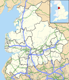
 Chatburn
Chatburn shown within LancashireOS grid reference SD765445 District Ribble Valley Shire county Lancashire Region North West Country England Sovereign state United Kingdom Post town CLITHEROE Postcode district BB7 Dialling code 01200 Police Lancashire Fire Lancashire Ambulance North West EU Parliament North West England UK Parliament Ribble Valley List of places: UK • England • Lancashire Chatburn is a village located in the Ribble Valley, East Lancashire, England. It is situated in a hollow between two ridges north-east of Clitheroe, just off the A59 road. It lies near Pendle Hill, which is to the east of the village. The River Ribble flows to the west of the town. The town is approximately 400 feet above sea level.
The village itself can be dated back to Anglo-Saxon times; it takes its name from one of the most distinguished characters of that time, St Chad. The village sits outside the Forest of Bowland and was never considered part of the ancient Lordship of Bowland.
A feature of the village is the spire of the parish church, which was erected around 1838. The steeple was struck by lightning in 1854, but was rebuilt in the same year.
Chatburn also had its own railway station, but it was closed by Dr Beeching in 1962.
The village also features Chatburn Post Office which was bombed during WW2. [1]
See also
- Chatburn (surname)
- Christ Church, Chatburn
References
- ^ http://www.chatburnvillage.org.uk/Bombing_story.html#> Chatburn Bombing Story
External links
Ceremonial county of Lancashire North West England Portal Unitary authorities Boroughs or districts Major settlements Accrington • Adlington • Bacup • Barnoldswick • Blackburn • Blackpool • Brierfield • Burnley • Burscough • Carnforth • Chorley • Clayton-le-Moors • Cleveleys • Clitheroe • Colne • Darwen • Earby • Fleetwood • Garstang • Great Harwood • Haslingden • Kirkham • Lancaster • Leyland • Longridge • Lytham St Annes • Morecambe • Nelson • Ormskirk • Oswaldtwistle • Padiham • Penwortham • Poulton-le-Fylde • Preesall • Preston • Rawtenstall • Rishton • Skelmersdale • Wesham • Whitworth
See also: List of civil parishes in LancashireRivers Canals Topics Categories:- Lancashire geography stubs
- Villages in Lancashire
- Civil parishes in Lancashire
- Geography of Ribble Valley

Wikimedia Foundation. 2010.