- Alabama River
Infobox_River
river_name = Alabama River
image_size = 300px
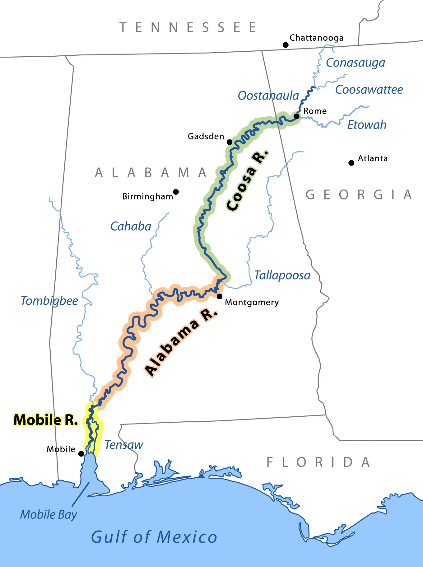
caption = The Mobile, Alabama, and Coosa rivers are essentially a single river whose name changes at the confluences of major tributaries.
origin =
mouth =
basin_countries =
length = 312 miles (502 km)
elevation =
mouth_elevation =
discharge =
watershed = The Alabama River, in the U.S. state ofAlabama , is formed by the Tallapoosa and Coosa rivers, which unite about six miles above Montgomery.The river flows west to Selma, then southwest until, about 45 miles (72 km) from Mobile, it unites with the Tombigbee, forming the Mobile and Tensaw rivers, which discharge into
Mobile Bay .The course of the Alabama is very meandering. Its width varies from 50 to 200 yards, and its depth from 3 to 40 feet. Its length as measured by the
United States Geological Survey is 312 miles (502 km), and by steamboat measurement, 420 miles (676 km).The river crosses the richest agricultural and timber districts of the state, and
railway s connect it with themineral regions of north central Alabama.After the Coosa and Tallapoosa rivers, the principal tributary of the Alabama is the
Cahaba River , which is about 200 miles (300 km) long and joins the Alabama River about 10 miles (16 km) below Selma. The Alabama River's main tributary, the Coosa River, crosses the mineral region of Alabama and is navigable for light-draft boats fromRome, Georgia , to about 117 miles (188 km) above Wetumpka (about 102 miles below Rome and 26 miles (42 km) below Greensport), and from Wetumpka to its junction with the Tallapoosa. The channel of the river has been considerably improved by the federal government.The navigation of the Tallapoosa River –- which has its source in
Paulding County, Georgia , and is about 250 miles (400 km) long -– is prevented byshoal s and a 60-foot (18 m) fall at Tallassee, a few miles north of its junction with the Coosa. The Alabama is navigable throughout the year.The river played an important role in the growth of the
economy in the region during the 19th century as a source oftransportation of goods. The river is still used for transportation of farming produce; however, it is not as important as it once was due to the construction ofroad s andrailway s.The Alabama, Coosa, and Tallapoosa rivers were central to the homeland of the Creek Indians before their removal in the early 19th century.
External links
* [http://reference.allrefer.com/gazetteer/A/A02218-alabama-river.html Allrefer.com]
* [http://Alabamamilebymile.com Alabamamilebymile.com] features an online map of the Alabama River between Selma and Tallassee including navigational, recreational and cultural landmarks. (Dead link 2007-04-28)
Wikimedia Foundation. 2010.