- Weitchpec, California
-
Coordinates: 41°11′17″N 123°42′30″W / 41.18806°N 123.70833°W
Weitchpec — Unincorporated community — Location in California
 Weitchpec
Coordinates: 41°11′17″N 123°42′30″W / 41.18806°N 123.70833°W Country United States State California County Humboldt County Elevation[1] 361 ft (110 m) Weitchpec (formerly, Durkee's Ferry and Weitchpec Bar)[2] is an unincorporated community in Humboldt County, California, United States.[1] It is located 35 miles (56 km) northeast of Eureka,[2] at an elevation of 361 feet (110 m).[1] The ZIP Code is 95546.[3]
Weitchpec is located in the northern part of the state at the confluence of the Klamath and Trinity Rivers, and the junction of State Highways 96 and 169.[4]
Weitchpec was originally the site of a Yurok village. The name Durkee's Ferry recalls Clark W. Durkee, who operated a ferry at the place in 1851.[2] In 1855, a temporary Federal post called Camp Strowbridge was established at Weitchpec, it was later called Fort Wool. A post office operated at Weitchpec from 1858 to 1860 and from 1891 to 1962.[2]
Today Weitchpec features Pearson's Grocery, a small store/gas station; the Yurok Tribal Office and Community Center; and Weitchpec Elementary School.
References
- ^ a b c U.S. Geological Survey Geographic Names Information System: Weitchpec, California
- ^ a b c d Durham, David L. (1998). California's Geographic Names: A Gazetteer of Historic and Modern Names of the State. Quill Driver Books. p. 165. ISBN 9781884995149.
- ^ USPS ZIP Code lookup tool
- ^ USGS Map "Weitchpec Quadrangle, 1997" 7.5 min. series
Municipalities and communities of Humboldt County, California Cities 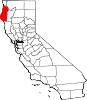
CDPs Alderpoint | Bayview | Benbow | Big Lagoon | Cutten | Fieldbrook | Fields Landing | Garberville | Humboldt Hill | Hydesville | Indianola | Loleta | McKinleyville | Manila | Miranda | Myers Flat | Myrtletown | Orick | Phillipsville | Pine Hills | Redcrest | Redway | Samoa | Scotia | Shelter Cove | Weott | Westhaven-Moonstone | Willow Creek
Unincorporated
communitiesAlton | Bayside | Blocksburg | Bracut | Brainard | Briceland | Bridgeville | Bucksport | Calville | Carlotta | Crannell | Dinsmore | Elk River | Englewood | Fairhaven | Fernbridge | Fort Seward | Freshwater | Freshwater Corners | Fruitland | Glendale | Holmes | Honeydew | Hoopa | Johnsons | King Salmon | Kneeland | Korbel | Maple Creek | Metropolitan | Moonstone | Orleans | Patricks Point | Pepperwood | Petrolia | Pine Hill | Port Kenyon | Ridgewoods Heights | Riverside Park | Rohnerville | Rosewood | Shively | Stafford | Sunny Brae | Weitchpec | Westhaven | Whitethorn
Indian
reservationsBig Lagoon Rancheria | Blue Lake Rancheria | Hoopa Valley Indian Reservation | Yurok Indian Reservation
Ghost towns Acorn | Albeeville | Apyu | Aranimokw | Arekw | Atsepar | Bald Hills | Blaine | Brock Creek | Bryan | Bryant | Buck's Port | Camp 4 Flat | Camp 19 | Camp Grant | Centerville | Chinits | Cleveland | Daby's Ferry | Dark Canyon | Dinty | Dyer Place | Eddyville | Elinor | Elk Grove | Elk Prairie | Erner | Ertlerger | Eshpeu | Frank | Gans | Hadley | Hartsook | Honsading | Humboldt City | Iaqua | Kokaman | Kworatem | Lippitt | Lockharts | Lone Star | Loolego | Luffenholtz | Mandala | Martins Ferry | McDuff | Meridian | Mountain View | Mower | Myrtle Grove | Northern Redwood Camp | Oketo | Opegoi | Ore'q | Panamenik | Pasara | Pekwan | Pekwuteu | Robinson's Ferry | Scribner | Shanamkarak | Showers Pass | Shregegon | Shumig | Skelly | Smith | Tanoak | Three Cabins | Tsofkara | Tsurau | West Humboldt | Wilder
Categories:- Humboldt County, California geography stubs
- Populated places in Humboldt County, California
- Unincorporated communities in California


Wikimedia Foundation. 2010.