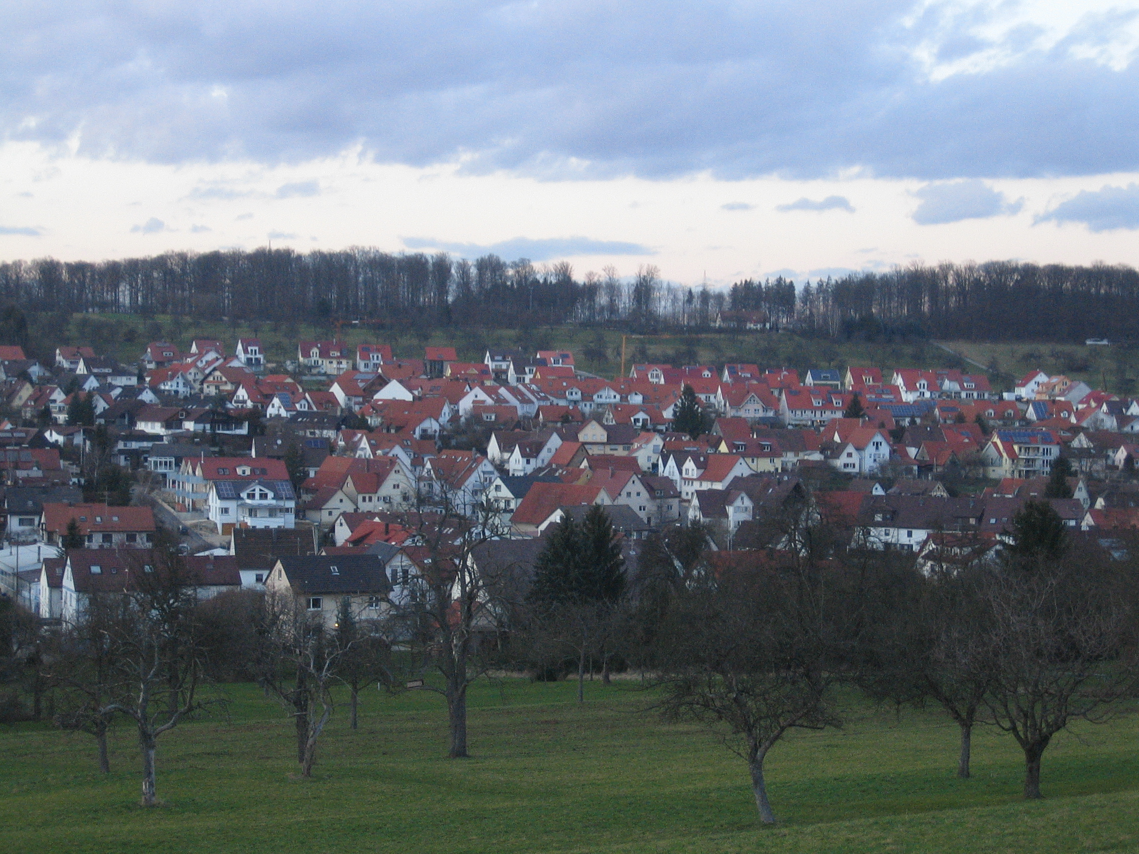
- Notzingen
-
Notzingen 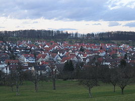


 NotzingenLocation of Notzingen within Esslingen district
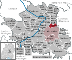

Coordinates 48°40′16″N 9°27′23″E / 48.67111°N 9.45639°ECoordinates: 48°40′16″N 9°27′23″E / 48.67111°N 9.45639°E Administration Country Germany State Baden-Württemberg Admin. region Stuttgart District Esslingen Mayor Sven Haumacher Basic statistics Area 7.70 km2 (2.97 sq mi) Elevation 316 m (1037 ft) Population 3,552 (31 December 2010)[1] - Density 461 /km2 (1,195 /sq mi) Other information Time zone CET/CEST (UTC+1/+2) Licence plate ES Postal code 73274 Area code 07021 Website www.notzingen.de Notzingen is a town in the district of Esslingen in Baden-Württemberg in southern Germany.
Contents
Geography
Notzingen is east of the district of Esslingen, in a valley between Kirchheim unter Teck and Hochdorf. The town is 35 km (22 mi) southeast from Stuttgart and 50 km (31 mi) from Ulm.
Nearby municipalities
- Wernau (Neckar)
- Hochdorf (Plochingen)
- Rosswälden
- Schlierbach
- Kirchheim unter Teck
Politics
Mayor
- 1952 - 1987 Helmut Maier (independent)
- 1987 – 2011 Jochen Flogaus (independent)
- from 2011 Sven Haumacher (CDU)
Municipal council
The result of the local government elections at 13. June 2004:
CDU 52,2% -2,2 7 seats -1 FWG 27,1% +1,6 4 seats +1 SPD 20,7% +0,6 3 seats ±0 Religions
- Protestant: 1941
- Roman Catholic: 815
Economy and infrastructure
Companies
- Eloxal Barz GmbH und Co. KG.
- Le Creuset GmbH
Education
- Notzingen has one basic school and three kindergartens.
References
- ^ "Bevölkerung und Erwerbstätigkeit" (in German). Statistisches Landesamt Baden-Württemberg. 31 December 2009. http://www.statistik-bw.de/Veroeffentl/Statistische_Berichte/3126_10001.pdf.
External links
Aichtal | Aichwald | Altbach | Altdorf | Altenriet | Baltmannsweiler | Bempflingen | Beuren | Bissingen (Teck) | Deizisau | Denkendorf | Dettingen (Teck) | Erkenbrechtsweiler | Esslingen am Neckar | Filderstadt | Frickenhausen | Großbettlingen | Hochdorf | Holzmaden | Kirchheim (Teck) | Kohlberg | Köngen | Leinfelden-Echterdingen | Lenningen | Lichtenwald | Neckartailfingen | Neckartenzlingen | Neidlingen | Neuffen | Neuhausen (Fildern) | Notzingen | Nürtingen | Oberboihingen | Ohmden | Ostfildern | Owen | Plochingen | Reichenbach an der Fils | Schlaitdorf | Unterensingen | Weilheim | Wendlingen | Wernau | Wolfschlugen Categories:
- Geography articles needing translation from German Wikipedia
- Municipalities in Baden-Württemberg
- Towns in Baden-Württemberg
- Esslingen district
- Stuttgart region geography stubs


Wikimedia Foundation. 2010.