- Dewanganj Upazila
-
Dewanganj
দেওয়ানগঞ্জ— Upazila — Location in Bangladesh
 Dewanganj
Coordinates: 25°8.5′N 89°47′E / 25.1417°N 89.783°ECoordinates: 25°8.5′N 89°47′E / 25.1417°N 89.783°E Country  Bangladesh
Division Dhaka Division District Jamalpur District Area - Total 266.59 km2 (102.9 sq mi) Population (1991) - Total 193,182 - Density 725/km2 (1,877.7/sq mi) Time zone BST (UTC+6) Postal code 2030 Website Official Map of Dewanganj Dewanganj (Bengali: দেওয়ানগঞ্জ) is an Upazila of Jamalpur District in the Division of Dhaka, Bangladesh.Dewanganj Upazila (jamalpur district) with an area of 266.59 sq km, is bounded by char rajibpur upazila on the north, islampur upazila on the south, baksiganj upazila and Meghalaya (India) on the east, gaibandha sadar and fulchhari upazilas on the west. Main rivers are Jamuna, old Brahmaputra, Brahmaputra. Dewanganj (Town) The town is now a municipality with an area of 4.54 sq km and population 34997; male 49.83%, female 50.17%. It has 9 wards and 43 mahallas. Literacy rate among the town people is 32.4%. Administration Dewanganj thana, now an upazila, was established in 1874.[1]
Contents
History
The early name of Dewanganj was 'Paddat Nagar' named after by a Hindu Land Lord. During the Mughal period two saints, Dewan Shah Jalal and Dewan Shah Jamal, preached Islam in the area. Dewanganj is named after these two saints. Bahadurabad Ghat of this upazila was a very important strategic place in the northern sector during 1971 . The Pak army deployed one-platoon soldiers of the 31st Baluch Regiment, one company Para Military Rangers Forces and about 50 Razakars to keep full control over the Bahadurabad Ghat along with the Jamuna River. On 3 July 1971 a group of 400 freedom fighters attacked the Bahadurabad Ghat under the command of Major Shafayet Jamil. The Pak army was defeated in this three-day battle; with this the freedom fighters were able to disrupt the railway communication berween Jamalpur and Bahadurabad Ghat.Marks of War of Liberation Mass grave 3. [2].
Geography
Dewanganj is located at 25°08′30″N 89°47′00″E / 25.1417°N 89.7833°E . It has 38023 units of house hold and total area 266.59 km².
Demographics
As of the 1991 Bangladesh census, Dewanganj has a population of 193182. Males constitute are 50.47% of the population, and females 49.53%. This Upazila's eighteen up population is 92441. Dewanganj has an average literacy rate of 20.9% (7+ years), and the national average of 32.4% literate.[3]
Administrative
Dewanganj has 10 Unions/Wards, 47 Mauzas/Mahallas, and 172 villages.
Educational institutions
College 2, government high school 1, non-government high school 15, Madrasa 5, government primary school 115, non-government primary school 63.Cultural organisations Club 61, library 1, cinema hall 2, theatre group 1, literary society 8, women's organisation 1, playground 31. Noted educational institutions: Dewangonj Government High School, Dewangonj Girls High School, A.K memorial College, Polly-technical College, Zill-Bangla High School, Aliya Madrasa, Sananda Bari High School, Sananda Bari Degree College,M.M memorial College,Hatibhanga.
Industry,Agriculture and others
Zill-Bangla sugar Mill. One of the finest sugar factory in Bangladesh. This sugar factory situated in Mill Bazar near Dewangonj railway station. Main crops Paddy, jute, sugarcane, mustard seed, wheat, potato, garlic, cabbage, cauliflower, brinjal, varieties of pulse and vegetables.Extinct or nearly extinct crops Ground nut, kaun. Main fruits Mango, banana, coconut, watermelon and futi. Fisheries, dairies, poultry Cattle breeding farm 1, hatchery 1.Cottage industries Loom 1400, handicraft 39, blacksmith 72, potteries 11, bamboo and cane work 71, wood work 159, painter 7, jute and cotton work 96 and tailoring 200.
Religion
Religious institutions Mosque 322, temple 5. Muslim 97.82%, Hindu 2.01%, Buddhist 0.02%, Christian 0.03% and others 0.12%.
Occupations
Main occupations Agriculture 39.34%, fishing 1.81%, agricultural labourer 28.77%, wage labourer 3.76%, commerce 9.44%, service 5.69% and others 11.19%.Land use Total cultivable land 16385.27 hectares, fallow land 2554.03 hectares; single crop 16.67%, double crop 45.86% and treble crop 9.81%; land under irrigation 771.35 hectares.Land control Among the peasants 14.04% are landless, 40.96% marginal, 27.82% small, 13.58% intermediate and 3.60% rich; cultivable land per head is 0.18 hectare.Value of land The market value of the land of the first grade is Taka 7500 per 0.01 hectare.
NGOs
NGO activities Operationally important NGOs are brac, asa, grameen bank, Unnayan Sangha and Progress.
Heath
Health centers Upazila health complex 1, family planning centre 8, satellite clinic 2.
Rivers
Jamuna and Brahammaputra.
Hats, bazars, place,model and fairs
Hats and bazars are 33, most noted are Dewanganj bazar, Sananda Bari Bazar, Moulvir chor bazar, fair 1 (Baruni Mela at Chaitra Samkranti) every year also observed Pahela Baishakh and arranged Mela at Sananda Bari Hich School yard.
References
- ^ banglapeadia
- ^ দেওয়ানগঞ্জের ইতিহাস by Shamresh Saha Bappy; 2011
- ^ "Population Census Wing, BBS.". Archived from the original on 2005-03-27. http://web.archive.org/web/20050327072826/http://www.bangladeshgov.org/mop/ndb/arpc91_v1/tables04.htm. Retrieved November 10, 2006.
 Upazilas of the Dhaka Division
Capital: Dhaka Dhaka District 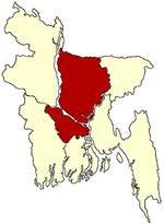
Faridpur District Gazipur District Gopalganj District Jamalpur District Kishoreganj District Astagram · Bajitpur · Bhairab · Hossainpur · Itna · Karimganj · Katiadi · Kishoreganj · Kuliarchar · Mithamain · Nikli · Pakundia · TarailMadaripur District Manikganj District Munshiganj District Mymensingh District Bhaluka · Dhobaura · Phulbari · Gaffargaon · Gauripur · Haluaghat · Ishwargan Mymensingh · Muktagachha · Nandail · Phulpur TrishalNarayanganj District Narsingdi District Netrokona District Atpara · Barhatta · Durgapur · Khaliajuri · Kalmakanda · Kendua · Madan · Mohanganj · Netrokona · PurbadhalaRajbari District Shariatpur District Sherpur District Tangail District Categories:- Upazilas of Jamalpur District
- Dhaka Division geography stubs


Wikimedia Foundation. 2010.