- Mount Abraham (Maine)
-
Mount Abraham 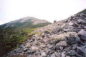
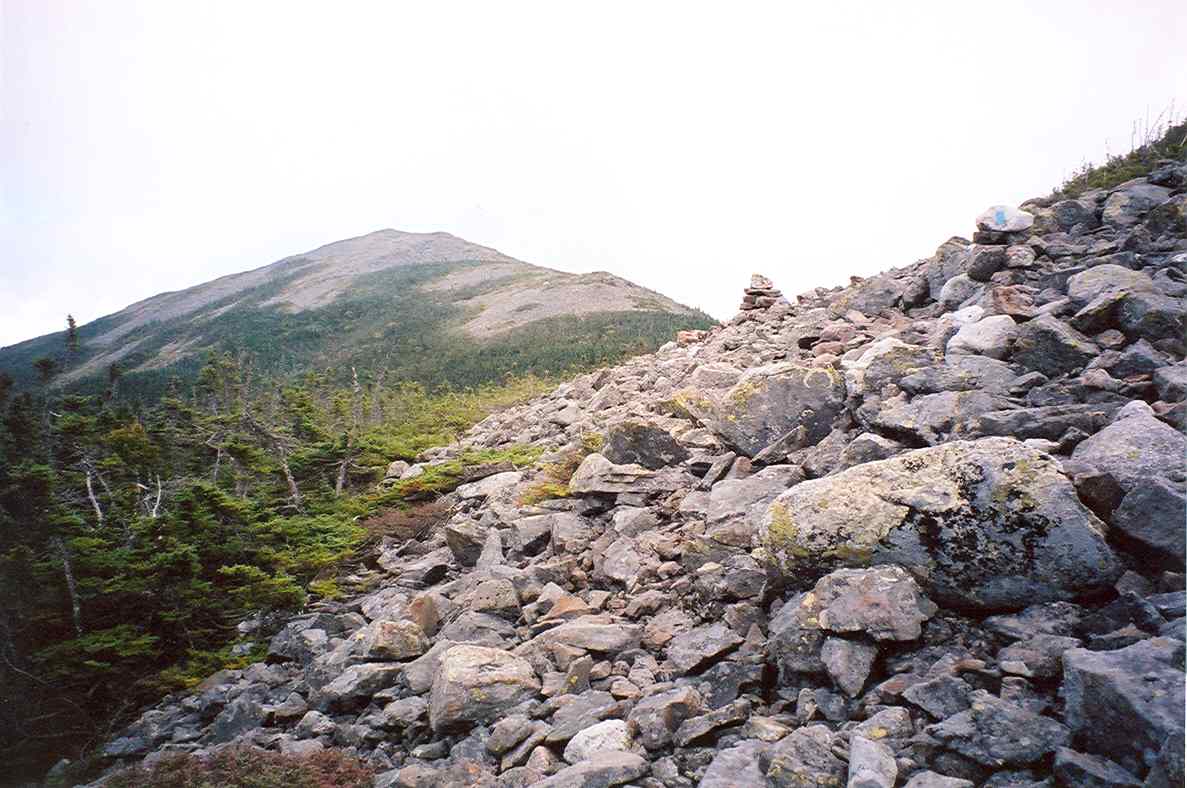
Mount Abraham seen from the Mount Abraham Side TrailElevation 4,050 ft (1,234 m) Prominence 900 ft (274 m) Listing New England 4000 footers Location Franklin County, Maine, USA
 Mount Abraham
Coordinates 44°58.38′N 70°19.59′W / 44.973°N 70.3265°WCoordinates: 44°58.38′N 70°19.59′W / 44.973°N 70.3265°W Topo map USGS Mount Abraham Mount Abraham is a mountain located in Franklin County, Maine. Mount Abraham is flanked to the north by Spaulding Mountain.
Contents
Watersheds
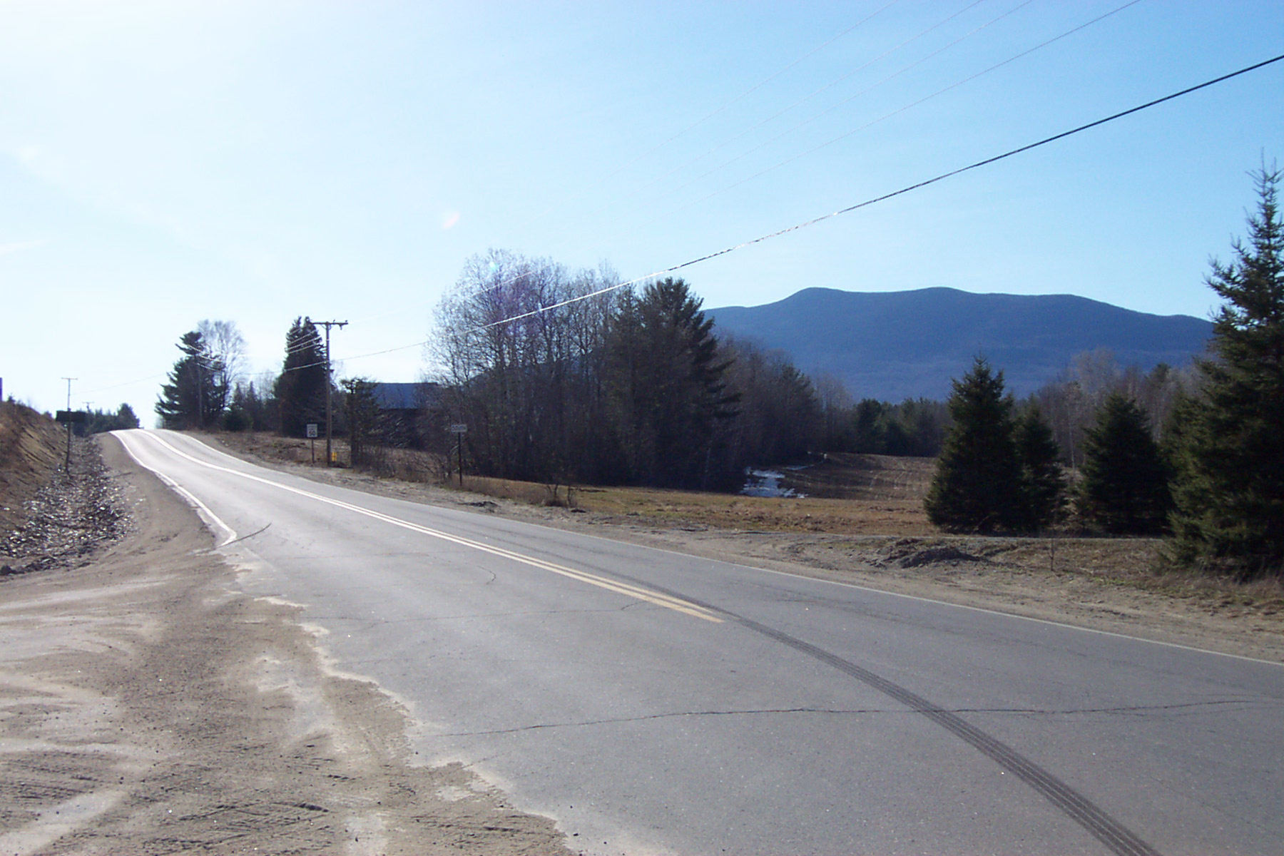
 Mount Abraham viewed from the south, at the junction of Routes 142 and 145, in Freeman Township
The northeast side of Mt. Abraham is drained by Rapid Stream, thence into the West Branch of the Carrabassett River, the Kennebec River, and into the Gulf of Maine. The southern half of the southwest side drains into Quick Stream, thence into the West Branch. The northern half drains into Perham Stream, thence into Orbeton Stream, and the Sandy River, another tributary of the Kennebec.
History
The mountain was logged in the late 19th century. Logs were moved down-slope in ice-covered wooden sluices. Logs, lumber, and pulpwood were shipped on the narrow-gauge Sandy River and Rangeley Lakes Railroad.[1]
Access
The Appalachian Trail (AT), a 2,170-mile (3,500-km) National Scenic Trail from Georgia to Maine, runs between Saddleback Junior and Spaulding, passing 2 mi. (3 km) northwest of the summit of Abraham. The summit of Mount Abraham can be reached from the AT via the Mount Abraham Side Trail.
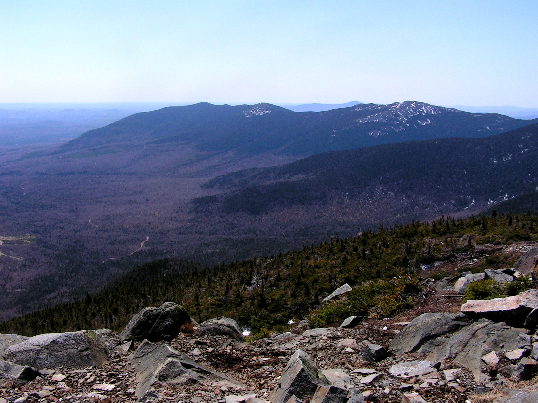
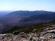 Mount Abraham viewed from the north, at the top of nearby Sugarloaf Mountain
South side route to the Summit
The South Side Trail head which is a snomobile/ATV trail to the summit of Mount Abraham is located on an unmarked logging road located at Lat/Long 44°57′35″N 70°19′00″W / 44.959666°N 70.31660°W [2]. Directions to the South Side Trailhead of Mount Abraham include navigating through a maze of 7 unnamed dirt logging roads.[3] Access to the south side trailhead requires an off-road capable vehicle to get over logging road washouts.
See also
Notes
References
- Jones, Robert C. (1979). Two Feet Between the Rails (Volume 1 - The Early Years). Sundance Books.
External links
- U.S. Geological Survey Geographic Names Information System: Mt. Abraham
- maineadventure.net: Mount Abraham Directions
- "Mount Abraham, Maine". Peakbagger.com. http://www.peakbagger.com/peak.aspx?pid=6844.
- summitpost.org: Mt. Abraham
4000-foot mountains of New England Baxter State Park High Peaks Abraham · Crocker · Redington · Saddleback · Saddleback, The Horn · South Crocker · Spaulding · SugarloafBigelow Range Eastern White Mountains Northern ranges Carter-Moriah Range Presidential Range Crawford Notch area Twin Range Pemigewasset Wilderness Sandwich Range Osceola · Osceola (East) · Tripyramid (Middle) · Tripyramid (North) · Passaconaway · Tecumseh · WhitefaceFranconia Range Western White Mountains Green Mountains Categories:- Mountains of Franklin County, Maine
- New England Four-thousand footers
- Maine geography stubs

Wikimedia Foundation. 2010.