- Zagórz
Infobox Settlement
name = Zagórz
imagesize = 250px
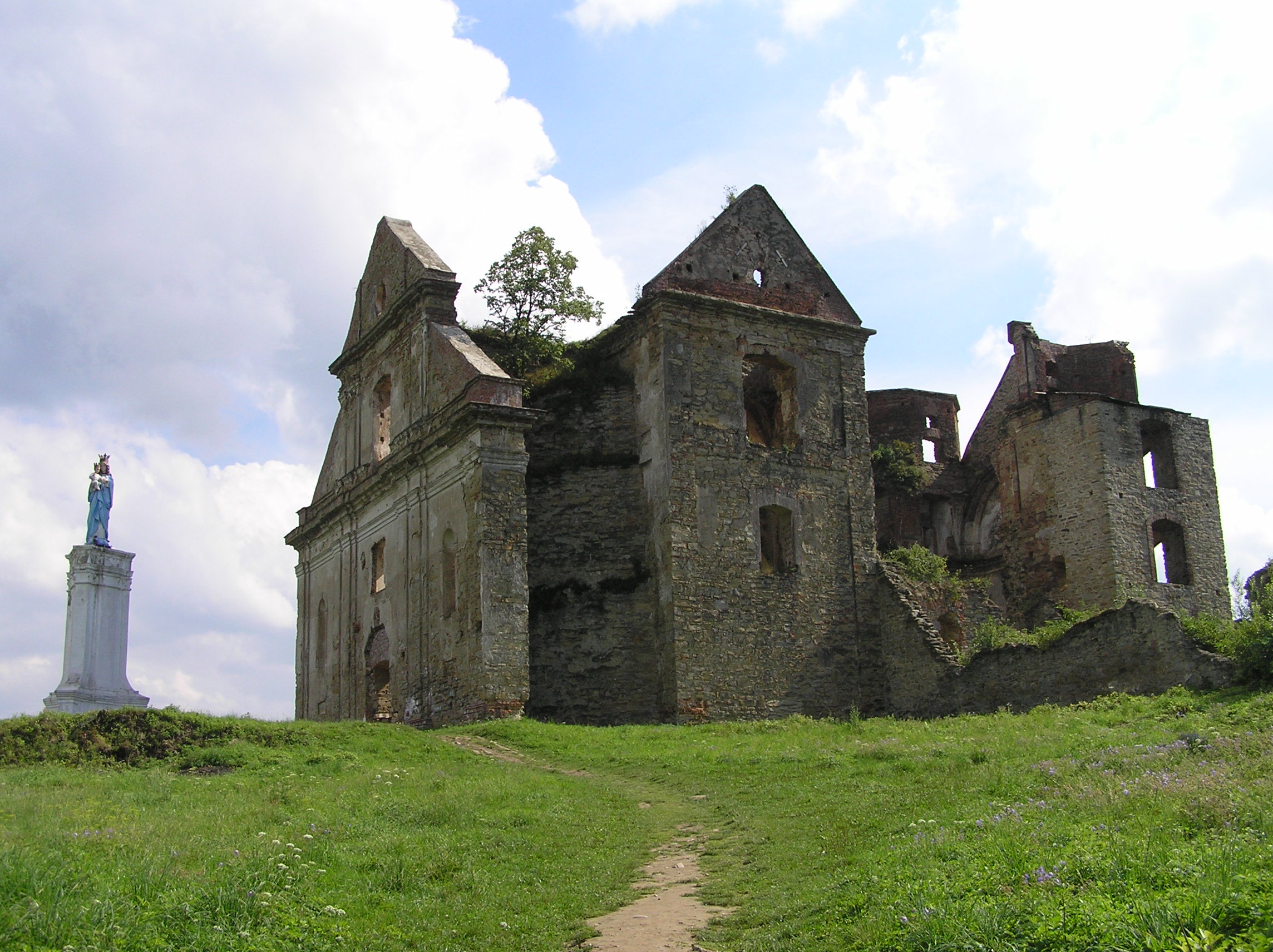
image_caption = Monastery ruins
image_shield = POL Zagórz COA.svg
pushpin_
pushpin_label_position = bottom
subdivision_type = Country
subdivision_name = POL
subdivision_type1 = Voivodeship
subdivision_name1 = Subcarpathian
subdivision_type2 = County
subdivision_name2 = Sanok
subdivision_type3 =Gmina
subdivision_name3 = Zagórz
leader_title = Mayor
leader_name = Bogusław Jaworski
established_title = Established
established_date = 1412
established_title3 = Town rights
established_date3 = 1977
area_total_km2 = 22.39
population_as_of = 2006
population_total = 4990
population_density_km2 = auto
timezone = CET
utc_offset = +1
timezone_DST = CEST
utc_offset_DST = +2
latd = 49 | latm = 31 | lats = | latNS = N | longd = 22 | longm = 16 | longs = | longEW = E
postal_code_type = Postal code
postal_code = 38-540
area_code = +48 13
blank_name = Car plates
blank_info = RSA
website = http://www.zagorz.pl Zagórz [IPA-pl|'|z|a|g|u|sz] is a town inSanok County ,Subcarpathian Voivodeship ,Poland , on the riverOsława in the Bukowsko Upland mountains, located near the towns ofMedzilaborce andPalota (in northeasternSlovakia ). It has a population of 4,963 (2004).There existed a Nazi
Zaslaw camp during World War II in Zasław, now part of Zagórz. Zagorz is the southeasternmost railroad junction of thePKP , with lines going into three directions - eastwards (toKrościenko and Ukrainian border), southwards (toNowy Lupkow andSlovakia n border) and westwards (toJasło and the rest of the country).References
Literature
* Prof.
Adam Fastnacht . Slownik Historyczno-Geograficzny Ziemi Sanockiej w Średniowieczu (Historic-Geographic Dictionary of the Sanok District in the Middle Ages), Kraków, 2002, ISBN 83-88385-14-3.External links
* [http://www.zagorz.pl/ Official town webpage]

Wikimedia Foundation. 2010.