- U.S. Route 259
Infobox U.S. Route
article_route=259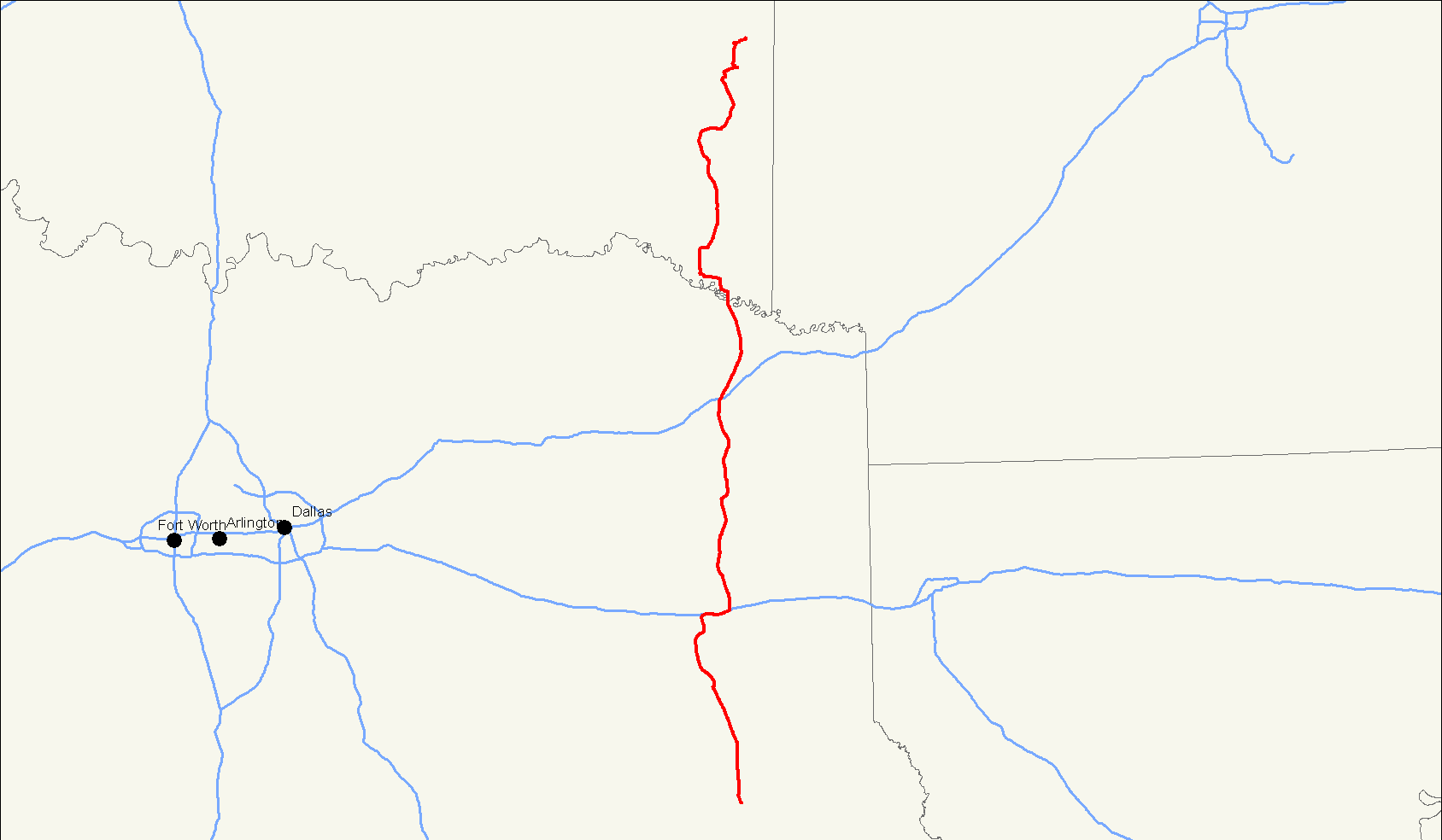
yrcom=1963 [Droz, Robert V. [http://www.us-highways.com/usbt.htm U.S. Highways : From US 1 to (US 830)] . URL accessed30 April 2006 ]
length_mi=250
length_km=402
direction_a=South
direction_b=North
from=Jct|state=TX|US|59|US-Bus|59|dab2=Nacogdoches in Nacogdoches, TX
to=Jct|state=OK|US|59|US|270 south of Heavener, OK
spur_of=59U.S. Route 259 is a north-south spur of
U.S. Route 59 that runs for 250 miles (402 km) through rural areas of southeastOklahoma and northeastTexas .The highway's northern terminus is in the
Ouachita Mountains , about 15 miles south ofHeavener, Oklahoma , where it branches off of its parent route, U.S. 59. The southern terminus is nearNacogdoches, Texas , where it reunites with U.S. 59. For most of its length, US 259 lies 30-50 miles to the west of its parent route.Route description
Texas
US 259 begins at an intersection with its parent, US 59, on the north side of Nacogdoches, Texas. The highway continues due north, passing through Mount Enterprise, and around the eastern side of Henderson and Kilgore. It then has a concurrency with Interstate 20 of about 6 miles, then continues north around the eastern edge of Longview. The highway continues due north, crossing Interstate 30 in northern Morris County, and crossing into Oklahoma in northwest Bowie County.
Oklahoma
After crossing into
McCurtain County, Oklahoma , US-259 immediately meets up with State Highway 87, and continues north through Harris. Maps indicate that US-259 and SH-87 overlap to Idabel, but officially, this is not the case,cite map|publisher=Oklahoma Department of Transportation|title=2008 Control Section Maps|page=McCurtain 45|url=http://www.odot.org/hqdiv/p-r-div/maps/control-maps/mccurtain.pdf|accessdate=2008-06-06] and ODOT signage does not reflect a concurrency.US-259 bypasses Idabel to the south and east, concurring with U.S. Highway 70 Bypass. East of Idabel, the bypass route ends, and US-259 begins a concurrency with mainline US-70 and SH-3. The three highways continue north to Broken Bow, where US-70 splits to the east toward
DeQueen, Arkansas and SH-3 splits to the west, bound for Antlers. US-259 continues north alone, taking a winding path through theOuachita Mountains of southeastern Oklahoma. The route passesBroken Bow Lake on its west side, with State Highway 259A serving as an access loop to the lake and Beavers Bend State Resort. Near the lake, US-259 crosses through theOuachita National Forest for the first time. Near Smithville, the highway serves as the western terminus of State Highway 4.North of the SH-4 junction, US-259 crosses into Le Flore County. The U.S. route then serves as the eastern terminus of SH-144 near Octavia. US-259 reenters the National Forest north of this junction, and intersects SH-63 at Big Cedar. It then has a junction with SH-1, the
Talimena Drive . The highway reunites with US-59 about convert|10|mi|km south of Heavener, reaching its northern terminus.History
In Texas, the highway was designated in 1962 and assumed the entire route of the State Highway 26, which was then cancelled.
In
Kilgore, Texas , US 259 is known as the "Charles K. Devall Memorial Highway," as named by theTexas legislature [Acts 2001, 77th Leg., ch. 1193, § 1, eff. June 15, 2001]Major intersections
*Interstate 30 north of
Omaha, Texas
*Interstate 20 nearKilgore, Texas Bannered routes
Kilgore business route
usban
banner=BYP
route=259
location=Idabel, Oklahoma
active=2006–US-259 has one Business route in Texas. This route travels through Kilgore, and was approved by the AASHO in September 2006.Idabel bypass
usban
banner=BYP
route=259
location=Idabel, Oklahoma
active=?–2000Formerly, US-259 continued into downtown Idabel, and the southeast portion of the Idabel bypass was double-designated as US-70 Bypass and US-259 Bypass. On
2000-03-06 , the bypass route was decommissioned, and mainline US-259 was moved onto the bypass.cite web|author=Oklahoma Department of Transportation, Planning & Research Division|url=http://www.okladot.state.ok.us/memorial/legal/us259.htm|title=Memorial Dedication & Revision History - US-259|accessdate=2008-06-09] However,as of 2008 , some bypass signage is still in place, including signage indicating the former terminus of Bypass US-259 at US-70/SH-3.H-259A
SH-259A is a 10-mile loop to
Broken Bow Lake andBeavers Bend Resort Park north ofBroken Bow, Oklahoma . It lies partially in theOuachita National Forest and is occasionally signed as a U.S. highway.ee also
Related routes
*
U.S. Route 59
*U.S. Route 159 References
###@@@KEYEND@@@###
Wikimedia Foundation. 2010.