Chalgrave Castle

Chalgrave Castle
Chalgrave Castle
Toddington, Bedfordshire, England
Chalgrave Castle is located in Bedfordshire
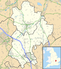
Shown within Bedfordshire
Type Castle
Coordinates grid reference TL009274
Current
condition
No visible remains

Chalgrave Castle stood to the south of the large village of Toddington, Bedfordshire.

This was a timber motte and bailey castle, constructed in two phases, built during the 11th century. By the 13th century, it had been abandoned.

The site was excavated in 1970, but has since been completely leveled. Nothing visible remains.

See also

References

  • Fry, Plantagenet Somerset, The David & Charles Book of Castles, David & Charles, 1980. ISBN 0-7153-7976-3


Wikimedia Foundation. 2010.

Игры ⚽ Нужна курсовая?

Look at other dictionaries:

  • Toddington, Bedfordshire — Coordinates: 51°57′N 0°32′W / 51.95°N 0.53°W / 51.95; 0.53 …   Wikipedia

  • Luton — For other uses, see Luton (disambiguation). Borough of Luton   Town, Borough Unitary authority   Luton Town Hall …   Wikipedia

  • Ampthill — Coordinates: 52°01′35″N 0°29′26″W / 52.0263°N 0.4906°W / 52.0263; 0.4906 …   Wikipedia

  • Dunstable — For the town in the United States, see Dunstable, Massachusetts. For the composer, see John Dunstaple. See also: Dunnstable Township, Pennsylvania Coordinates: 51°53′10″N 0°31′16″W /  …   Wikipedia

  • Maps of castles in England by county — The castles displayed on each map are those listed in the List of castles in England for the corresponding county or area. Click on the red or green dot to display a detailed map showing the location of the castle. Green dots represent for the… …   Wikipedia

  • Odell, Bedfordshire — Coordinates: 52°12′26″N 0°35′23″W / 52.2073°N 0.5898°W / 52.2073; 0.5898 …   Wikipedia

  • Riseley, Bedfordshire — Coordinates: 52°15′05″N 0°28′37″W / 52.2514°N 0.4769°W / 52.2514; 0.4769 …   Wikipedia

  • List of places in Bedfordshire — This is a list of all the towns and villages in the county of Bedfordshire. See the list of places in England for places in other counties. The red links represent settlements that currently do not have enough knowledge about them to be put into… …   Wikipedia

  • Eyeworth — Coordinates: 52°05′41″N 0°10′43″W / 52.09459°N 0.1787°W / 52.09459; 0.1787 …   Wikipedia

  • Dunstable Priory — For the Dominican friary in the town, see Dunstable Friary. The Priory Church, Dunstable The Priory Church of St. Peter, Dunstable Country United Kingdom Denomination …   Wikipedia

Share the article and excerpts

Direct link
Do a right-click on the link above
and select “Copy Link”