Quashnet River

Quashnet River
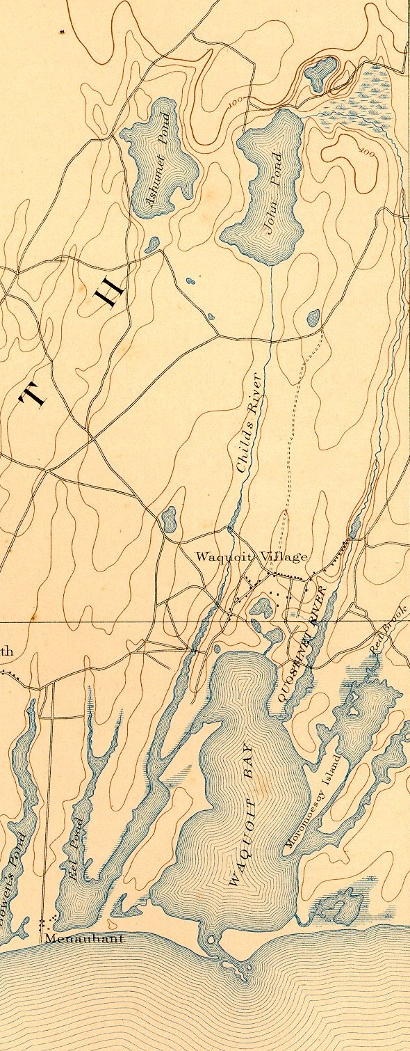
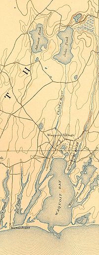
Quashnet River and environs

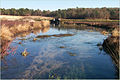
The Quashnet River, also known as Quoshnet River or Moonakis River, is a 5.1-mile-long (8.2 km)[1] estuary in Falmouth, Massachusetts on Cape Cod. Its area is about 1-square-mile (2.6 km2).

The river is connected by ditch to John's Pond in Mashpee, just north of today's Route 28. It is fed by groundwater and flows south, gaining water as it goes, into Waquoit Bay which then flows into Nantucket Sound. During colonial times it was known for its abundant brook trout but was dammed in the mid-19th century for water power. After the mills burned and the dam was breached, the valley was converted to cranberry cultivation in the early 20th century. Cranberry production stopped in the 1950s, and the cranberry bogs were abandoned. The land was purchased by the Commonwealth of Massachusetts beginning in the late 1950s, and Trout Unlimited and other organizations began to restore the river to trout-quality in the 1970s.

Today the river is an important migratory fish run for alewife and salter brook trout, home to herring and eels, and is Waquoit Bay's largest source of fresh water. Additional portions of its watershed were purchased through the years by various entities. The area is now a wildlife management and conservation preserve managed by the Waquoit Bay National Estuarine Research Reserve.

References

  1. ^ U.S. Geological Survey. National Hydrography Dataset high-resolution flowline data. The National Map, accessed April 1, 2011


Wikimedia Foundation. 2010.

Игры ⚽ Нужно решить контрольную?

Look at other dictionaries:

  • Mystic River — For other uses, see Mystic River (disambiguation). Mystic River River …   Wikipedia

  • Neponset River — with Granite Avenue in background Basin countries United States Length 29 mi (47 …   Wikipedia

  • Nashua River Rail Trail — The Nashua River Rail Trail at the Groton School Pond in Groton, MA The Nashua River Rail Trail is a 12.5 mile (20.1 km) paved mixed use rail trail in northern Massachusetts and southern New Hampshire under control of the Massachusetts… …   Wikipedia

  • Charles River Reservation — Charles River Basin Historic District U.S. National Register of Historic Places U.S. Historic district …   Wikipedia

  • Mashpee River Reservation — is a park in Mashpee, Massachusetts on the Mashpee River. The Trustees of Reservations owns and maintains the park. Pristine shoreline, natural spawning areas, and excellent water quality make the Mashpee River one of Massachusetts finest sources …   Wikipedia

  • Connecticut River Greenway State Park — consists of a number of separate state land holdings in the Pioneer Valley of western Massachusetts. The park includes critical wildlife and plant habitat as well as areas providing public access to the Connecticut River. The Department of… …   Wikipedia

  • Mystic River Reservation — The Mystic River Reservation is a publicly owned nature preserve located along the Mystic River in Massachusetts, United States. It forms part of the 75 square mile (190 km2) Mystic River Watershed, and runs through the towns of Arlington,… …   Wikipedia

  • Otter River State Forest — Coordinates: 42°37′27.24″N 72°4′39.39″W / 42.6242333°N 72.0776083°W / 42.6242333; 72.0776083 …   Wikipedia

  • Charles River Peninsula — The Charles River Peninsula is a 30 acre (12 ha) nature preserve in Needham, Massachusetts owned and managed by the Trustees of Reservations. The Charles River turns nearly 180 degrees, creating the peninsula. A 20 acre (8 ha)… …   Wikipedia

  • Childs River — and environs The Childs River, also known as Child s River, is a 5.1 mile long (8.2 km)[1] river near Falmouth, Massachusetts on Cape Cod. Its drainage area is about 1 square mile (2.6 km2). It has been heavily …   Wikipedia

Share the article and excerpts

Direct link
Do a right-click on the link above
and select “Copy Link”