- Ohio State Route 579
-
State Route 579
Route information Maintained by ODOT Length: 10.76 mi[1] (17.32 km) Existed: 1937 – present Major junctions West end:  SR 51 near Northwood
East end:  SR 2 near Williston
Location Counties: Wood, Ottawa Highway system Ohio highways
Interstates • U.S. Routes • State Routes←  SR 578
SR 582  →
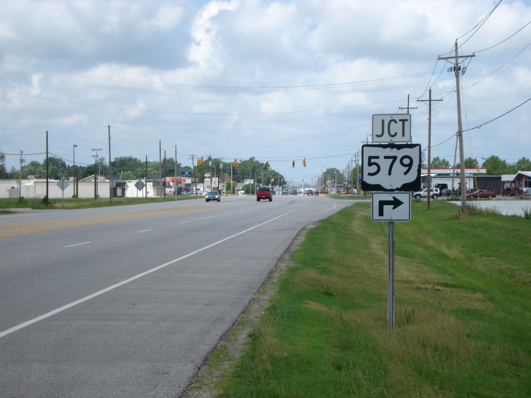
→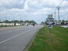 Junction signage for OH 579 on NB OH 51 in advance of OH 579's western terminus.
State Route 579 (SR 579, OH 579) is an east–west state highway in northwestern Ohio, a U.S. state. The western terminus of State Route 579 is at State Route 51 just south of the city limits of Northwood. Its eastern terminus is at a T-intersection with State Route 2 approximately 4 miles (6.4 km) to the east of Williston.
Contents
Route description
State Route 579 travels through Wood and Ottawa Counties along its way. The highway is not a part of the National Highway System, a network of highways determined to be most important for the country's economony, mobility and defense.[2]
Wood County
A signalized intersection with State Route 51 in Lake Township just south of Northwood marks the starting point of State Route 579. The route starts out in a northeasterly direction, but as it sweeps by the southeast corner of Woodville Mall, it turns due east, as it lines itself up with the boundary between Lake Township and the City of Northwood. State Route 579, which starts out briefly as a five-lane road, quickly narrows down to two lanes, and enters into a more rural setting. Passing by a mix of generally flat open space and subdivisions, State Route 579 intersects Bradner Road and Millbury Road on the way to its intersection with Fostoria Road, which marks the boundary between Wood and Ottawa Counties.[3]
Ottawa County
Once it enters into Ottawa County's Allen Township, State Route 579 continues on an easterly path, traversing numerous fields and passing by the occasional house. After Billman Road, State Route 579 abuts the north side of the Chippewa Golf Club. East of there, State Route 579 has split intersections with Reiman Road and Genoa-Clay Center Road. Past Genoa-Clay Center Road, State Route 579 enters into the unincorporated community of Williston, where the state route is primarily a residential street. Following a split intersection with Martin-Williston Road and a railroad crossing, State Route 579 treks back into rural territory. The landscape remains both flat and consistent, with a mix of open fields and houses as State Route 579 has a split intersection with Opfer-Lentz Road, then goes on to meet Nissen Road.[3]
Following the Nissen Road intersection, where State Route 579 enters into Benton Township, the highway has split intersections with Elliston-Trowbridge Road and Graytown Road. Just east of Graytown Road, State Route 579 bends slightly to the south, then back to the north, to come into the T-intersection with State Route 2 that serves as its eastern terminus.[3]
History
State Route 579 debuted in 1937 along its current alignment. No major changes have taken place to State Route 579 since its inception.[4] [5]
Major intersections
County Location Mile[1] Destinations Notes Wood Lake Township 0.00 SR 51Western terminus at a signalized intersection. Ottawa Benton Township 10.76 SR 2Eastern terminus at a T-intersection. 1.000 mi = 1.609 km; 1.000 km = 0.621 mi References
- ^ a b Ohio Department of Transportation. "Technical Services Straight Line Diagrams". http://www.odotonline.org/techservapps/SLD/default.htm. Retrieved 2009-01-10.
- ^ Federal Highway Administration (December 2003) (PDF). National Highway System: Ohio (Map). http://www.fhwa.dot.gov/planning/nhs/maps/oh/oh_Ohio.pdf. Retrieved 2010-10-26.
- ^ a b c Yahoo! Inc. Yahoo! Maps – overview map of State Route 579 (Map). Cartography by NAVTEQ. http://maps.yahoo.com/#mvt=m&lat=41.601955&lon=-83.35862&zoom=12&q1=41.599888%2C-83.461316&q2=41.60398%2C-83.255634. Retrieved 2009-01-10.
- ^ Ohio Department of Transportation (1936). Ohio State Map (Map).
- ^ Ohio Department of Transportation (1937). Ohio State Map (Map).
External links
Categories:- State highways in Ohio
- Transportation in Wood County, Ohio
- Transportation in Ottawa County, Ohio

Wikimedia Foundation. 2010.