- Georgia State Route 39
Infobox road
state=GA
type=
route=39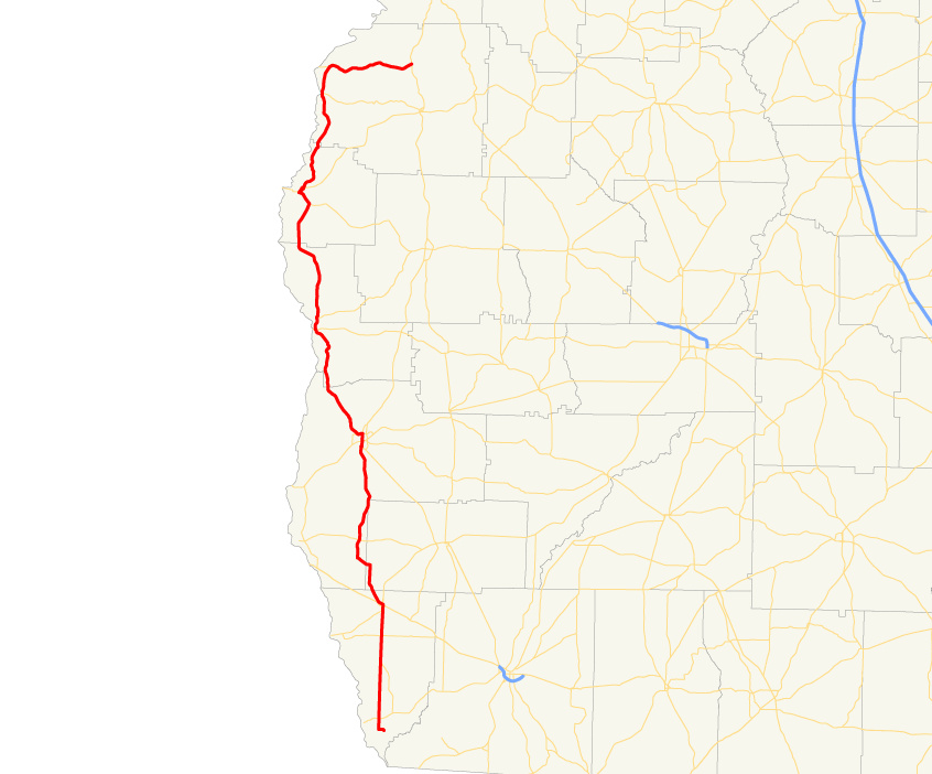
length_mi=
length_ref= [http://www.dot.state.ga.us/DOT/plan-prog/transportation_data/400reports/2002/dpp444_2002.pdf]
length_round=2
established=
direction_a=South
direction_b=North
starting_terminus=Lake Seminole in southern Seminole County
junction=
ending_terminus=
previous_route=38
next_route=40State Route 39 is a north-south state route located in the southwestern part of the
U.S. state of Georgia. The route travels fromLake Seminole in southern Seminole County north to U.S. 27/S.R. 1 north of Lumpkin.Routing
From its southern terminus at Lake Seminole, State Route 39 travels north to Donalsonville, where it is briefly cosigned with State Route 91. After intersecting
U.S. Route 84 /State Route 38, the routes continue to the north side of the city, where State Route 39 departs and continues north into Miller County. After briefly travelling north in Miller County, the route jogs to the west into Early County, where it resumes its northward route to Blakely. In Blakely, State Route 39 becomes cosigned with U.S. Route 27 Business / State Route 1 Business north through downtown. On the north side of the city, State Route 39 departs U.S. Route 27 Business/State Route 1 Business, and, after briefly traveling west cosigned with State Route 62 Bypass, continues north to Fort Gaines, where it is briefly cosigned with State Route 37. North of Fort Gaines, State Route 39 runs along the eastern shore ofWalter F. George Lake , and passes throughGeorge T. Bagby State Park . Southeast of Georgetown, the route becomes cosigned withU.S. Route 82 /State Route 50 westward. Just to the east of Georgetown, State Route 39 departs to the north, running parallel to theChattahoochee River . Shortly after passingFlorence Marina State Park , the route takes a drastic turn to the east at Omaha where it meets State Route 39 Spur, and continues east to its northern terminus at U.S. Route 27/State Route 1 north of Lumpkin.History
The portion of State Route 39 north of Georgetown was formerly State Route 375. However, it was renumbered as an extension of State Route 39 after just a few months. [http://psr.southeastroads.com/ga375_profile.htm]
ignificance
State Route 39 is a rural route, and as a result, sees very little traffic. Most of the route sees an Average Annual Daily Traffic of less than 2,000 vehicles. [http://www.dot.state.ga.us/dot/plan-prog/transportation_data/mapproducts/Documents/Trafficflow_05.pdf]
Banner routes
tate Route 39 Connector
.
tate Route 39 Spur
.
External links
* [http://psr.southeastroads.com/ga375_profile.htm Peach State Roads profile on State Route 375]
References
Wikimedia Foundation. 2010.