- Georgia State Route 36
Infobox road
state=GA
type=
route=36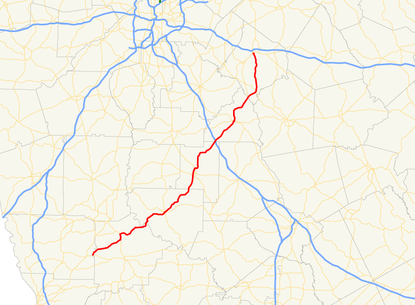
length_mi=
length_ref= [http://www.dot.state.ga.us/DOT/plan-prog/transportation_data/400reports/2002/dpp444_2002.pdf]
length_round=2
established=
direction_a=South
direction_b=North
starting_terminus=
junction=
ending_terminus=
previous_route=35
next_route=37State Route 36 is a north-south state route located in the
U.S. state of Georgia. Though it's mainly a north-south route, it is erroneously signed as east-west for its entire length. The route travels from S.R. 208 in Waverly Hall northeast to S.R. 81 in Covington.Routing
From its southern terminus at State Route 208 in Waverly Hall, just inside Harris County, the route travels northeast into Talbot County to State Route 41. The two routes become cosigned north to Woodland. In Woodland, State Route 36 departs and continues northeast through Upson County, and its county seat, Thomaston, before enterng Lamar County. In Lamar County, State Route 36 becomes cosigned with
U.S. Route 41 /State Route 7, and State Route 18. State Routes 36 and 7 continue north, cosigned with U.S. 41 for a short distance, before State Route 36 departs and continues to the northeast. Shortly after entering Butts County, the route has an interchange withInterstate 75 . After arriving in Jackson, the county seat of Butts County, the route continues north, crossing into Newton County. The route meets its northern terminus at State Route 81 in Covington, the county seat of Newton County.ignificance
State Route 36 is a somewhat significant route in the area, with an Average Annual Daily Traffic of over 5,000 vehicles for much of the route between Barnesville and Covington. Traffic is significantly less on the section of the route south of Thomaston. There are future plans of widing State Route 36 into 4 lanes from Jackson to Thomaston. [http://www.dot.state.ga.us/dot/plan-prog/transportation_data/mapproducts/Documents/Trafficflow_05.pdf]
References
Wikimedia Foundation. 2010.