- Montville, Queensland
-
Montville
Queensland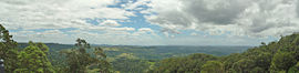
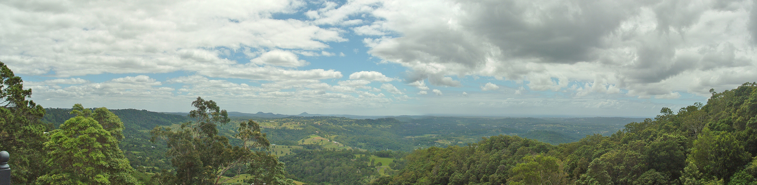
Lookout from Montville
 Montville
Population: 853[1] Postcode: 4560 Location: LGA: Sunshine Coast Regional Council State District: Nicklin Federal Division: Fairfax Montville is a small town in the Sunshine Coast hinterland, on the Blackall Range in Queensland, Australia, around 400 metres above sea level. At the 2006 census, Montville and the surrounding area had a population of 853.[1]
Contents
Early settlement
The first white settlers arrived in the area in 1887 and the town was later named by Henry Smith (who bought a selection of land there in 1893) after a suggestion by his mother, as it reminded her of their early years in Montville, USA.[2]
Montville was predominantly a logging then farming community (dairy, citrus, avocados, pineapples and macadamia nuts) until a tourism boom which commenced during the 1970s, taking advantage of the scenic views of the Sunshine Coast and the nearby rainforest walks.
Community facilities
The town is well served with facilities, including churches, a village green and community hall and a large sportsground featuring a football field, tennis courts and a wood working centre. The Montville State School, founded in 1896, has grown in recent years and now has around 160 pupils.
Attractions
The town is now a popular short break tourist destination for the people of Brisbane and is famous for its parks and walks including the Sunshine Coast Hinterland Great Walk. Popular attractions include galleries, restaurants, wineries, cheese factories and craft and clothing shops. The world-renowned Australia Zoo is a 20 minute drive down the range at nearby Beerwah. Montville is becoming a very popular location for destination weddings at its many resorts, b&bs, wineries and restaurants.
The nearby Baroon Pocket Dam, which provides water for Caloundra and Maroochydore, is also a recreational facility, permitting boating, fishing and picnicking.
There are many places to stay in and around Montville, with accommodation ranging from private cottages to family style units and suites.
References
- ^ a b Australian Bureau of Statistics (25 October 2007). "Montville (Maroochy Shire) (State Suburb)". 2006 Census QuickStats. http://www.censusdata.abs.gov.au/ABSNavigation/prenav/LocationSearch?collection=Census&period=2006&areacode=SSC36771&producttype=QuickStats&breadcrumb=PL&action=401. Retrieved 2008-07-05.
- ^ "Place Name Origins - Maroochy Shire Council". Maroochy Shire. 2006. http://www.maroochy.qld.gov.au/sitePage.cfm?code=Fact_File.
External links
- University of Queensland: Queensland Places: Montville
- Montville history
- Montville Guide
- Montville - Wikitravel article
- Baroon Pocket Dam
Coordinates: 26°41′S 152°53′E / 26.683°S 152.883°E
Categories:- Towns in Queensland
- Suburbs of the Sunshine Coast, Queensland

Wikimedia Foundation. 2010.