- Csaroda
-
Csaroda Country  Hungary
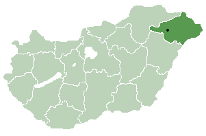
County Szabolcs-Szatmár-Bereg Area - Total 24.68 km2 (9.5 sq mi) Population (2001) - Total 654 - Density 26.5/km2 (68.6/sq mi) Time zone CET (UTC+1) - Summer (DST) CEST (UTC+2) Postal code 4844 Area code(s) 45 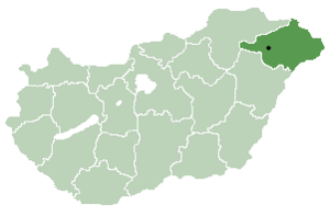 Location of Szabolcs-Szatmar-Bereg county in Hungary
Csaroda is a village in Szabolcs-Szatmár-Bereg county, in the Northern Great Plain region of eastern Hungary.
Contents
Geography
It covers an area of 24.68 km2 (10 sq mi) and has a population of 654 people (2001).
Setting
Csaroda is in Szabolcs-Szatmár-Bereg county, on the Beregi-plane, near to Nyíregyháza (73 km) and to Vásárosnamény (12 km).
History
Csaroda and its vicinity was mentioned first in written form in 1299. Its name came from the river name Csernavoda (Black water) where it is setting. In the 13. c. the Káta family was the landowner of the village. A 14. c. the Csaroda family is the landowner, a leading family of Bereg county. In 1446 Vetési family, from 1461 to 1476 the Tegzes, Drágfy, Daróczy and Újhelyi families are the landowners, later the Lónyai, Rédey and Bay family, finally the Teleky counts.
Sightseeings
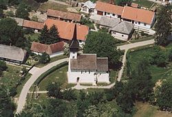
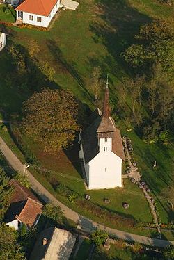
Csaroda has its beautiful little 13th C. Romanesque village church with 14th C. Gothic frescos, 17th C. paintings and wood-carvings. An old wooden bell-tower stands by the church (13.c.)
References
- Dercsényi D. (1972): Románkori építészet Magyarországon. Corvina, Budapest
- Gerevich T. (1938): Magyarország románkori emlékei. (Die romanische Denkmäler Ungarns.) Egyetemi nyomda. Budapest
- Gerő, L. (1984): Magyar műemléki ABC. (Hungarian Architectural Heritage ABC.) Budapest
- Henszlmann, I. (1876): Magyarország ó-keresztyén, román és átmeneti stylü mű-emlékeinek rövid ismertetése, (Old-Christian, Romanesque and Transitional Style Architecture in Hungary). Királyi Magyar Egyetemi Nyomda, Budapest
Outer references
Coordinates: 48°10′N 22°28′E / 48.167°N 22.467°E
Categories:- Populated places in Szabolcs-Szatmár-Bereg county
- Romanesque architecture in Hungary
- Szabolcs-Szatmár-Bereg geography stubs


Wikimedia Foundation. 2010.