- Dörentrup
-
Dörentrup 

 DörentrupLocation of Dörentrup within Lippe district
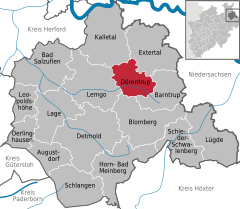

Coordinates 52°01′59″N 9°00′0″E / 52.03306°N 9°ECoordinates: 52°01′59″N 9°00′0″E / 52.03306°N 9°E Administration Country Germany State North Rhine-Westphalia Admin. region Detmold District Lippe Local subdivisions 5 Mayor Friedrich Ehlert (CDU) Basic statistics Area 49.79 km2 (19.22 sq mi) Elevation 250 m (820 ft) Population 8,219 (31 December 2010)[1] - Density 165 /km2 (428 /sq mi) Other information Time zone CET/CEST (UTC+1/+2) Licence plate LIP Postal code 32694 Area codes 0 52 65 Website www.doerentrup-lippe.de Dörentrup is a municipality in the Lippe district of North Rhine-Westphalia, Germany. It has an area of 49.79 km² and c. 8,600 inhabitants (2007).
Respect of the nocturnal environment
A noticeable point of this village is the respect of nocturnal environment.
In fact, every night at 11 pm, all street lights turn off. Inhabitants can then turn it back on if they need it by sending a code to a special phone number called Dial4light. Each street has is own code that can be found either online on a specific website or on each light post. This is a great way to reduce energy use, save money, respect the nocturnal fauna and avoid light pollution.
References
- ^ "Amtliche Bevölkerungszahlen" (in German). Landesbetrieb Information und Technik NRW. 31 December 2010. http://www.it.nrw.de/statistik/a/daten/amtlichebevoelkerungszahlen/index.html.
External links
- Official website (German)
- Dial4Light : http://www.travelbugholiday.com/?p=1672
- BBC video about Dial4Light : http://news.bbc.co.uk/2/hi/europe/7796800.stm
Augustdorf | Bad Salzuflen | Barntrup | Blomberg | Detmold | Dörentrup | Extertal | Horn-Bad Meinberg | Kalletal | Lage | Lemgo | Leopoldshöhe | Lügde | Oerlinghausen | Schieder-Schwalenberg | Schlangen Categories:
- Municipalities in North Rhine-Westphalia
- Towns in North Rhine-Westphalia
- North Rhine-Westphalia geography stubs


Wikimedia Foundation. 2010.