- Cholsan
-
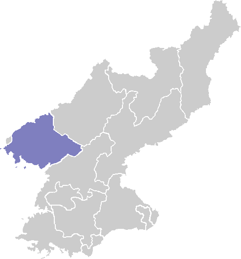
Cholsan Chosŏn'gŭl 철산군 Hancha 鐵山郡 McCune–Reischauer Ch'ŏlsan kun Revised Romanization Cheolsan-gun Statistics Area 361.4 km2 (139.5 sq mi) Administrative divisions 1 ŭp, 2 workers' districts, 25 ri Cholsan is a kun, or county, in North Pyongan province, North Korea. It occupies the Cholsan Peninsula, which juts into the Yellow Sea. Cholsan borders Yomju and Tongrim to the north, and is bounded on all other sides by water.
The terrain is dominated by rolling hills, seldom exceeding 300 m; the highest peak is Yondaesan at 393 m. The offshore island of Kado enjoys similar terrain, with Yondaebong reaching 335 m. There are a total of 28 offshore islands, some of which are uninhabited. The coastline measure 123 kilometers in length, or 265 km if the islands are also included.
Cholsan enjoys a relatively mild maritime climate, with the warmest winters in North Pyongan. The annual temperature is 8.9 °C, with a January average of -7.9 °C and an August average of 24 °C. Annual rainfall is 900 mm. 46% of the county's land is occupied by forests, which are dominated by pine and oak. 40% is cultivated, with crops including rice, maize, and soybeans. Clams and fish are harvested from nearby waters.
Local tourist attractions include the Pansong archipelago, known for its scenery, and the Mason cavern (마선굴). The island of Wondo has been made into a nature preserve.
Educational institutions in Cholsan include Cholsan Advanced Technical School (철산고등전문학교).
References
- International Information Research Institute (국제정보연구소) (1999). "철산군". 北韓情報總覽 2000 [Bukhan jeongbo chong-ram 2000]. Seoul: Author. pp. 829–830.
See also
External links
- (Korean) In Korean language online encyclopedias:
North P'yŏngan Capital 
Cities Counties Categories:- Counties of North Pyongan
Wikimedia Foundation. 2010.