- Oravská Polhora
-
Oravská Polhora Village 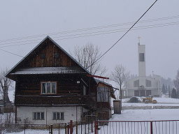
 Coat of arms
Country Slovakia Region Žilina District Námestovo Elevation 688 m (2,257 ft) Coordinates 49°31′N 19°27′E / 49.517°N 19.45°E Area 84.52 km2 (32.63 sq mi) Population 3,623 (2004-12-31) Density 43 / km2 (111 / sq mi) First mentioned 1550 Postal code 029 47 Area code +421-43 Car plate NO 

 Location of Oravská Polhora in Slovakia
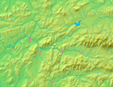
 Location of Oravská Polhora in the Žilina Region
Statistics: MOŠ/MIS Oravská Polhora is a large village and municipality in Námestovo District in the Žilina Region of northern Slovakia.
History
In historical records the village was first mentioned in 1580. Natural heritage is a complex of forests, as well as iodine-bromine springs known as spa salt water. They were known in the neighborhood and the rumor was brought to Vienna. Source location in Oravská Polhora - Slaná Voda (Saltwater) already mentioned in 1550 in a handwritten map of Orava.Of the Upper Ungarn chamber, the view that undermines the right of the king's salt monopoly, the king sent two commissioners and Andreas Kraiser and Joseph Milaver, from Hallstadt. They were experts in extracting salt. To be accompanied by salt water census customs station manager of Tvrdosin. Commissioners have written extensively on the visit of the sources and report it to enclose a handwritten map of surrounding area. On the map, which is the oldest map projection upper Orava Orava is plotted Polhora (Pagus Polgora) and other municipalities. A written report on the map binds primarily salt water spring, which is plotted on the map south of the Babia Hora mountain (Mons Baba) as well walled area Rabča territory of the village. (Pagus Rapcia). In the inscription Puteus salsus intra fines Rapciae possession. The economic data is to map note, according to which the Beskydy and deposits of gold, silver, lead and other metals. In montibus istis aurum, argentum, et aes plumbum alique metal reperire est.
Geography
The municipality lies at an altitude of 688 metres and covers an area of 84.519km². It has a population of about 3,635 people.
Námestovo
Babín · Beňadovo · Bobrov · Breza · Hruštín · Klin · Krušetnica · Lokca · Lomná · Mútne · Novoť · Oravská Jasenica · Oravská Lesná · Oravská Polhora · Oravské Veselé · Rabča · Rabčice · Sihelné · Ťapešovo · Vasiľov · Vavrečka · Zákamenné · Zubrohlava
ir:Oravská Polhora
Categories:- Villages and municipalities in Námestovo District
- Žilina Region geography stubs


Wikimedia Foundation. 2010.