- New Norfolk, Tasmania
-
New Norfolk
Tasmania
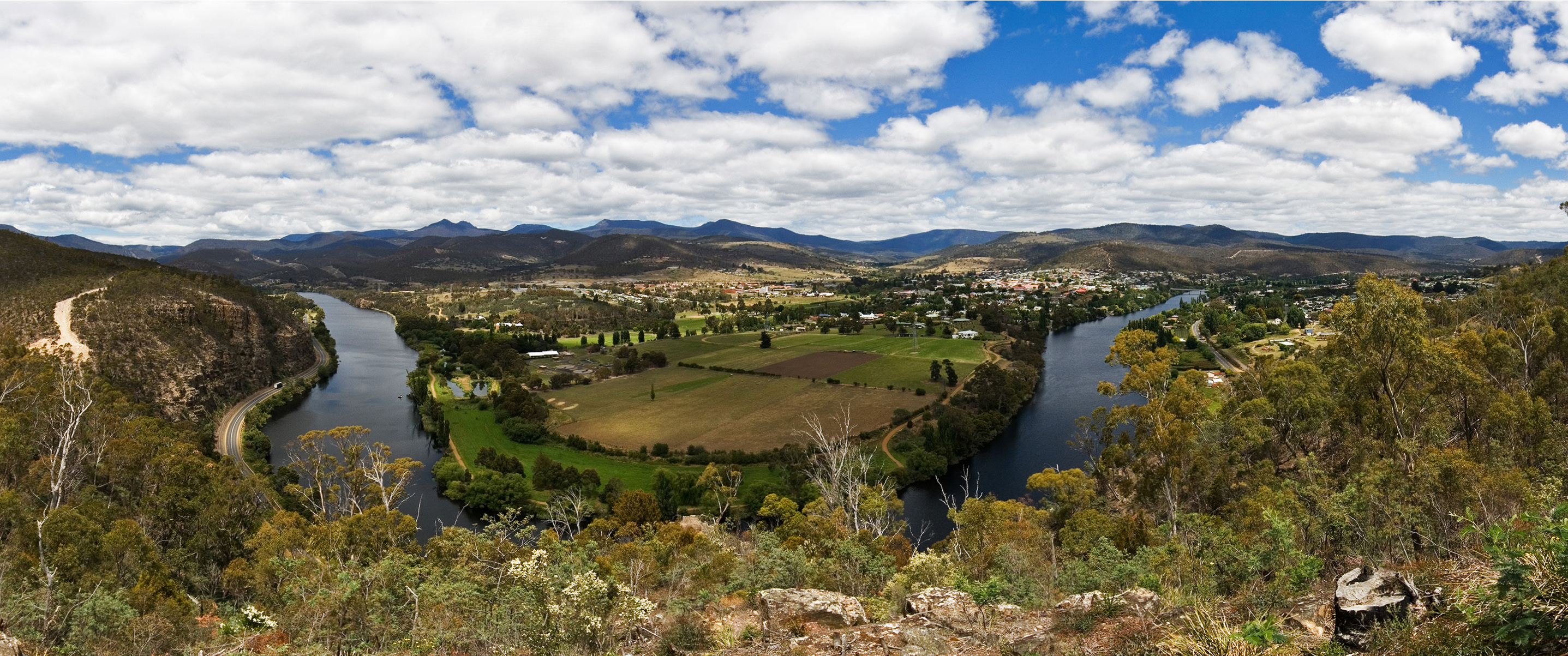
New Norfolk from Pulpit Rock Lookout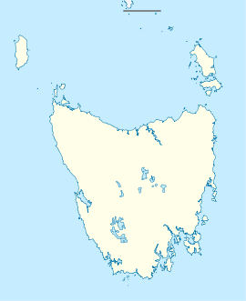
 New Norfolk
Population: 5,230 (2006 Census)[1] Postcode: 7140 Coordinates: 42°46′58″S 147°03′34″E / 42.78278°S 147.05944°ECoordinates: 42°46′58″S 147°03′34″E / 42.78278°S 147.05944°E Location: - 32 km (20 mi) from Hobart
- 38 km (24 mi) from Hamilton
- 213 km (132 mi) from Queenstown
LGA: Derwent Valley Council State District: Lyons Federal Division: Lyons New Norfolk is a town on the willow-lined Derwent River, in the south-east of Tasmania, Australia. At the 2006 census, New Norfolk had a population of 5,230.[1]
It lies 32 km north-west of Hobart on the Lyell Highway and has all modern facilities while preserving its pioneer heritage. Two fine examples are Tasmania's oldest Anglican church Saint Matthews, built in 1823, and Australia's oldest hotel The Bush Inn Hotel, trading continuously in the same building since 1815, using the same continuous licence issued on 29 September 1825[2]. Many private homes from the 1820s and later have also survived.
Contents
History
Resettlement of Norfolk Islanders
The town's pioneers were many of the 554 folk resettled from Norfolk Island during the period of 29 November 1807 to 2 October 1808.[3] Lt. Governor David Collins selected the site as a separate crop production area in the fertile valley, as the Norfolk Islanders were mainly farming families, who were offered extra acres in Tasmania as an incentive to relocate. The climate was colder than sub-tropical Norfolk Island, which proved a challenge for the hardy pioneers during the first few years, but eventually the district became self-supporting.
Many of these folk were "First Fleeters" as Norfolk Island was founded just a few weeks after Sydney. Nine First Fleeters are buried in the Methodist Chapel at Lawitta, New Norfolk. Notable is Betty King, née Elizabeth Hackery, a first fleet convict girl who married Sam King at New Norfolk on 28 January 1810. The headstone on her still tended grave reads, "The first white woman to set foot in Australia" from the First Fleet. She was also the last surviving female First Fleeter when she died at 89 years of age on 7 August 1856. Eight other First Fleeters there are Ellen Guy (nee Wainright), William Dempsey, William Edmunds, William Foyle, Abraham Hand, Stephen Martin, John Ruglass, and Edward Westlake. The pioneers soon farmed the rich land around the town and hop plants were introduced in 1846, which became an important crop. There remain a number of hop drying kilns known as oast houses in the area.[4]
Later History
Originally called "The Hills" district, visiting New South Wales Governor Lachlan Macquarie named it Elizabeth Town after his wife, but in 1825 it was officially named New Norfolk by its residents.[5]
The first road connecting the town to Hobart was built in 1818; the first railway was in 1887. During the 1940s, a newsprint mill was established at nearby Boyer, boosting industry in the local area. The railway is now preserved as the Derwent Valley Railway.
On 19 April 1827, Governor George Arthur issued an order to create the Willow Court infirmary, later known as the Royal Derwent Hospital, which was established as an asylum to accept invalid and sick convicts from Hobart, Launceston and outstations. For some years after 1848, New Norfolk was the place of exile of the Irish nationalist leader Terence MacManus. His cottage "The Grange" still stands. Later he was joined by his fellow Irish rebel William Smith O'Brien. In 1888, Australia's first telephone trunk call was connected from Hobart to the Bush Inn Hotel in New Norfolk.[4]
Transport
New Norfolk is located on the Lyell Highway which is the main east-west highway in the sourthern half of the state, running from Hobart, Tasmania to Strahan on the west coast. It is in fact the only east-west road in the southern half of Tasmania.
A rail link was opened in 1887 but was closed in 1995 when floods and declining usage made repairs uneconomic. The line has been used for tourist trips by the Derwent Valley Railway but this has not been possible since 2005 due to lack of support for track maintenance.
There is no airport, since the town is only 55Km from Hobart International Airport which services the southern half of the state.
Tourism
New Norfolk is a central location for tourism in the upper Derwent Valley since it is the last sizeable town heading west until Strahan on the west coast. It is therefore something of a hub for more remote tourist attractions of Mount Field, Lake Pedder, Strathgordon hydroelectric site, and the South West Wilderness. It is a convenient take-off point for the Lyell Highway to the west coast via Hamilton, Ouse, Tarraleah, Derwent Bridge and Queenstown.
There is a tourist information centre staffed by enthusiastic volunteers located in Circle Street next to the Council Chambers at the top end of High Street.
Climate
New Norfolk has a cool temperate climate.
Climate data for New Norfolk Month Jan Feb Mar Apr May Jun Jul Aug Sep Oct Nov Dec Year Record high °C (°F) 39.4
(102.9)39.4
(102.9)37.8
(100.0)29.0
(84.2)23.8
(74.8)19.6
(67.3)20.0
(68.0)23.1
(73.6)27.6
(81.7)31.1
(88.0)36.1
(97.0)37.2
(99.0)39.4
(102.9)Average high °C (°F) 23.2
(73.8)24.0
(75.2)21.2
(70.2)17.9
(64.2)14.1
(57.4)11.0
(51.8)10.8
(51.4)12.8
(55.0)14.8
(58.6)17.6
(63.7)19.3
(66.7)21.3
(70.3)17.3 Average low °C (°F) 10.8
(51.4)11.3
(52.3)9.5
(49.1)7.1
(44.8)4.7
(40.5)2.6
(36.7)1.9
(35.4)2.8
(37.0)4.7
(40.5)6.2
(43.2)8.2
(46.8)9.8
(49.6)6.6 Record low °C (°F) −1.2
(29.8)2.0
(35.6)0.3
(32.5)−1
(30.2)−3.4
(25.9)−5.7
(21.7)−4
(24.8)−2.8
(27.0)−3
(26.6)−1.5
(29.3)0.0
(32.0)1.2
(34.2)−5.7
(21.7)Precipitation mm (inches) 39.8
(1.567)34.6
(1.362)38.7
(1.524)47.6
(1.874)44.0
(1.732)48.6
(1.913)48.4
(1.906)46.6
(1.835)49.0
(1.929)55.0
(2.165)47.2
(1.858)49.6
(1.953)548.9
(21.61)Avg. precipitation days 8.0 6.8 8.8 10.1 11.1 12.0 13.0 13.9 13.2 13.8 12.0 10.8 133.5 Source: [6] References
- ^ a b Australian Bureau of Statistics (25 October 2007). "New Norfolk (Urban Centre/Locality)". 2006 Census QuickStats. http://www.censusdata.abs.gov.au/ABSNavigation/prenav/LocationSearch?collection=Census&period=2006&areacode=UCL611400&producttype=QuickStats&breadcrumb=PL&action=401. Retrieved 21 November 2011.
- ^ "Bush Inn holds title of Australia’s oldest pub". http://www.australianbeers.com/pubs/bushin/bush.htm.
- ^ New Norfolk History 1986 ISBN 1 86252 303
- ^ a b "Derwent Valley". University of Tasmania. 2006. http://www.utas.edu.au/library/companion_to_tasmanian_history/D/Derwent%20Valley.htm. Retrieved 2009-12-05.
- ^ New Norfolk - Capital of the Derwent Valley - Tasmania - Australia[1]. Retrieved 2010-04-03.
- ^ "Climate statistics for New Norfolk". Bureau of Meteorology. http://www.bom.gov.au/climate/averages/tables/cw_095015_All.shtml. Retrieved 15 October 2011.
5. Fellowship of First Fleeters.
6. New Norfolk's History and Achievements by Joe Cowburn and Rita Cox 1986
External links
- New Norfolk, Tasmania - Capital of the Derwent Valley - Australia has extensive local information, history, photographs, resources and attractions
Categories:- Towns in Tasmania
- Tasmania geography stubs

Wikimedia Foundation. 2010.