- Porto Santo Island
Infobox Islands
name = Porto Santo
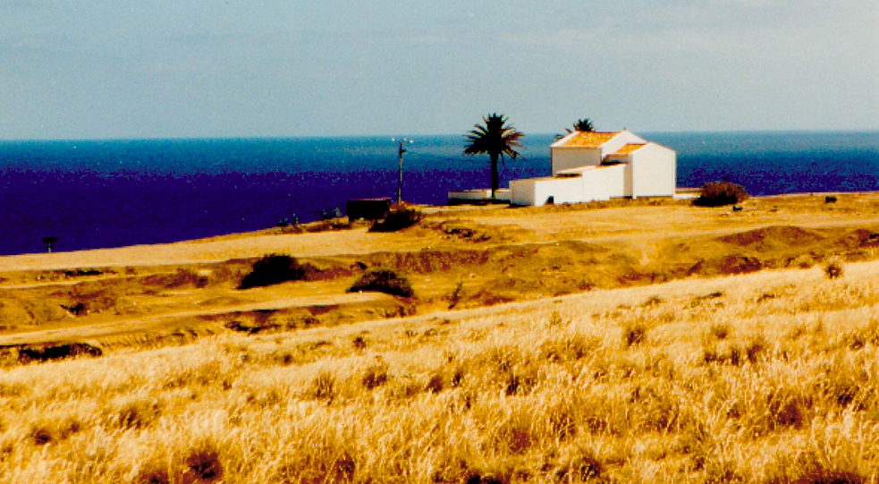
image caption =
image size =
locator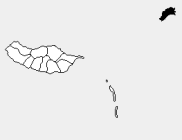
native name =
native name link = Portugal
nickname =
location =Atlantic Ocean
coordinates = coord|33|3|43|N|16|21|23|W|region:ID_type:isle|display=inline,title
archipelago =Madeira Islands
total islands =
major islands =
area = 42.27 km²
highest mount =
elevation = 402 m
country = Portugal
country admin divisions title = Autonomous Region
country admin divisions =Madeira Islands
country admin divisions title 1 =
country admin divisions 1 =
country capital city =
country largest city =Porto Santo (town)
country largest city population = 4,474
country leader title =
country leader name =
population = 4,474
population as of = 2001
density = 106
ethnic groups =
additional info =Porto Santo Island (pron. IPA2|'poɾtu 'sɐ̃tu) is a Portuguese island 50 km northeast of
Madeira Island in theNorth Atlantic Ocean . Administratively, it is part of the Autonomous Region of Madeira. The main urban area in which is one of the five Portuguese municipalities that have only one parish is the city of Porto Santo, also known asVila Baleira (pron. IPA2|'vilɐ bɐ'lɐiɾɐ). The population in2001 was 4,474. The density was 106.1/km². The island also has an airport which serves flights toFunchal , which is only a 15-minute flight away. It is the northernmost and the easternmost island of the Madeira Archipelago. The municipality has no land boundaries and is encircled by theAtlantic Ocean . The nearest place isMachico in the island ofMadeira to the southwest which serves as its port to Funchal. The length of the island is about 9 km. The main industry is tourism.Geography
The island's geography includes farmlands in the southern and central parts and further to the south a long shoreline with a few beaches, forests and grasslands to the west, rocky ledges and cliffs with a longer coastline to its north, forests to the northeast, drylands with grasses to the northern part and mountains along the northeastern part with about five to six main mountaintops with a few grasslands. Much of the coastline is to the west, the north and the east. There are islets to the north east and a small peninsula with a mountaintop in the eastern end of the main island. Porto Santo has about 9 km of sandy beaches while Madeira island has virtually none, with tiny exceptions such as Calheta.
*Location of Vila Baleira:
**Latitude: 33.0667 (33°4') N
**Longitude: 16.33 (16°20') W
*Altitude:
**Lowest: Atlantic Ocean
**Centre: 175 m (577 feet)History
The official discovery of Porto Santo occurred in
1418 , with the trip of the knights of Infant Henry,João Gonçalves Zarco andTristão Vaz Teixeira , in accordance with the orders of king D. John I.Its captain-donee was
Bartolomeu Perestrelo , that received letter of donation in November of1445 . The name of Porto Santo (Holy Port) was given, originally to the bay that, in the south coast, served of shelter when the navigators had been gathered by a storm.In the first centuries of settling, the development of this place knew some difficulties due to scarcity of water and to the assaults of Algerian and French pirates.
* The discoveries of Porto Santo and Madeira were first described by Gomes Eannes de
Azurara in "Chronica da Descoberta e Conquista da Guiné". (Eng. version by Edgar Prestage in 2 vols. issued by the Hakluyt Society, London, 1896-1899: "The Chronicle of Discovery and Conquest of Guinea".)*
Arkan Simaan relates in French these discoveries in his novel: "L’Écuyer d’Henri le Navigateur", published by Éditions l’Harmattan.Tourism
The 9km long sandy beach is the main attraction for tourists.
Christopher Columbus married and lived there for some time. Columbus' house is now a museum that presents a permanent exhibition about his life and family ties with Porto Santo, as well as temporary art exhibitions.The island has a
golf course that is promoted by Spanish golfing championSeveriano Ballesteros . Porto Santo Golf Course will be the largest course in the whole of the Madeira Archipelago once the planned second course is completed and will be able to accommodate 500 players at once. At the moment (2008) there is one 18-hole golf course and one nine-hole course. Porto Santo golf complex, includes eight tennis courts and an equestrian center, circles Pico Ana Ferreira.Porto Santo has several schools, a
lyceum , a gymnasium, several churches, a square ("praça "), a Congress Centre, a museum, shopping centres, bars, and restaurants.Porto Santo Airport
Porto Santo Island Airport(PXO) has flights to Madeira/Funchal(Santa Catarina-Santa Cruz)(FNC),Lisbon(Lisboa/Portela de Sacavem-Loures/Lisboa)(LIS),Oporto(Porto/Sa Carneiro/Pedras Rubras-Maia)(OPO)and connecting service to several airports,such as:Faro(Faro/Algarve)(FAO) and Ponta Delgada(Papa Joao Paulo II/Nordela-Sao Miguel/Azores)(PDL).
Settlements and geographic areas
External links
[http://www.flickr.com/photos/vitor107/sets/1831598/ Photos from Porto Santo]
Wikimedia Foundation. 2010.