- North Carolina Highway 62
-
NC 62
Route information Maintained by NCDOT Length: 84.4 mi[1] (135.8 km) Existed: early 1920s – present Major junctions South end:  NC 109 in Thomasville
 I-40 / I-85 in Burlington
 US 158 in Yanceyville
North end:  SR 62 at the VA line in Milton
Location Counties: Davidson, Randolph, Guilford, Alamance, Caswell Highway system ←  NC 60
NC 60US 64  →
→North Carolina Highway 62 is a primary state highway in the U.S. state of North Carolina. Primarily in the Piedmont Triad, it runs from NC 109 in Thomasville northeast to the Virginia state line in Milton.
Contents
Route description
NC 62 begins in Thomasville at the intersection of Randolph Street (NC 109) and Julian Avenue; it is .4 miles (0.64 km) from I-85 and shadows the Interstate from Thomasville to Archdale. East of Archdale, it overlaps with NC Bike Route 2 through the communities of Climax and Julian. Before the town of Alamance, the highway goes right through the middle of the Alamance Battleground (the area will be marked with several colored flags and monuments). After crossing I-40/I-85, NC 62 does a zig-zag through downtown Burlington. Continuing north of town, it goes through the communities and towns of Pleasant Grove, Jericho, and Yanceyville, before reaching the town of Milton. After crossing the Dan River, it enters the Commonwealth of Virginia; where it continues for 4 miles (6.4 km) before ending on US 58/US 360, east of Danville, Virginia.
Junction list
County Location Mile[1] Destinations Notes Davidson Thomasville 0 NC 109 (Randolph Street) / Julian Avenue – DentonNC 62 begins Randolph Archdale 7 Main Street – High Point Guilford 8.5  NC 610 west (Fairfield Road)
9 


 I-85 to I-74 to US 311 – Greensboro, Charlotte
16  US 220 – Greensboro, Asheboro
Also Future I-73 Climax 22.5  NC 22 south – Franklinville
Julian 24.5  US 421 – Greensboro, Siler City
33.5  NC 61 north – Whitsett
Alamance Burlington 41.5 I-40 / I-85 – Greensboro, Durham, Raleigh42.5 
 US 70 west (Church Street) / NC 54 east (Chapel Hill Road)
West end of US 70 overlap 44.5 
 NC 87 / NC 100 (Webb Avenue)
44.7 US 70 east (Church Street)East end of US 70 overlap Pleasant Grove 55  NC 49 – Haw River, Roxboro
Caswell Jericho 62.7 Cherry Grove Road – Camp Springs Yanceyville 72  US 158 / NC 86 – Hillsborough, Roxboro, Danville
Brief .2 miles (0.32 km) concurrency Milton 84  NC 57 south (Broad Street) – Roxboro
1.000 mi = 1.609 km; 1.000 km = 0.621 mi
Concurrency terminus • Closed/Former • Incomplete access • UnopenedBannered routes
Alternates
Historically there was one 3 miles (4.8 km) alternate route in New London, from 1935-1940; it was labeled as NC 62A. It was soon renumbered as NC 49A when NC 49 replaced NC 62 in the area.[2] Later, in 1947, it would renumber again to NC 6, then finally in 1953 as an extension and terminus of NC 8.[3]
History
NC 62 was an original state highway; starting from Asheboro (then NC 70, currently US 221 Business), going northeast through Liberty and Graham, ended in Yanceyville (then NC 14, currently Main Street). In 1928, the route was extended from Asheboro to New London, and again in 1930 from Yanceyville to Milton. In 1933, the route was moved north of New London and extended to Mount Pleasant.[4]
In 1940, NC 62 was realigned to a new routing south of Pleasant Grove to its now current routing through Burlington and Archdale, ending in Tomasville at NC 109. Former route to Mount Pleasant is now part of NC 49.[4]
In 1947, NC was extended into Virginia, which also creating VA 62. The last change to the route was between 1954-57, between the community of Fitch to Yanceyville, moving to a new road east; leaving behind Oak View Loop Road and Badgett Sisters Parkway.[4]
Alternate names
Though the highway is commonly known as "NC 62" throughout the state, the highway does have other known names it uses locally in areas.
- Academy Street - Road name in Milton.
- Alamance Road - Road name between Church Street in Burlington to Alamance county line.
- Broad Street - Road name in Milton.
- Church Street - Road name in downtown Burlington.
- Cloniger Drive - Road name in Thomasville city limits.
- Fisher Street - Road name of southbound NC 62 in downtown Burlington.
- Glencoe Road - Road name in Morgantown town limits.
- Liberty Road - Road name east of Main Street in Archdale.
- Main Street - Road name in Yanceyville.
- Rauhut Street - Road name north of Church Street to city limits.
- Trindale Road - Road name west of Main Street in Archdale.
Photo gallery
-
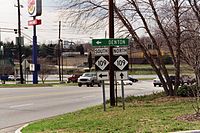
NC 62 South Terminus, only NC 109 directional signs (2001-03-06).
See also
- Alamance Battleground
- Burlington-Alamance Regional Airport
- Dan River
- North Carolina Bicycle Route 2
- North Carolina Bicycle Route 4
- Randleman Lake
- Virginia International Raceway
References
- ^ a b "Google Maps". http://maps.google.com. Retrieved 2011-01-02.
- ^ "NCRoads.com: N.C. 62-A". http://members.cox.net/ncroads/nc62a.html. Retrieved 2011-01-02.
- ^ "NCRoads.com: N.C. 6". http://members.cox.net/ncroads/nc006.html. Retrieved 2011-01-02.
- ^ a b c "NCRoads.com: N.C. 62". http://members.cox.net/ncroads/nc062.html. Retrieved 2011-01-03.
External links
Categories:- State highways in North Carolina
- Transportation in Davidson County, North Carolina
- Transportation in Randolph County, North Carolina
- Transportation in Guilford County, North Carolina
- Transportation in Alamance County, North Carolina
- Transportation in Caswell County, North Carolina


Wikimedia Foundation. 2010.