- New York State Route 96B
-
NYS Route 96B
Route information Auxiliary route of NY 96 Maintained by NYSDOT and the city of Ithaca Length: 19.56 mi[3] (31.48 km) Existed: early 1950s[1][2] – present Major junctions South end:  NY 96 in Candor
North end: 
 NY 13 / NY 34 / NY 96 in Ithaca
Location Counties: Tioga, Tompkins Highway system Numbered highways in New York
Interstate • U.S. • N.Y. (former) • Reference • County←  NY 96A
NY 97  →
→New York State Route 96B (NY 96B) is a north–south state highway in the Southern Tier of New York, United States. It connects NY 96 in the village of Candor in Tioga County to NY 13, NY 34, and NY 96 in the city of Ithaca in Tompkins County. NY 96B approaches Ithaca from the south as Danby Road and then as South Aurora Street, before turning westward onto Clinton Street and proceeding to its northern terminus at a junction with NY 13, NY 34, and NY 96. The portion of NY 96B from the Ithaca city line to its northern terminus is maintained by the city.
Contents
History
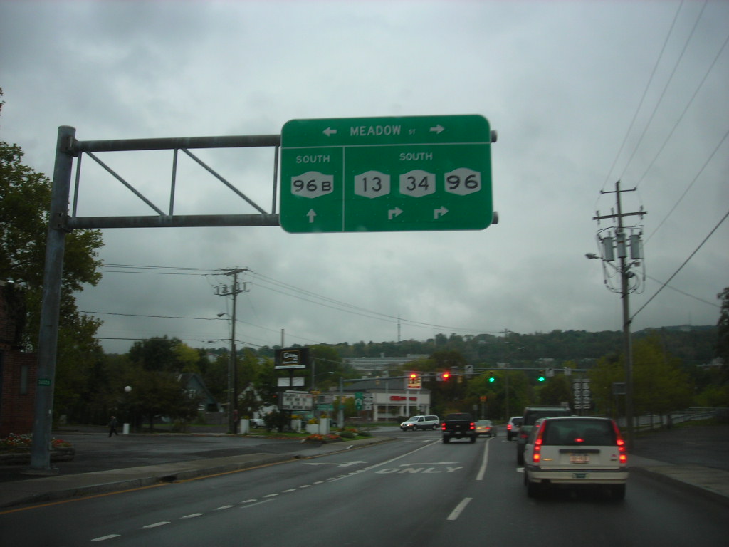
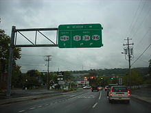 Overhead signage denoting NY 96B's northern terminus in Ithaca
The north–south highway connecting the village of Candor to the city of Ithaca was originally designated as part of Route 36, an unsigned legislative route assigned by the New York State Legislature in 1908.[4] When the first set of posted routes in New York were assigned in 1924, this part of Route 36 was included in the new NY 15, a highway extending from Owego to Rochester.[5][6] NY 15 was renumbered to NY 2 ca. 1939 to eliminate numerical duplication with U.S. Route 15.[7][8] NY 2 was subsequently renumbered to NY 96 in the early 1940s.[9][10] In the early 1950s, NY 96 was realigned between Candor and Ithaca to follow NY 223 to Spencer and NY 34 to Ithaca. The former routing of NY 96 between Candor and Ithaca was redesignated as NY 96B.[1][2]
Major intersections
County Location Mile[3] Destinations Notes Tioga Village of Candor 0.00 NY 96Tompkins City of Ithaca 19.56 NY 13 / NY 34 / NY 961.000 mi = 1.609 km; 1.000 km = 0.621 mi References
- ^ a b Sunoco (1952). New York (Map). Cartography by Rand McNally and Company.
- ^ a b Esso (1954). New York with Special Maps of Putnam–Rockland–Westchester Counties and Finger Lakes Region (Map). Cartography by General Drafting (1955–56 ed.).
- ^ a b "2008 Traffic Volume Report for New York State" (PDF). New York State Department of Transportation. June 16, 2009. p. 154. https://www.nysdot.gov/divisions/engineering/technical-services/hds-respository/NYSDOT%20TVR%202008%20by%20Route.pdf. Retrieved January 31, 2010.
- ^ State of New York Department of Highways (1909). The Highway Law. Albany, New York: J. B. Lyon Company. p. 65. http://books.google.com/books?id=jZ0AAAAAMAAJ&printsec=frontcover#PPA65,M1. Retrieved May 25, 2009.
- ^ "New York's Main Highways Designated by Numbers". The New York Times: p. XX9. December 21, 1924.
- ^ Rand McNally and Company (1926). Rand McNally Auto Road Atlas (western New York) (Map). http://www.broermapsonline.org/members/NorthAmerica/UnitedStates/Midatlantic/NewYork/unitedstates1926ra_008.html. Retrieved May 25, 2009.
- ^ Esso (1938). New York Road Map for 1938 (Map). Cartography by General Drafting.
- ^ Standard Oil Company (1939). New York (Map). Cartography by General Drafting.
- ^ Esso (1940). New York (Map). Cartography by General Drafting.
- ^ Esso (1942). New York with Pictorial Guide (Map). Cartography by General Drafting.
External links
Categories:- State highways in New York
- Transportation in Tioga County, New York
- Transportation in Tompkins County, New York

Wikimedia Foundation. 2010.