- Epping, New South Wales
Infobox Australian Place | type = suburb
name = Epping
city = Sydney
state = New South Wales
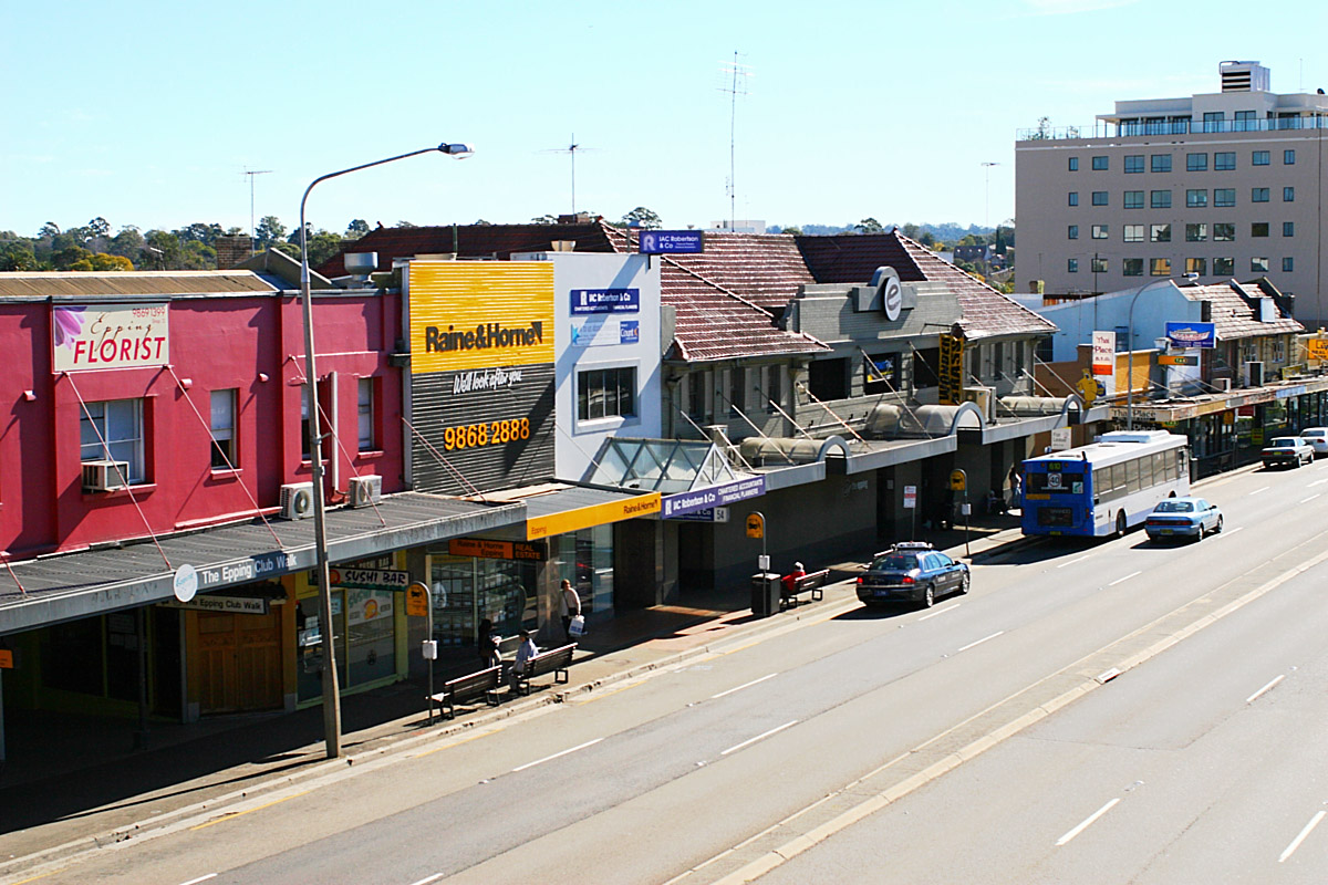
caption = Beecroft Road, from Epping Railway Station
lga =Hornsby Shire ,City of Parramatta
postcode = 2121
pop = formatnum:18970
pop_footnotes = Census 2006 AUS|id = SSC11367|name = Epping (State Suburb)|accessdate = 2008-03-15 |quick=on]
est = 1899
area =
propval = [http://www.domain.com.au/public/suburbprofile.aspx?mode=%20$257,000&searchterm=Epping#mapanchor $800,600] (2007)
stategov = Epping
fedgov = Bennelong
near-nw = Beecroft
near-n = Cheltenham
near-ne = North Epping
near-w = Carlingford
near-e = Marsfield
near-sw = Dundas Valley
near-s = Eastwood
near-se = Marsfield
dist1 = 18
dir1 = north-west
location1= Sydney CBDEpping is a
suburb ofSydney , in the state ofNew South Wales ,Australia . Epping is located 18kilometres north-west of theSydney central business district in the local government areas of theCity of Ryde , theCity of Parramatta andHornsby Shire .History
Epping is derived from
Epping Forest inEssex ,England .The Wallumedegal Aboriginal tribe lived in the area between the
Lane Cove River andParramatta River , which was known as Walumetta. Fact|date=September 2008In 1792,
Governor Phillip began the granting of parcels of lands to marines, and the area was referred to on Phillip's maps as the Field of Mars, named after the Roman Field of Mars probably because of the military link. It contained the area of what is now Epping, along with the surrounding suburbs of Ryde and Marsfield.Epping railway station was originally called 'Field of Mars' and then was changed to Carlingford. The first post office opened as East Carlingford. To avoid confusion, the postal department suggested changing the name of the railway station to East Carlingford but strong opposition led to other names being suggested such as Corella and East Lynne. In 1899 the suburb name of Epping was adopted after suggestion by a local landowner William Midson (1849-1924), after a town near
Epping Forest inEssex , where his father was born. ["The Book of Sydney Suburbs", Compiled by Frances Pollen, Angus & Robertson Publishers, 1990, Published in Australia ISBN 0-207-14495-8, page 100]Commercial Area
Epping features a small shopping centre close to Epping railway station. Other commercial and industrial developments are also located in the surrounding area.
Epping RSL club is a popular venue, which attracts many people including students from the nearby
Macquarie University . Epping also has a bar (Epping Hotel) with its own nightclub 'Tracks', also popular on Wednesdays and the weekend.Epping features some television production studios owned by the
Seven Network in the south of the suburb, but production of programs has moved to Pyrmont and the News & live studios in Martin Place in the centre of theSydney CBD . The station's former headquarters are due to close in 2009.Transport
Epping Station is on Northern railway line of Sydney's
CityRail network. Epping will soon become a junction for the Epping to Chatswood line, which is currently under construction and expected to be fully operational in early 2009. The second stage of this project which was intended to run west from Epping to Parramatta has been put on hold indefinitely.A
North West Metro is also under planning which will link Epping to Rouse Hill via Castle Hill and toSydney CBD viaTop Ryde, New South Wales ,Gladesville, New South Wales and Pyrmont.Epping is also well-serviced by bus facilities by
Sydney Buses andHillsbus . TheM2 Hills Motorway runs along the northern border to theSydney CBD .Epping Road is a major arterial road in the area that runs east from the railway station to the Pacific Highway.Churches
* Epping Seventh-day Adventist Church [http://www.eppingsda.org.au]
* Chester St Uniting Church, Oxford St Uniting Church, West Epping Uniting Church
* Emmaus Bible College
* Epping Baptist Church
* Epping Church of Christ
* Epping Gospel Chapel
* Epping Presbyterian Church, Presbyterian Reformed Church Epping
* North Side Chinese Alliance Church
* Our Lady Help of Christians (Roman Catholic ) Church
* St. Albans (Anglican ), St. Aidens - West Epping (Anglican) - part of the Epping Parishchools
* Arden Anglican School (formerly the Catholic girls' school "Our Lady of Mercy College")
*Epping Boys High School (located in Marsfield)
*Epping Heights Public School
*Epping North Public School
*Epping Public School
*Epping West Public School
* [http://www.olhcepping.dbb.catholic.edu.au/ Our Lady Help of Christians Catholic Primary School]Population
According to the
Australian Bureau of Statistics 2006 Census, Epping had a population of 18,970, of which 9,216 (48.6%) were male and 9,754 (51.4%) were female. Approximately 64% of residents living in Epping are Australian born and the majority of its migrant residents hail from Hong Kong (5%), China (4%), Korea (4%), Britain (4%) and India (2%) respectively.Epping is also known to be a more affluent suburb in its region, as evidenced by its higher median house prices compared to neighbouring suburbs, and the high proportion of professionals who reside in Epping (nearly double the Sydney average). [ [http://www.domain.com.au/public/suburbprofile.aspx?mode=%20$257,000&suburb=Epping&postcode=2121#mapanchor Epping suburb profile @ domain.com.au ] ]
Politics
Epping is primarily under the municipal authority of Ward C in the
Hornsby Shire Council, although theCity of Parramatta also administers a small area within the suburb.References
External links
Wikimedia Foundation. 2010.