- Goleniów County
Infobox Settlement
name = Goleniów County
native_name = Powiat goleniowski
settlement_type = County
total_type = Total
image_shield = POL powiat goleniowski COA.svg
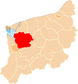
map_caption = Location within the voivodeship
subdivision_type = Country
subdivision_name = POL
subdivision_type1 = Voivodeship
subdivision_name1 = West Pomeranian
area_total_km2 = 1616.99
population_total = 78738
population_as_of = 2006
population_density_km2 = auto
population_urban = 42266
population_blank1_title = Rural
population_blank1 = 36472
coor_type = Goleniów
latd = 53
latm = 33
lats =
latNS = N
longd = 14
longm = 49
longs =
longEW = E
seat =Goleniów
parts_type =Gmina s
parts = Total 6
p1 =Gmina Goleniów
p2 = Gmina Maszewo
p3 =Gmina Nowogard
p4 =Gmina Osina
p5 =Gmina Przybiernów
p6 =Gmina Stepnica
blank_name = Car plates
blank_info = ZGL
website = http://www.powiat-goleniowski.pl __NOTOC__Goleniów County ( _pl. powiat goleniowski) is a unit of territorial administration and local government (powiat ) inWest Pomeranian Voivodeship , north-westernPoland . It was created onJanuary 1 ,1999 as a result of the Local Government Reorganization Act of 1998. Its administrative seat and largest town isGoleniów , which lies convert|22|km|mi|0 north-east of the regional capitalSzczecin . The county also contains the towns ofNowogard , lying convert|24|km|mi|0|abbr=on north-east of Goleniów, andMaszewo , convert|19|km|mi|0|abbr=on south-east of Goleniów.The county covers an area of convert|1616.99|km2|sqmi|1. As of 2006 its total population is 78,738, out of which the population of Goleniów is 22,448, that of Nowogard is 16,745, that of Maszewo is 3,073, and the rural population is 36,472.
Neighbouring counties
Goleniów County is bordered by
Kamień County andGryfice County to the north,Łobez County to the east,Stargard County to the south, the city ofSzczecin to the south-west,Police County to the west, and the city ofŚwinoujście (across theSzczecin Lagoon ) to the north-west.Administrative division
The county is subdivided into six
gmina s (three urban-rural and three rural). These are listed in the following table, in descending order of population.References
* [http://www.stat.gov.pl/gus/45_655_PLK_HTML.htm Polish official population figures 2006]

Wikimedia Foundation. 2010.