- Crandon Park
-
Crandon Park 
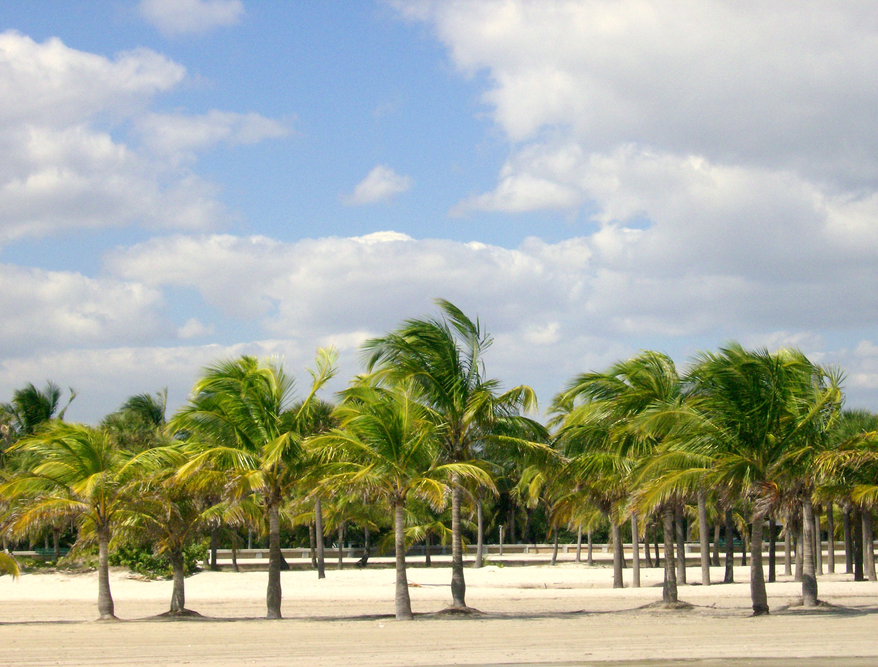
View West from on the beach, showing many of the coconut palm treesType Municipal Location 6747 Crandon Boulevard
Key Biscayne, Miami, Florida, United StatesArea 808.8 acres (3.273 km2) Created 1947 Operated by Miami-Dade Parks and Recreation Department Website Crandon Park Crandon Park is a 808-acre (3.27 km2) urban park in metropolitan Miami, occupying the northern part of Key Biscayne. It is connected to mainland Miami via the Rickenbacker Causeway.
Contents
History
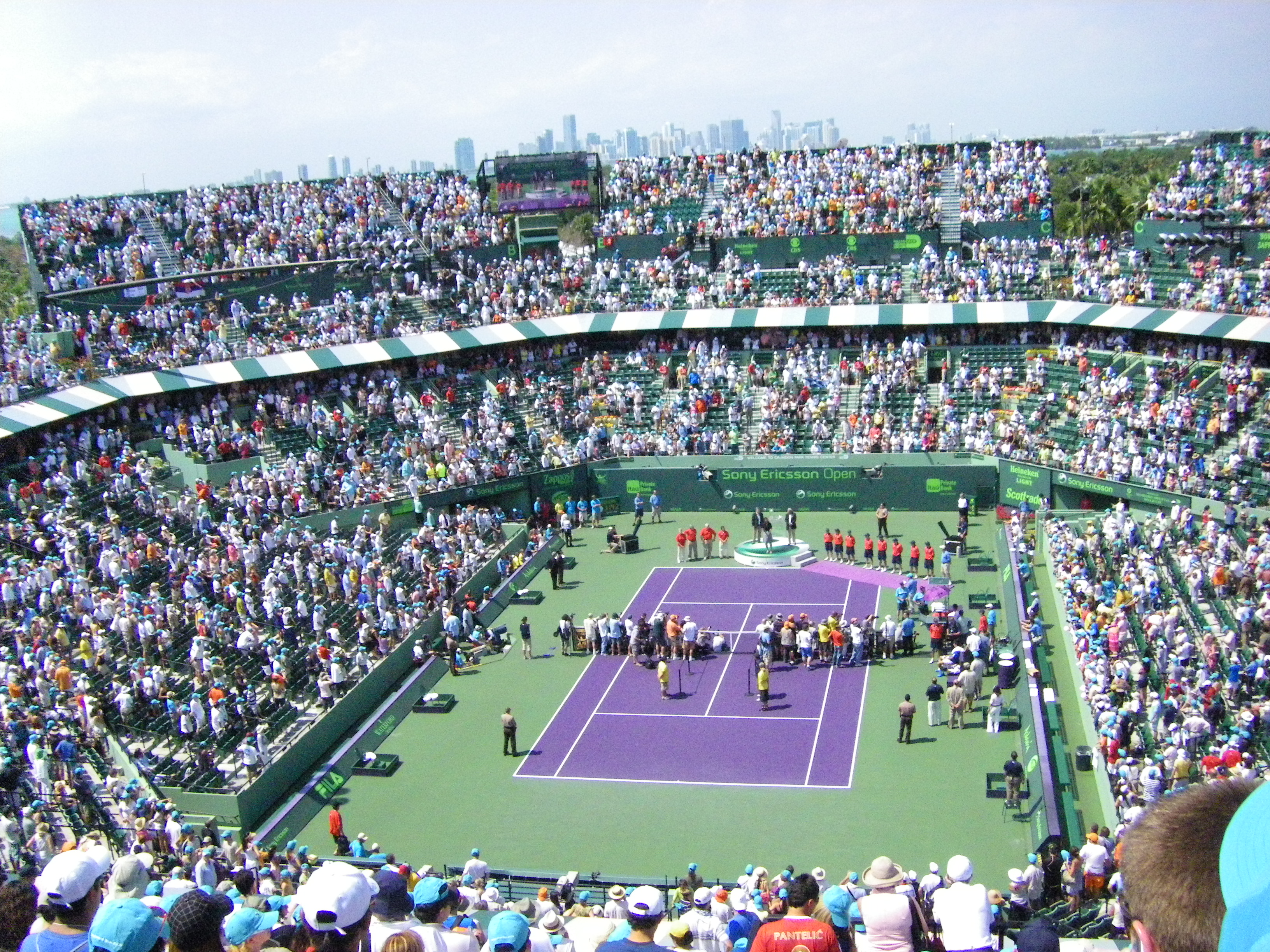
 Just south of Downtown Miami (visible background), Crandon Park is home to the Miami Masters, one of the world's major tennis tournaments
The land Crandon Park occupies was once part of the largest coconut plantation in the United States, operated by William John Matheson and his heirs. In 1940 the Matheson family donated 808.8 acres (327.3 hectares) of their land to Dade County (now Miami-Dade County) for a public park. In return, county commissioner Charles H. Crandon promised that the county would build a causeway to Key Biscayne. World War II delayed construction, but the causeway opened in 1947.
At one time Crandon Park also included a zoo, occupying 48 acres (19.4 hectares) of the park. The first animals in the zoo, including some lions, an elephant and a rhinoceros, had been stranded when a circus went out of business in Miami. Some Galapagos tortoises, monkeys and pheasants were added from the Matheson plantation. Other animals were added, including a white Bengal tiger. In 1981 the Crandon Park Zoo was moved from the park to a location south of Miami, and became the Miami MetroZoo, later renamed the Miami-Dade Zoological Park and Gardens.[1]
Since 1987, a major professional tennis tournament for both men and women has been held annually in Key Biscayne at the Tennis Center in Crandon Park. Currently known as the Sony Ericsson Open, the event was formerly the Lipton Tennis Championships from 1985 to 1999, the Ericsson Open in 2000 and 2001, and NASDAQ-100 Open from 2002 to 2006.
Facilities
The park is more than 800 acres (325 hectares) in size, and has two miles (3.2 kilometers) of beach on the Atlantic Ocean side. Crandon Boulevard extends from the end of the Rickenbacker Causeway through the length of the park, providing access to the Village of Key Biscayne and Bill Baggs Cape Florida State Park.
The park has a variety of facilities, including a marina, a golf course, a tennis center, a family amusement center, picnic shelters and a nature center. There is parking for more than 3,000 vehicles in the park. Part of the park is set aside as the Bear Cut Preserve, a designated natural Environment Study Area. Guided tours through the preserve are available.[2]
Gallery
-

View of South Beach from Crandon
-
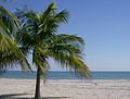
View of the Atlantic Ocean from on the beach
References
- Notes
- ^ Blank, Joan Gill. 1996. Key Biscayne. Sarasota, Florida: Pineapple Press, Inc. ISBN 1-56164-096-4. pp. 158-160, 163-164.
- ^ Miami-Dade Park and Recreation - Crandon Beach - URL retrieved September 12, 2006
- Bibliography
- Blank, Joan Gill. 1996. Key Biscayne. Sarasota, Florida: Pineapple Press, Inc. ISBN 1-56164-096-4.
- Crandon, Charles H. (no date, circa 1976). Country Bumpkin. Miami: Johnson Press.
- Wilkinson, Jerry (2001). "Life and Times of William John Matheson". http://www.keyshistory.org/Matheson-1.html. Retrieved March 02, 2011.
Coordinates: 25°42′36.79″N 80°9′23.12″W / 25.7102194°N 80.1564222°W
Categories:- Parks in Miami-Dade County, Florida
- Beaches of Miami-Dade County, Florida
-


Wikimedia Foundation. 2010.