- Trujillo Alto, Puerto Rico
Infobox Settlement
settlement_type =
subdivision_type = Country
subdivision_name =United States subdivision_type1 = Territory
subdivision_name1 =Puerto Rico
subdivision_type2 =
subdivision_name2 =timezone=AST
utc_offset=-4
timezone_DST=
utc_offset_DST=
unit_pref=Imperial
map_caption =Location of PAGENAME within Puerto Rico.
latNS=N
longEW=W| official_name = Trujillo Alto, Puerto Rico | nickname = "Ciudad de los Manantiales", "El Pueblo de las Ocho Calles", "La Ciudad En El Campo", "Los Arecostaos"
image_
| population_blank1 = Trujillanos|population_blank1_title=Gentilic| | population_blank1 = Trujillanos|population_blank1_title=Gentilic|
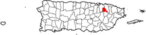
| map_caption = Location within the island ofPuerto Rico
established_date = January 8, 1801|established_title=Founded| leader_title =Mayor | leader_title=Mayor
leader_name = Hon. Pedro Padilla Ayala
political party = Partido Popular Democrático| leader_party = PPD
leader_title1=Senatorial dist.
leader_name1= 8 - Carolina
leader_title2=Representative dist.
leader_name2 = 40| area_magnitude = | area_total_km2 = 55.61
area_land_km2 = 55| area_water_km2 = .61| population_as_of = 2000 | population_note =
population_total = 76808|population_footnotes= | population_density_km2 = 1386.9| timezone = AST | utc_offset = -4 | timezone_DST = | utc_offset_DST = -4| latd= |latm= |lats=
longd=|longm= |longs=
latitude =
longitude =
website =
footnotes = Anthem – "Duerme mi lindo Trujillo" |Trujillo Alto (troo-HEE-yo AHL-to) is a
municipality ofPuerto Rico located in the Northern Coastal Plain and in thekarst zone, north of Caguas,and Gurabo; southeast of San Juan, and west of Carolina. Although Trujillo Alto has no important tourist attractions it is part of theSan Juan Metropolitan Area , which includes the municipalities of Bayamón, Guaynabo, Cataño, Toa Baja,Toa Alta and Canovanas. Trujillo Alto is spread over 6 wards and Trujillo Alto Pueblo (The downtown area and the administrative center of the city).Trujillo Alto is Puerto Rico's tenth largest municipality by population.
History
Trujillo Alto was founded on January 8,
1801 by the neighbors of the high part of the Loíza River. The name of the municipality comes from Alonso de Trujillo, the former owner of the "latifundio".Flag
White rectangular flag and the whole shield in the center of the flag
Coat of Arms
In a silver field, three green mountains, a Latin cross of blue centered above the mountains. Bordered in blue with eight spurts of water, in silver. The shield is stamped with a gold crown, heightened with five towers.
Demographics
Population
As of
2003 , the municipality has more than 75,000 habitants which makes it the tenth municipality in Puerto Rico in terms ofpopulation . The following table shows the growth of the population during the last century:Historical populations|type=Puerto Rico
1899|5683
1920|7470
1940|11726
1950|13605
1960|18251
1970|30351
1980|51389
1990|61120|Barrios (Districts/Wards) [http://welcome.topuertorico.org/maps/trujilloalto.pdf]
*Carraízo
*Las Cuevas
*Dos Bocas
*La Gloria
*Quebrada Grande
*Quebrada Negrito
*Saint Just
*Trujillo Alto PuebloGeo/Topography
*Carraízo dam
*Gorges; Colorada, Grande, Haya Fría, Infierno, Limones, Maracuto, Naranjo, Pastrana.
*Grande de Loíza RiverAnthem
Duerme mi lindo Trujillo
entre rojos tulipanes
bordado de flamboyanes
como silencioso nido
Eres remanso tranquilo
eres jardín en el valle
ensoñación inefable
prolongación de un idilioCuando subo a la montaña
miro de lo alto a lo hondo
y se retrata en el fondo
como cristal que no empañaEl Loíza que te baña
y al margen de su recodo
te va filtrando un tesoro
de rubia arena y de cañaY en la charca transparente
de la gran comba serena
en noches de luna llena
vuelca su arco reluciente,
tu centinela de puente
y es invertida diadema
suspendida en la corriente
aunque se vaya la arena...De tus delicados lirios
a lo largo del Loíza
lleva un secreto la brisa
que lo roba con sigiloCuando en sus pausados giros
en una tierna caricia
les regala una sonrisa
y les arranca un suspiroLa tortuosa carretera
que serpentea en tu entrada
es una cinta enlazada
que parte en dos la ladera...Y en invierno y primavera
se ve con flores regada...
Es que flora perfumada
es tu bendición eterna.Y cuando rompe la calma
y su ira desenfrena el Río Grande,
ruge austera su corriente
y se derrama sobre la ancha rivera;
y a tus manteles de grana prende
girones de arena con alfileres de palmaEconomic
Agriculture
*Fruits and cattle ranching.
Industrial
*Factories; nutritional products, wood, fabric, metal, electrical and electronic machinery;
*Stone quarries,Tourism
Trujillo Alto holds its festivities in September, and in 2001, it conmemorated its 200 year history. Each year Trujillo Alto celebrates "El maratón del Arrecostao", which is a very popular marathon in the town.
Landmarks and places of interest
• Carraízo Dam • Convent Carmelitas de San José• Lourdes Grotto• Manantial de la Montaña (spring)
Festivals and events
*Patron Festivities - May but celebrate in September
*Paso Fino Fair - November
*Macabeo Festival - DecemberMain Roads
The main road is the “Carretera #181” (Highway #181) that crosses the municipality of north to south. After that, are other highways are the #852 of the Quebrada Grande neighborhood and Dos Bocas, the #175 of the neighborhood Carraízo, the Avenue “Las Cumbres” and the “Carretera #851” from “La Gloria” neighborhood.
Notable "Trujillanos"
*
Tulio Larrinaga - - Civil Engineer and Resident Commissioner
*Medardo Carazo - Most notable educator and school principal after whom the town's high school is named
*Yolandita Monge - Singer and Actress
*Emmanuel Vélez Pagán - Member ofMenudo (band)
*Jorge Maldonado (Rico Casanova) - Professional Wrestler
*Irmaris "la guay" Rios - pincho maker and syrup smuggler
*Mario Estrada - Lechoneer & Pernil Carver
*Glorimar Urbina Reyes - criminal lawyer
*Emilio Diaz Valcarcel - Novelist after whom the Municipal library is named
*Manuel Rivera Morales - Radio personality and Sports announcer after whom the "Expreso de Trujillo" thoroughfare is namedReferences
External links
* [http://factfinder.census.gov/servlet/GCTTable?_bm=y&-geo_id=05000US72139&-_box_head_nbr=GCT-PH1&-ds_name=DEC_2000_SF1_U&-redoLog=false&-mt_name=DEC_2000_SF1_U_GCTPH1_CO2&-format=CO-2 Trujillo Alto and its barrios, United States Census Bureau]
Wikimedia Foundation. 2010.