- Nürensdorf
-
Nürensdorf 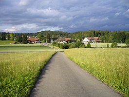
Country Switzerland 
Canton Zurich District Bülach 47°30′N 8°22′E / 47.5°N 8.367°ECoordinates: 47°30′N 8°22′E / 47.5°N 8.367°E Population 5,170 (Dec 2010)[1] - Density 512 /km2 (1,327 /sq mi) Area 10.03 km2 (3.87 sq mi)[2] Elevation 502 m (1,647 ft) Postal code 8309 SFOS number 0064 Surrounded by Bassersdorf, Brütten, Kloten, Lindau, Oberembrach Website www.nuerensdorf.ch
SFSO statistics
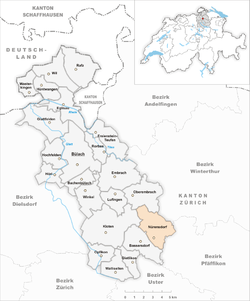
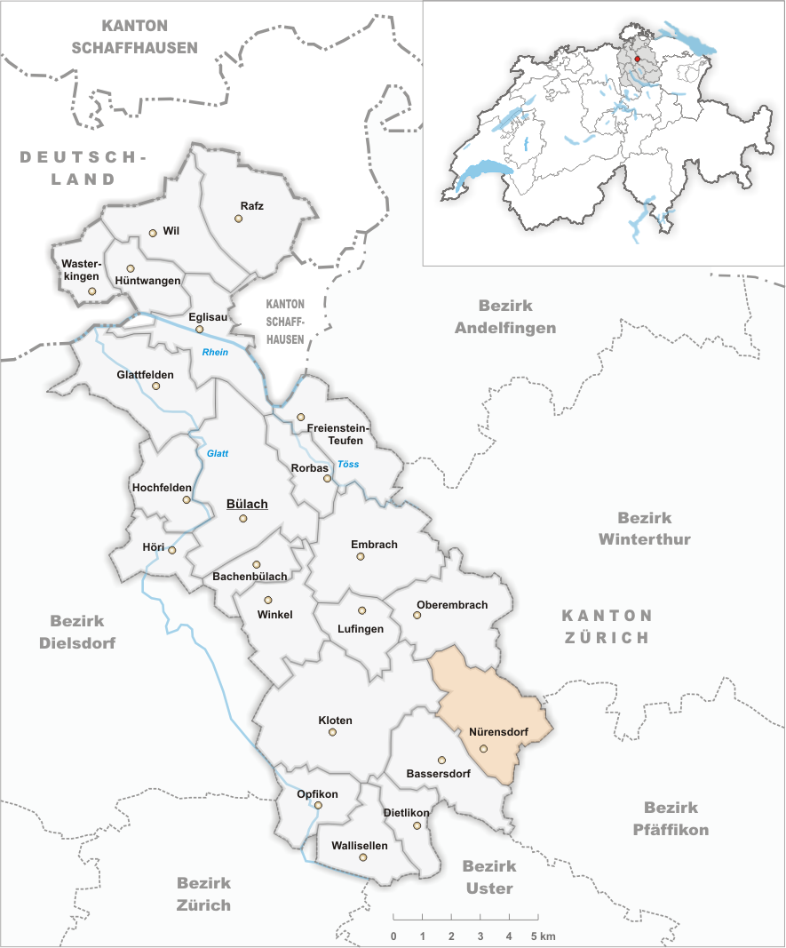
 NürensdorfMap of Nürensdorf
Nürensdorf is a municipality in the district of Bülach in the canton of Zürich in Switzerland.
Contents
History
Nürensdorf is first mentioned around 1150 as Noelistorf. In 1277 it was mentioned as Nueristorf.[3]
Geography
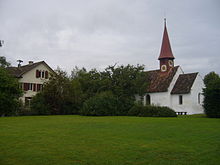 Nürensdorf school and Chappel of St. Oswald
Nürensdorf has an area of 10.1 km2 (3.9 sq mi). Of this area, 48.6% is used for agricultural purposes, while 32.1% is forested. The rest of the land, (19.2%) is settled.[4]
The municipality is located on the south west edge of the Brütten plateau. The main village is Nürensdorf, a Haufendorf (an irregular, unplanned and quite closely packed village, built around a central square) which was a Straßendorf (Linear village) until about 1700. The municipality also includes the town sections of Birchwil (first mentioned around 1155 as Byrchenwilare), Breite and Oberwil, the hamlets of Hakab, Breitenloo, Chlihus and until 1931 Baltenswil (now part of Bassersdorf). Additionally, since 1869, the village of Breitehof has been part of the municipality.
Demographics
Nürensdorf has a population (as of 31 December 2010) of 5,170.[1] As of 2007[update], 11.3% of the population was made up of foreign nationals. Over the last 10 years the population has grown at a rate of 12.9%. Most of the population (as of 2000[update]) speaks German (90.6%), with Italian being second most common ( 2.2%) and French being third ( 1.2%).
In the 2007 election the most popular party was the SVP which received 45.6% of the vote. The next three most popular parties were the FDP (15.3%), the SPS (11.8%) and the CSP (9.5%).
The age distribution of the population (as of 2000[update]) is children and teenagers (0–19 years old) make up 22.5% of the population, while adults (20–64 years old) make up 66.2% and seniors (over 64 years old) make up 11.3%. In Nürensdorf about 83.9% of the population (between age 25-64) have completed either non-mandatory upper secondary education or additional higher education (either university or a Fachhochschule).
Nürensdorf has an unemployment rate of 1.75%. As of 2005[update], there were 68 people employed in the primary economic sector and about 29 businesses involved in this sector. 327 people are employed in the secondary sector and there are 42 businesses in this sector. 452 people are employed in the tertiary sector, with 111 businesses in this sector.[4] The historical population is given in the following table:[3]
year population 1467 145 1634 409 1799 832 1850 1,114 1900 1,068 1950 777a 1960 906 1970 2,012 2000 4,475 - ^a Baltenswil had a population in 1930 of 245. It became part of Bassersdorf in 1931.
References
- ^ a b Canton of Zurich Statistical Office (German) accessed 29 March 2011
- ^ Arealstatistik Standard - Gemeindedaten nach 4 Hauptbereichen
- ^ a b Nürensdorf in German, French and Italian in the online Historical Dictionary of Switzerland.
- ^ a b Swiss Federal Statistical Office accessed 30-Jul-2009
External links
- Official website (German)
Municipalities in the district of Bülach, Switzerland Bachenbülach | Bassersdorf | Bülach | Dietlikon | Eglisau | Embrach | Freienstein-Teufen | Glattfelden | Hochfelden | Höri | Hüntwangen | Kloten | Lufingen | Nürensdorf | Oberembrach | Opfikon | Rafz | Rorbas | Wallisellen | Wasterkingen | Wil | Winkel
Canton of Zürich | Districts of Canton Zürich | Municipalities of the canton of Zurich


Wikimedia Foundation. 2010.