- Mount Tyree
-
Mount Tyree Elevation 4,852 m (15,919 ft) [1] Listing Seven Second Summits Location Location Antarctica Range Sentinel Range Coordinates 78°24′S 85°55′W / 78.4°S 85.917°WCoordinates: 78°24′S 85°55′W / 78.4°S 85.917°W[1] Climbing First ascent 1967 by Barry Corbet and John Evans, members of Nicholas Clinch's team Easiest route Rock and snow climb 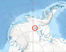 Location of Sentinel Range in Western Antarctica.
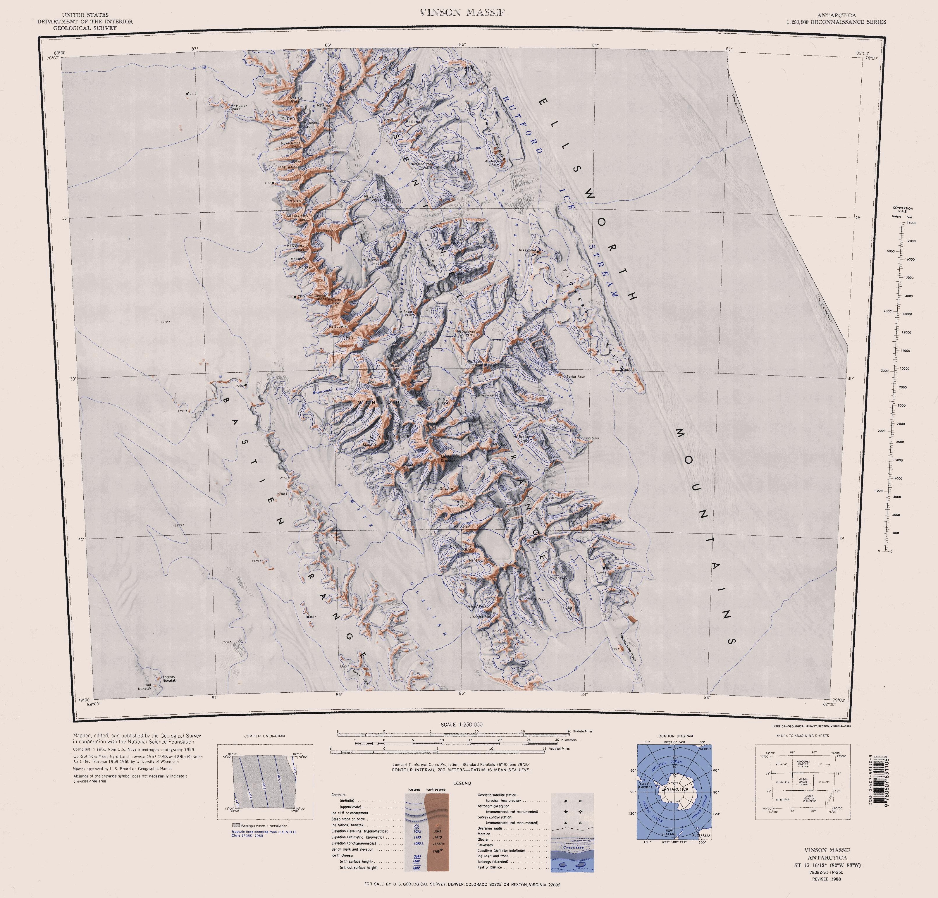
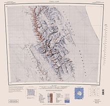 Sentinel Range map.
Mount Tyree (4852m) is the second highest mountain of Antarctica located 13 kilometres northwest of Vinson Massif (4,892 m), the highest peak on the continent.
Mt. Tyree was discovered in January 1958 during reconnaissance flights by the United States Navy VX-6 squadron, and mapped later that month by the Marie Byrd Land Traverse Party. The mountain was named for Rear Admiral David M. Tyree, who was commander of the U.S. Naval Support Force in Antarctica, from April 14, 1959 to November 26, 1962.[1]
As of 2007, the summit has only been reached on four occasions, by a total of seven people, via three different routes: in January 1967 by John Evans and Barry Corbet (of Corbet's Couloir); in January 1989 by Terry ‘Mugs’ Stump; in 1997 by French alpinists Antoine de Choudens and Antoine Cayrol; and later in 1997 by Conrad Anker and Alex Lowe. Out of seven mountaineers who successfully climbed Mt Tyree, three died in unrelated mountaineering accidents within four years of their respective ascents.[2] The still-unclimbed south face is 2,000 metres (6,600 ft) in height and one of the largest walls in Antarctica.
The climbing season is November to January, when the sun is above the horizon 24 hours a day and the air is warmest - up to −30 °C (−20 °F) near the summit.[citation needed] Like the nearby Mount Vinson, the mountain may be accessed by the means of a 6-hour flight from Punta Arenas, Chile to Union Glacier Camp followed by a 200 km flight on a ski plane to the base of the mountain.
References
Seven Second Summits Asia K2 (8,611 m/28,251 ft)
South America Ojos del Salado (6,893 m/22,615 ft)
North America Mount Logan (5,959 m/19,551 ft)
Africa Mount Kenya (5,199 m/17,057 ft)
Europe Dykh-Tau (5,205 m/17,077 ft) • or Monte Rosa (4,634 m/15,203 ft)Antarctica Mount Tyree (4,852 m/15,919 ft)
Australia (Oceania) Puncak Trikora (4,730 m/15,518 ft) • or Mount Townsend (2,209 m/7,247 ft)

This Ellsworth Land location article is a stub. You can help Wikipedia by expanding it.