- Mount Marsabit
-
Mount Marsabit 
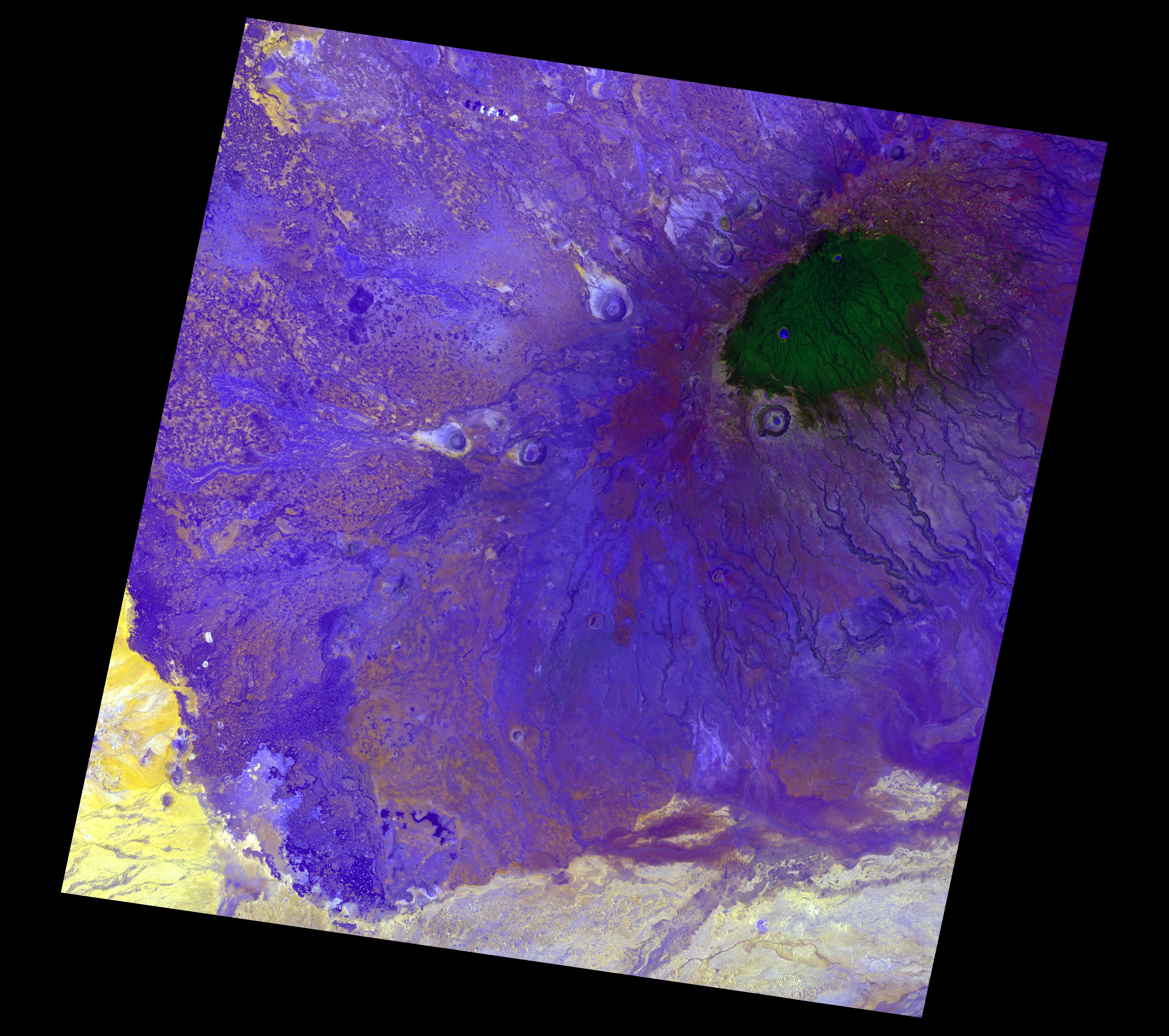
Satellite image of MarsabitElevation 1,707 m (5,600 ft) Location Location Eastern Province, Kenya Coordinates 2°19′N 37°58′E / 2.317°N 37.967°E Geology Type shield volcano Last eruption unknown Marsabit is a 6300 km² basaltic shield volcano in Kenya, located 170 km east of the center of the East African Rift, in Marsabit District near the town of Marsabit. This was primarily built during the Miocene, but some lava flows and explosive maar-forming eruptions have occurred more recently. At least two of the maars host crater lakes.
The volcano is covered by dense forest. Marsabit National Park is in the area.
See also
References
- "Marsabit". Global Volcanism Program, Smithsonian Institution. http://www.volcano.si.edu/world/volcano.cfm?vnum=0202-021.
External links
Categories:- Marsabit District
- Eastern Province (Kenya)
- Volcanoes of Kenya
- Maars
- Mountains of Kenya
- Crater lakes
- Miocene volcanoes
- Eastern Province, Kenya geography stubs
Wikimedia Foundation. 2010.