- Murrumbidgee River Rail Bridge (Wagga Wagga)
-
Murrumbidgee River Rail Bridge 
Wrought iron lattice railway bridgeCarries Rail Crosses Murrumbidgee River Locale Wagga Wagga, New South Wales Design Lattice Truss Total length 159 feet (48.5 m) Opened 1881 Closed 3 January 2007 Murrumbidgee River Rail Bridge is located over the Murrumbidgee River in Wagga Wagga, New South Wales. The bridge was the only 4 span wrought iron lattice truss bridge constructed and is the second oldest bridge out of the twelve related wrought iron lattice truss series bridges in Australia. The bridge was opened on the Main Southern railway line in 1881, each of the 4 lattice truss spans is 48.5 metres (159 ft) long which joined onto the what was thought to be the longest timber viaduct in Australia which has since been replaced[1]. The bridge is of major importance to the history of bridge engineering in Australia.[2][3][4]
The bridge was removed and replaced with a new concrete bridge during a 4 day shut down from 30 December 2006 to 3 January 2007. The wrought iron lattice railway bridge was cut away using Oxy cutters. One cut section of the bridge was given to Tumbarail located at Ladysmith.[5]
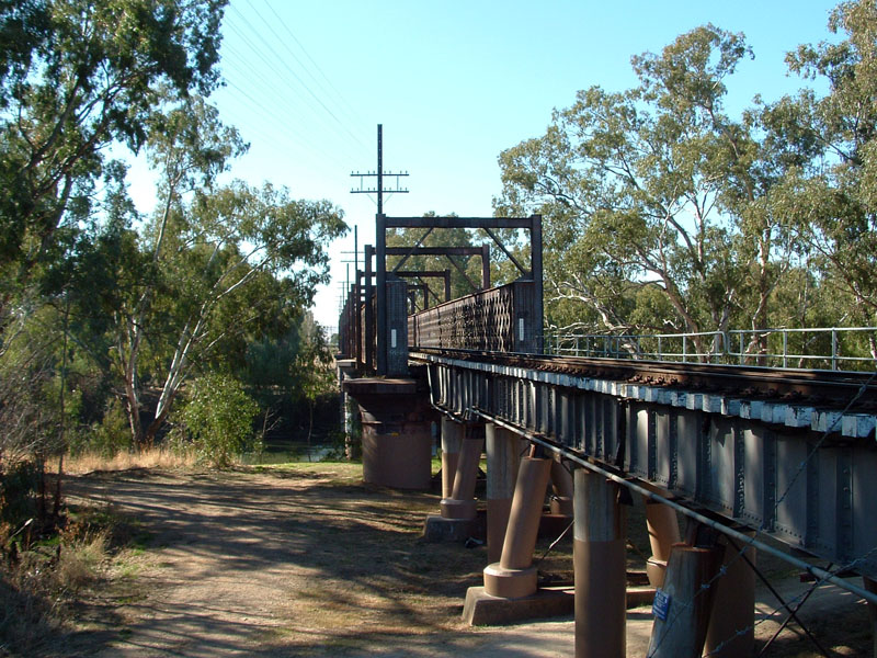
Photographs
-

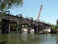
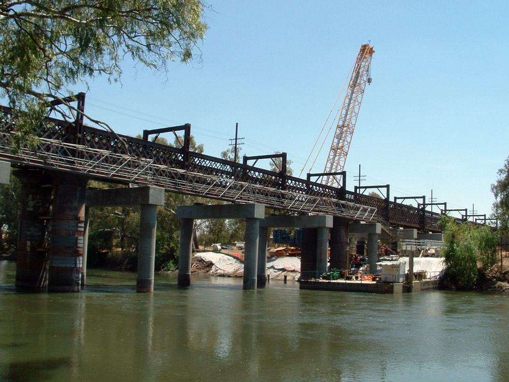
Wrought iron lattice railway bridge (27 July 2006)
-

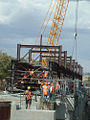
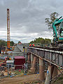
Construction
-
Southeastern Side of the new and old bridge
-
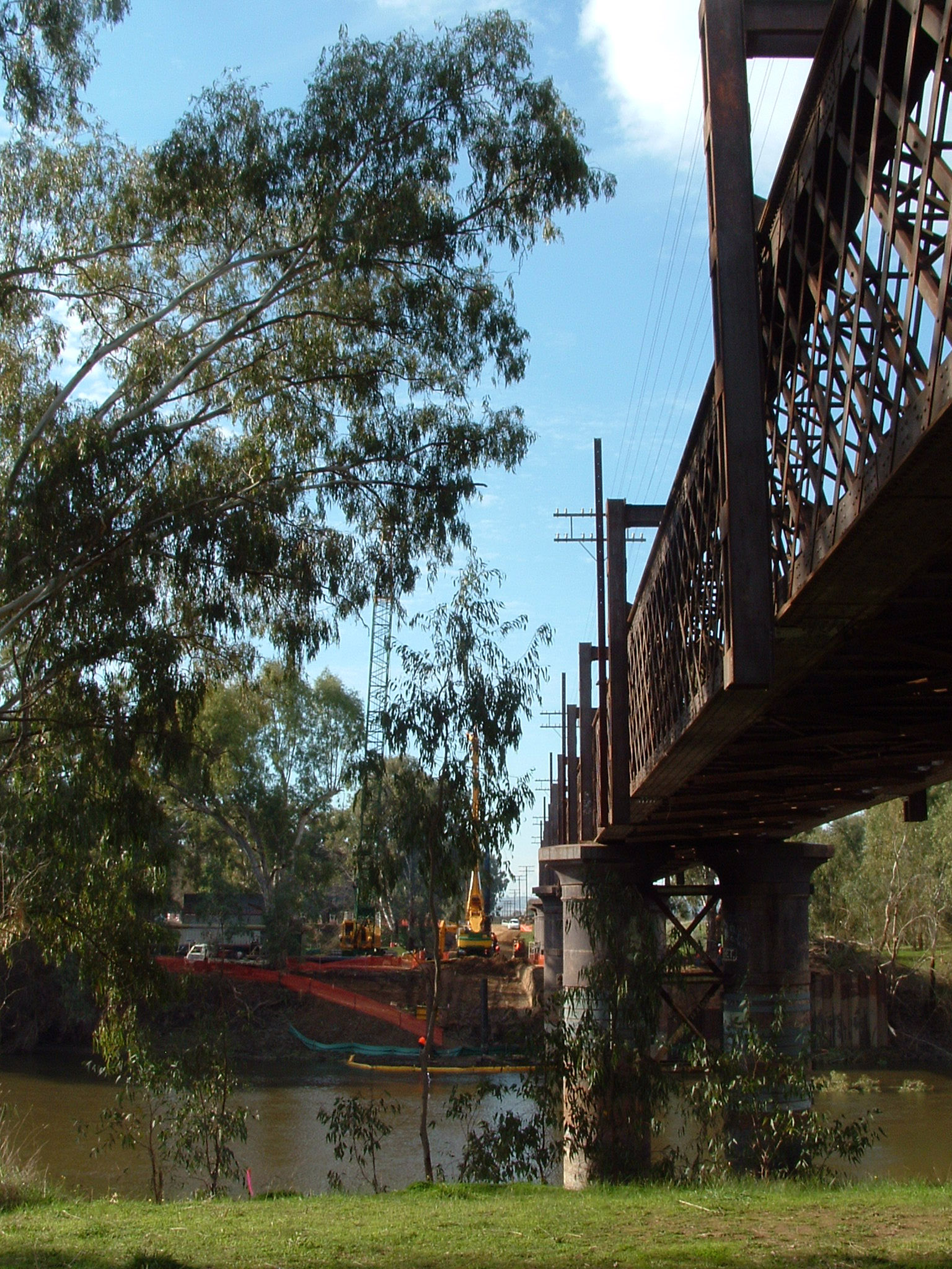
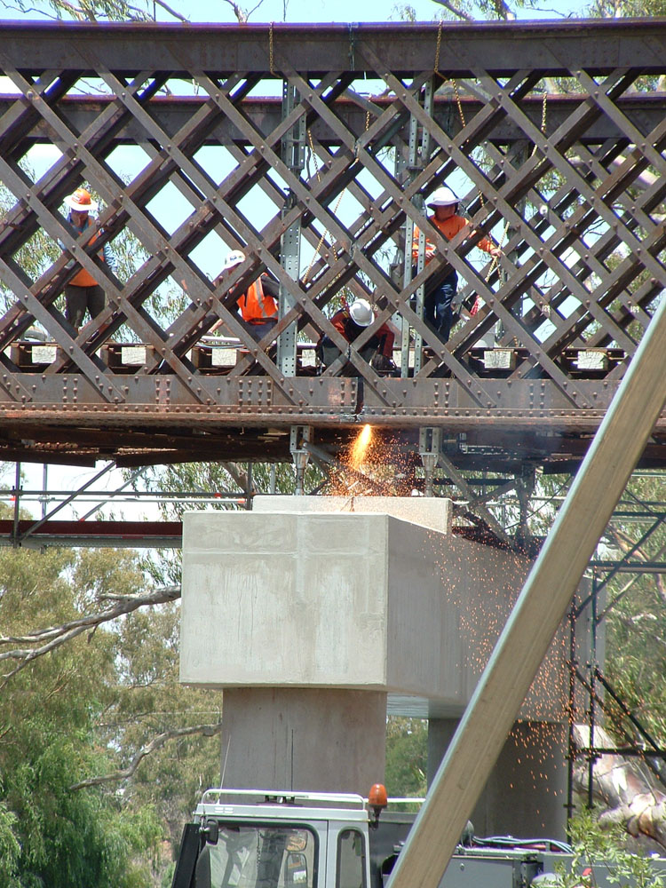
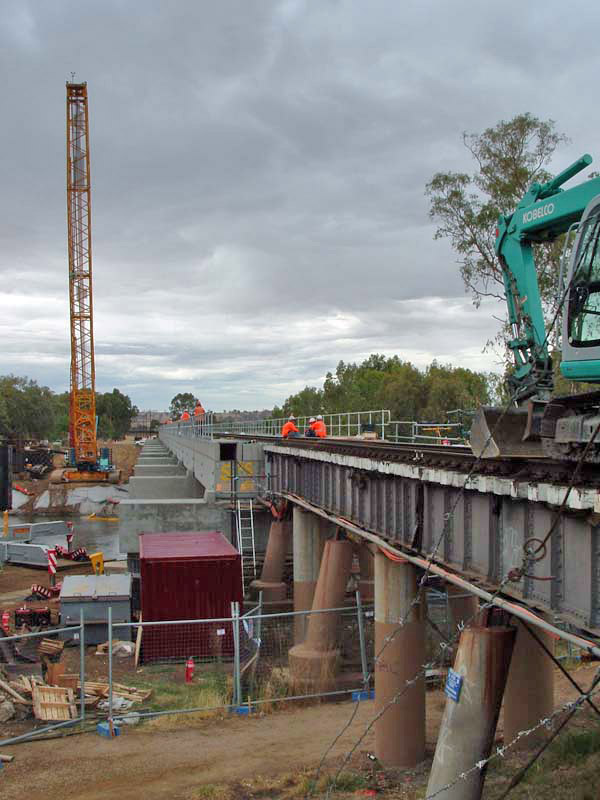
Removal of the old bridge
-
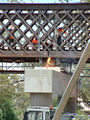
Removal of a 16 m span of the bridge.
-

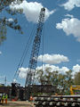
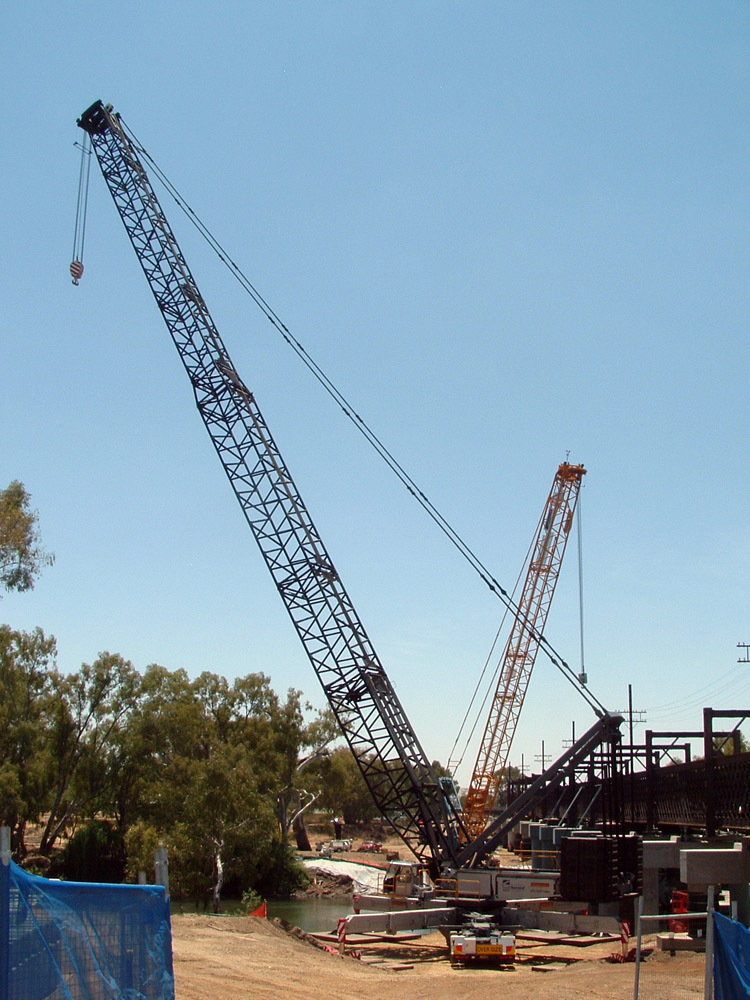
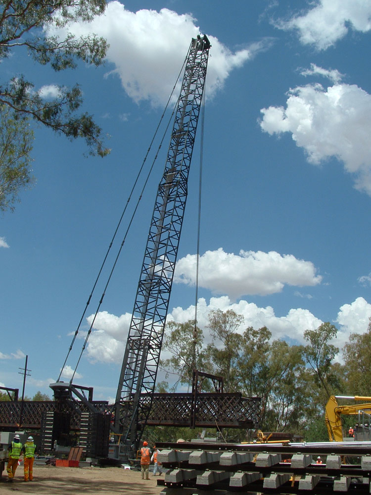
Work site view.
-
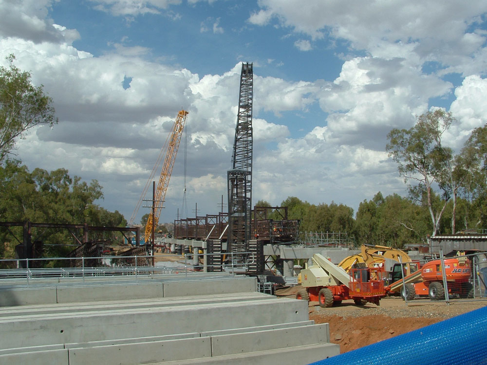
Whats left of the bridge removal.
-
New Bridge.
Notes
- ^ Australian Railway Historical Society Bulletin, January, 1987 pp3-15
- ^ "Murrumbidgee River Rail Bridge, Wagga Wagga, NSW (entry AHD15910)". Australian Heritage Database. Department of Sustainability, Environment, Water, Population and Communities. http://www.environment.gov.au/cgi-bin/ahdb/search.pl?mode=place_detail;place_id=15910. Retrieved 2007-01-30.
- ^ "Iron Lattice Girder Railway Bridges" (pdf). Endangered Places. National Trust of Australia. Archived from the original on 2006-10-08. http://web.archive.org/web/20061008112319/http://www.nationaltrust.org.au/pdfs/0305.pdf. Retrieved 2007-01-30.
- ^ "Wagga Wagga" (pdf). Railway Lattice Bridge and Viaducts. Institution of Engineers. Archived from the original on 2006-12-31. http://web.archive.org/web/20061231003951/http://www.sydney.ieaust.org.au/heritage/PDFs/Railway+Wagga.pm.pdf. Retrieved 2007-01-30.
- ^ "New $16m bridge for Wagga". The Daily Advertiser. 2006-12-30. http://www.riverinamediagroup.com.au/Home/news.asp?publication=The%20Daily%20Advertiser&articleType=Local&ArticleID=15125. Retrieved 2007-01-30.
External links
Coordinates: 35°6′56.53″S 147°22′58.16″E / 35.1157028°S 147.3828222°E
Categories:- Bridges in New South Wales
- Railway bridges in Australia
- Bridges completed in 1881
- Concrete bridges
- Crossings of the Murrumbidgee River
-

Wikimedia Foundation. 2010.