- Roosevelt Island
Infobox Islands
name = Roosevelt
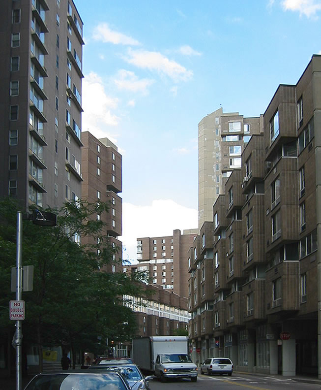
image caption = Main Street on Roosevelt Island
image size = 250px
locator
Location map|USA New York City|lat=40.761927|long=-73.950093
map_custom = yes
native name =
native name link =
nickname =
location =East River
coordinates = coord|40.761927|N|73.950093|W|display=inline
archipelago =
total islands =
major islands =
area = convert|147|acre|km2|abbr=on
length = convert|2|mi|km|abbr=on
width = convert|800|ft|m|abbr=on
highest mount =
elevation =
country = United States
country admin divisions title = State
country admin divisions = flag|New York
country admin divisions title 1 = City
country admin divisions 1 =New York City
country admin divisions title 2 = Borough
country admin divisions 2 =Manhattan
country largest city =
country largest city population =
population = 9,520
population as of = 2000
density = 16135.59
ethnic groups = 45% white (non-Hispanic), 27% black, 11% Asian or Pacific Islander, and .3% other races
additional info =Roosevelt Island, formerly known as Welfare Island, and before that Blackwell's Island, is a narrow island in the
East River ofNew York City . It lies between the island ofManhattan to its west and the borough ofQueens to its east. Running from Manhattan's East 46th to East 85th streets, it is about two miles long, with a maximum width of 800 feet, and a total area of 147 acres. The island is part of the Borough of Manhattan and New York County. Together withMill Rock Island, Roosevelt Island comprises New York County's Census Tract 238, which has a land area of .279 sq mi. [ [http://factfinder.census.gov/servlet/DTTable?_bm=y&-context=dt&-ds_name=DEC_2000_SF1_U&-CONTEXT=dt&-mt_name=DEC_2000_SF1_U_G001&-tree_id=4001&-transpose=N&-redoLog=true&-all_geo_types=N&-_caller=geoselect&-geo_id=14000US36061023800&-search_results=15000US360610240009&-format=&-_lang=en&-show_geoid=Y] United States Census Bureau] and had a population of 9,520 in 2000 according to the US Census. [ [http://www.nytimes.com/2007/09/02/realestate/02livi.html "An Island Joins the Mainstream" - New York Times (September 2, 2007)] ] The Roosevelt Island Operating Corporation estimated its population was about 12,000 in 2007. [According to the US Census 2000, Mill Rock Island (Census Block 9000) is unpopulated] The land is owned by the city, but was leased to the State of New York'sUrban Development Corporation for 99 years in 1969. Most of the residential buildings on Roosevelt Island are rental buildings. One (Rivercross) is a cooperative. One (Riverwalk Place) is a condo. One rental building (Eastwood) has left New York State'sMitchell-Lama affordable housing program, though current residents are protected. Three other buildings are now working toward privatization, including the cooperative.History
Before European Colonization, the island was called Minnahononck [ [http://www.britannica.com/eb/article?tocId=9083898 "Roosevelt Island." Encyclopædia Britannica. 2006. Encyclopædia Britannica Premium Service] (18 Jan. 2006)] (sometimes spelled Minnahanock) by the native Americans.
In 1637, the Dutch purchased the island from the natives and named it Varckens (Hogs') Island. It was named Manning's Island after captain John Manning between 1666 and 1686, Blackwell's Island between 1686 and 1921, and Welfare Island between 1921 and 1973. Throughout the 19th century, various hospitals, asylums, and correctional institutions were located on the island. Welfare Penitentiary (where entertainer
Mae West once served time) was closed in 1935 after the completion of a new penitentiary onRikers Island . (At least one source claims the island was named "Flynn's Island" prior to being renamed Blackwell's Island.)In 1973, the island was renamed again in anticipation of the building of a major
United States Presidential Memorial to PresidentFranklin D. Roosevelt . The monument was intended - in part - to make the island more attractive to potential residents and visitors. It was planned as a large three-walled granite room open to the sky and facing the water at the island's southern tip, with theFour Freedoms inscribed on one wall. Owing primarily to the untimely death of the architect,Louis Kahn , the memorial was never built. Some still hope to complete the project despite the construction of aFranklin Delano Roosevelt Memorial in the nation's capital. [ [http://cityroom.blogs.nytimes.com/2007/10/26/a-campaign-to-build-a-long-delayed-fdr-memorial/index.html A Campaign to Build a Long-Delayed F.D.R. Memorial - City Room - Metro - New York Times Blog ] ] An alternative proposal involving calling for a large public plaza at the site also has been halted.During the 1980s and 1990s, the island was developed as a residential community with a number of
high-rise apartment buildings. Two long-term medical care facilities of Goldwater Hospital are located at opposite ends of the island. Many foreign diplomats live on Roosevelt Island because of its proximity toUnited Nations headquarters on the East Side of Manhattan. Residents are members of a Residents Association (RIRA), and the Island is served by a fortnightly community newspaper, "The Main Street WIRE ", and by a resident-operated website, NYC10044.com at http://nyc10044.com.Roosevelt Island is sometimes referred to as "The Little Apple" - a jocular allusion to New York City's "
Big Apple " moniker. A detailed history of the Island is available at http://nyc10044.com/timeln/timeline.html.Architecture
Though small, Roosevelt Island has a distinguished architectural history. It has several architecturally significant buildings, and has been the site of numerous important unbuilt architectural competitions and proposals.
The island's masterplan, adopted by the New York State
Urban Development Corporation in 1969, was developed by the firm ofPhilip Johnson andJohn Burgee . The plan divided the island into three residential communities. The plan is noteworthy because it forbade the use of automobiles on the island. It was intended that residents would park their cars at a large garage and use public transportation to circulate. Another innovation was the plan's development of a 'mini-school system' in which classrooms for the island's public intermediate school were distributed among all the residential developments, in a campus-like fashion (as opposed to being centralized in one large building).The first phase of Roosevelt Island's development was called "Northtown." It consists of four housing complexes: Eastwood, Island House, Rivercross, and Westview. Rivercross is a
Mitchell-Lama co-op, while the rest of the buildings in Northtown are rentals. Eastwood, the largest apartment complex on the island, and Westview were designed by noted architectJosep Lluis Sert , then dean ofHarvard Graduate School of Design . Eastwood, along with Peabody Terrace (in Cambridge, Massachusetts), is a prime example of Sert's investigations into high-rise multiple-dwelling residential buildings. It achieves a remarkable level of efficiency by triple-loading corridors with duplex apartment units, such that elevators and public corrdiors are only needed every three floors. Island House and Rivercross were designed by Johansen & Bhavnani. The two developments were noteworthy for their use of pre-fabricated cladding systems.Subsequent phases of the island's development have been less innovative, architecturally. Northtown Phase II was developed by the Starrett Corporation and was designed by the firm Gruzen Samton in a pseudo-historical post-modern style. It was completed in 1989, over a decade after Northtown. Southtown, also designed by Gruzen Samton, is the third phase of the island's development. It was not started until 1998, and is still in the process of development.
As of January 2008, Buildings 1, 2, 3 and 4 have been completed. Buildings 5 and 6 are currently under construction. Residential development of Southtown has brought new retail businesses to Roosevelt Island, including a
Starbucks andDuane Reade . Roosevelt Island, which is known for its limited variety of restaurants, has also gained two new restaurants as a result of Southtown development: Nonno's Foccaceria and Fiji East.The Octagon, one of the island’s six landmarks, was restored in 2006. Originally designed by Alexander Jackson Davis in 1839 as the New York Lunatic Asylum, the national landmark and LEED Silver green building is now a high-end apartment community. It also houses the largest array of solar panels on any building in New York City.
In addition to Louis Kahn's Roosevelt Memorial, the island has also been the site of numerous other architectural speculations.
Rem Koolhaas and theOffice of Metropolitan Architecture proposed two projects for the Island in his book "Delirious New York": the Welfare Island Hotel and the Roosevelt Island Redevelopment Proposal (both in 1975-76). That proposal was Koolhaas's entry into a competition held for the development of Northtown Phase II. Other entrants includedPeter Eisenman ,Robert A. M. Stern , andOswald Mathias Ungers .In 2006, ENYA (Emerging New York Architects) made the island's abandoned southern end the subject of one of its annual competitions.
Transportation
Although Roosevelt Island is located directly under the
Queensboro Bridge , it is not directly accessible from the bridge itself. A trolley connected passengers from Queens and Manhattan to a stop in the middle of the bridge, where passengers could take an elevator down to the island. The trolley operated from the bridge's opening untilApril 7 ,1957 . [Phillips, McClandish. [http://select.nytimes.com/gst/abstract.html?res=F10C15FF345A137A93C5A9178FD85F438585F9&scp=1&sq=%22welfare%20island%22%20trolley&st=cse "City's Last Trolley at End of Line; Buses Will Replace 49-Year Route on Queensboro Span"] , "The New York Times ",April 7 ,1957 . AccessedAugust 17 ,2008 .] Between 1930 and 1955, the only vehicular access to the island was provided by an elevator system in the Elevator Storehouse that transported cars and commuters between the bridge and the island. The elevator was closed to the public after the construction of theRoosevelt Island Bridge between the island and Astoria in 1955. It was finally demolished in 1970.In 1976, the
Roosevelt Island Tramway was constructed to provide access to Midtown Manhattan. Access to theIND 63rd Street Line (now NYCS 63rd IND) finally arrived in 1989. Located over 100 feet below ground level, the Roosevelt Island station is one of the deepest in New York City's subway system.Roosevelt Island's residential community was not designed to support automobile traffic during its planning in the early 1970s. Automobile traffic has become common even though much of the island remains a car-free area. The
MTA Bus Company Q102 route operating between the island and Astoria obviates the need for automobiles to some extent.The Roosevelt Island Operating Corporation (RIOC) operates an on-island shuttle bus service from apartment buildings to the subway and tramway for a fare of 25¢ (10¢ for seniors and disabled people). The bright red buses are highly visible.
Waste in the Roosevelt Island is collected by an
Automated Vacuum Collection System. This is the only AVAC system serving a residential complex in the USA.Demographics
As of the 2000 census [ [http://www.rioc.com/community.htm rioc.com] ] , Roosevelt Island had a population of 9,520. 4,995, or 52% of the population, were female, and 4,525, or 48%, were male. The population was spread out with 5% under the age of 5, 20% under the age of 18, 67% between the ages of 18 and 65, and 15% over the age of 65.
The racial makeup of the island was 45% white (non-Hispanic), 27% black, 11% Asian or Pacific Islander, and .3% other races. 14% were Hispanic or Latino of any race.
The median income was $49,976. 37% had an income under $35,000. 40% had incomes between $35,001 and $99,999, and 23% had an income over $100,000.
55% of the total households were family households, and 45% were non-family households. 17% of the residents were married couples with children, and 19% were married couples without children. 36% of the households were one-person households, and 9% were two or more non-family households. 3% were male-based households with related and unrelated children, and 16% were female-based households with related and unrelated children.
Since 2000, demographics have likely shifted. In April 2006, The Octagon, a 500-unit luxury rental building, opened its doors. Many young, affluent tenants occupy the studio, one-, two- and three-bedroom units.Fact|date=February 2008 100 of the units therein are set aside for middle-income residents. Also in 2006, a multi-building luxury condominium called [http://www.riverwalknyc.com Riverwalk] completed construction of its first buildings.
Education
Roosevelt Island, as with all parts of New York City, is served by the
New York City Department of Education .Residents are zoned to P.S. 217/I.S. 217 Roosevelt Island School. The Child School and Legacy High School serve K-12 special needs children with learning and emotional disabilities,
Nearby high schools include:
*Manhattan
**Eleanor Roosevelt High School
**High School of Art and Design
**Talent Unlimited CES Vanguard High School
**CES-Manhattan International Urban Academy Lab High School
*Queens
**Long Island City High School Media
"The Main Street WIRE"
Roosevelt Island has its own community newspaper, "The Main Street WIRE", founded in 1979 and published fortnightly. Volunteers deliver the newspaper to every residential door in the community.
The newspaper confines its coverage to Roosevelt Island matters, reporting on community concerns ignored by other New York City media, including issues that arise by virtue of Roosevelt Island being a community within New York City which is operated by the State (not the City) of New York, with a local "authority" called the Roosevelt Island Operating Corporation (RIOC) in charge. For several years, The WIRE has editorialized in favor of a stronger element of elected home rule for the community, and various small steps have been taken in that general direction. Most recently, the Residents Association (RIRA) has been in the process of mounting an election which will serve to nominate members to the Board of Directors of the RIOC. The Governor will retain the final nominating power, however.
The WIRE derives its name from the first four residential buildings constructed on Roosevelt Island: Westview, Island House, Rivercross, and Eastwood. Current and back issues are on line at http://nyc10044.com.
Notable residents and visitors
Prisoners on Blackwell's and Welfare Island
*
George Washington Dixon — served six months forlibel against ReverendFrancis L. Hawks
*The Farid Family
*Emma Goldman — several times, for activities in support ofanarchism andbirth control and against theWorld War I draft.
*Peter H. Matthews — for operating policy games (illegallotteries ) all over New York City
*Madame Restell — for performingabortion s
*Boss Tweed — served one year on corruption-related charges
*Mae West — served eight days on publicobscenity charges for her play "Sex"
*Billie Holiday — served on prostitution charges.
*Fritz Joubert Duquesne -Nazi spy and leader of theDuquesne Spy Ring , the largest convictedespionage case in United States history.
*Dutch Schultz - arrested for burglaryVisitors who exposed conditions on Blackwell's Island
*
Nellie Bly — went undercover as a patient in the Women's Lunatic Asylum
*Charles Dickens — described conditions at the "Octagon", an asylum for thementally ill then located on the northern portion of the island, in his "American Notes " (1842)Former residents of Roosevelt Island
*"Grandpa"
Al Lewis of "The Munsters ", now deceased
*ComedianBuddy Hackett , now deceased
*Sarah Jessica Parker , "Sex and the City"
*ComedianAndrea Rosen [ cite web| publisher=The Apiary| url=http://www.theapiary.org/archives/2007/10/inside_with_and_1.html| title=Inside With: Andrea Rosen| author=Eliot Glazer| date=2007-10-11]
*Artist & Photographer: Jason A. CinaModern residents of Roosevelt Island
*Author
Gwynne Forster
*Tim Keller , Christian author and minister
*Fez Whatley of "The Ron and Fez Show "
*Samantha Stone Roosevelt Island in fiction, film, & popular entertainment
*(1893) In the opening chapter of Stephen Crane's novelette, Maggie: A Girl of the Streets, "a worm of yellow convicts" is seen emerging from a prison building on Roosevelt Island.
*(1922) Yank, the main character inEugene O'Neill 's comedy The Hairy Ape is imprisoned in Blackwells Island prison, in chapter VI.
*(1925) Roosevelt Island appears inF. Scott Fitzgerald 's classic novel "The Great Gatsby " as Blackwells Island, in Chapter Four, when Nick and Jay drive into Manhattan via theQueensboro Bridge .
*(1966) A sign posted on the Williamsburg Bridge in the film "Mister Buddwing" reads: "Stairway to Welfare Island." Suzanne Pleshette, playing the character Grace, tries to throw herself off the bridge wearing nothing but a fitted trenchcoat and white ankle boots, before James Garner saves her.
*(1973) In most Pink Floyd Dark Side of the Moon videos Roosevelt island can be seen during a sequence in the song Us and Them with footage taken on top of the Queensboro Bridge.
*(1981) A Roosevelt Island Tramway car is held hostage in theSylvester Stallone film "Nighthawks 1981 film ".
*(1985) In the final scenes of the film "Turk 182" the Timothy Hutton character swings above Roosevelt Island on the Queensboro Bridge.
*(1991) In the opening scene of "City Slickers" Billy Crystal's character "Mitch Robbins" is shown commuting to work via the Roosevelt Island tram.
*(1993) In the film "For Love or Money ", Doug Ireland (Michael J. Fox ) wants to buy the "abandoned hotel" at the south end of Roosevelt Island.
*(1994) In the ProfessionalLéon (film) theNatalie Portman character "Mathilda" takes the Tramway to Roosevelt Island to seek asylum at the Spenser School.
*(1997) The film Conspiracy Theory was shot on location in and around New York City. Sites included Times Square, Union Square, Greenwich Village, the Queensboro Bridge, Roosevelt Island, and the Westchester Medical Center in Valhalla, New York.
*(2001) Roosevelt Island's ruins, particularly the Smallpox Hospital and the Strecker Laboratory, play a central role inLinda Fairstein 's police procedural novel "The Dead House" (Scribner 2001).
*(2002) Near the end of the film "Spider-Man", theGreen Goblin blows up the Roosevelt Island side tram station and leaves a group of children hanging inside one car. He also brings Spider-man down to fight with him in an abandoned building on the island. The island is also featured in the video gameSpider-Man 2
*The tram and the island make another appearance in Spider-Man media, in Amazing Spider-Man #161 and #162, appearing on the cover of the latter. [http://www.marveldatabase.com/Amazing_Spider-Man_162] Also, Spider-Man and Hulk fight on the Roosevelt Island in Amazing Spider-Man #328.
*(2002) In the film "Gangs of New York", Leonardo Di Caprio's character Amsterdam Vallon is seen leaving "Hellgate House of Reform, Blackwell's Island, New York City"
*(2005) Roosevelt Island is the setting for the movie "Dark Water " whereJennifer Connelly moves into a low-rent apartment with her daughter and then is terrorized by the ghost of a dead girl that used to live upstairs.
*(2005) In the second season episode of "" called "Dancing with the Fishes", a crime is committed inside one the Roosevelt Islandtram .
*(2005) In the famous novel by Caroline B. Cooney, Code Orange's main character, Mitty, is studying smallpox for his own survival. He goes and visits the smallpox hospital ruins on Roosevelt Island.
*(2006) The fictional high school which the main characters attend in the StudioGONZO anime seriesRed Garden is on Roosevelt Island.
*(2007) In the film "The Brave One", starring Jodie Foster, a memorable scene takes place at the Roosevelt Island parking lot. The film mentions the island several times.
*(2008) In thevideo game ,Grand Theft Auto IV , there is a island resembling Roosevelt Island, named Colony Island. It also includes the ruins of a hospital, similar to the small pox hospital.*The old
King Kong Tramway ride atUniversal Studios inOrlando, Florida , featured the Roosevelt Island Tram [http://www.totallyfuncompany.com/kongmedia/articles/kingkongarticle.htm]Tram malfunction
On
April 18 ,2006 , at 5:15 p.m., 67 passengers and two operators were trapped on both cable cars linking Manhattan to Roosevelt Island. Though no one was hurt, they were stranded for over 6 hours, the last passenger reaching the ground at 4 a.m. ("The last 10 passengers made it down 11 hours after the trams stopped dead"). The stranded passengers passed the time by singing songs, telling scary stories, and entertaining each other while waiting to be rescued. For details, see reports in "The Main Street WIRE" at http://nyc10044.com/wire/2615/wire2615.pdf. Reports on the cause are at http://nyc10044.com/wire/2616/wire2616.html.As of
September 1 ,2006 , after some $500,000 in renovations and repairs to the tramway were made, the Roosevelt Island cable cars resumed operation. Renovations included repairs to the primary and back-up drive systems. The tram cars were also provided with 5-gallon plastic buckets with toilet seats, to function as sanitary facilities in the event of another emergency.ee also
*
Theodore Roosevelt Island ,Washington, D.C.
*United States Presidential Memorial References
External links
* [http://nyc10044.com The Main Street WIRE] — Roosevelt Island Community Newspaper
* [http://maps.google.com/maps?f=q&hl=en&geocode=&q=queensbridge&sll=40.752841,-73.943235&sspn=0.004291,0.009356&layer=c&ie=UTF8&t=h&cbll=40.755644,-73.948124&ll=40.761203,-73.948159&spn=0.017163,0.037422&z=15 Google Maps image of Roosevelt Island]
* [http://nyc10044.com/timeln/timeline.html Island History] - Roosevelt Island History Timeline
* [http://www.nytimes.com/2005/12/04/realestate/04cov.html?pagewanted=3&ei=5088&en=6f1825f8c09956c1&ex=1291352400&partner=rssnyt&emc=rss The Changing Landscape of Roosevelt Island] — New York Times,December 4 ,2005
* [http://www.nytimes.com/2008/01/15/realestate/15comm.html Next Stop: Roosevelt Island Tram - New York Times 2008 January 15]
* [http://www.riwalk.com The Roosevelt Island Historical Walk]
* [http://www.rioc.com/ Roosevelt Island Operating Corporation]
* [http://www.nycroads.com/crossings/roosevelt-island/ Roosevelt Island Information at NYCroads.com]
* [http://www.aiany.org/committees/emerging/competition/Southpoint/ ENYA Competition]
* [http://RooseveltIsland360.blogspot.com Roosevelt Island 360] - Blog containing short videos about Roosevelt Island including news, events, geography, and views from Roosevelt Island]
*Geolinks-US-streetscale|40.761927|-73.950093
* [http://www.mstda.org Main Street Theatre & Dance Alliance] Local theatre and dance
* [http://adventuresofagoodman.com/rooseveltisland.html Adventures of a GoodMan] Photo gallery of Roosevelt Island
Wikimedia Foundation. 2010.