- Tiffield
-
Coordinates: 52°09′40″N 0°58′49″W / 52.161233°N 0.980260°W
Tiffield 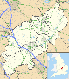
 Tiffield
Tiffield shown within NorthamptonshirePopulation 370 (2001 Census)[1]
387 (est.2009)[2]OS grid reference SP698517 - London 67 miles (108 km) Parish Tiffield District South Northamptonshire Shire county Northamptonshire Region East Midlands Country England Sovereign state United Kingdom Post town TOWCESTER Postcode district NN12 Dialling code 01327 Police Northamptonshire Fire Northamptonshire Ambulance East Midlands EU Parliament East Midlands UK Parliament Northampton South List of places: UK • England • Northamptonshire Tiffield is a village and civil parish in the English county of Northamptonshire; it is located north of the town of Towcester between the A5 road to its west and the A43 road to its east.
Contents
Governance
Tiffield is part of the district of South Northamptonshire.
Demographics
The 2001 census[1] shows 370 residents, evenly split between male and female, 185 each living in 142 dwellings.
Facilities
The primary school, one of the smallest in the country, with just 46 pupils in the 2007/08 academic year. It is Church of England, Voluntary Aided and has two classrooms. The old Victorian school building, used for KS2 and a 1960s mobile classroom for KS1, was to be demolished in summer 2008 and replaced by a modern classroom behind the Victorian building. Most pupils who leave the school progress to Sponne School in Towcester. There is a church dedicated to St John the Baptist and a pub ("The George"). It also has a pocket park and a playing field, Claydon's Field, which was opened in 1979 after 8 years of fundraising by villagers.
The village has one main road, which runs from the St. John's turning on the A43 to the village of Gayton. Two 1960s roads exist: Pigeon Hill at the southern end of the village and Meadow Rise at the northern end. The village is approximately ½ mile long. It is linked directly to Gayton and Eastcote by road.
Tiffield Pocket Park was declared a Local Nature Reserve in 2008. The Pocket Park land was originally part of the Northampton and Banbury Junction Railway, which was closed in the 1960s. It now is a linear trail connecting several footpaths and rights of way. Three orchid species are found within the Pocket Park and may be seen flowering between April to June (depending on the season).
The Gateway School
The Gateway school teaches more than 50 pupils with behavioural, emotional and social difficulties. It moved from its old building in Raeburn Road, Northampton in May 2008 which cost £6.4m of government funding. The official opening ceremony was attended by HRH The Duchess of Gloucester[3]. The site was occupied by an Approved School many years ago and, before that the Northampton Society's Reformatory School for Boys which opened on 21 January 1856[4].
See also
External links
- Contact Details of the parish council
- Some details about the parish church
- 'Clutch', a history website set up by residents
- 'Tiffield Online', the official website for Tiffield
- Tiffield Primary School's website
- Tiffield Primary School at the County Council website
References
- ^ a b "UK census 2001 - data". http://neighbourhood.statistics.gov.uk/dissemination/LeadDatasetList.do?a=3&b=797386&c=NN12+8QQ&d=16&g=473781&i=1001x1003&m=0&r=0&s=1225448642726&enc=1&domainId=15. Retrieved 2008-10-31.
- ^ SNC (2009). South Northamptonshire Council Year Book 2009-2010. Towcester NN12 7FA. pp. 39.
- ^ "Chronicle & Echo, Northampton, 12 May 2008". Chronicle & Echo, Northampton. http://www.northamptonchron.co.uk/news/HRH-officially-opens-new-schools.4074010.jp. Retrieved 2008-10-29.
- ^ "Reformatory School for Boys, Tiffield". Workhouse.org. http://www.workhouses.org.uk/index.html?IS/England.shtml. Retrieved 2008-10-29.
Categories:- Villages in Northamptonshire

Wikimedia Foundation. 2010.