- Clifton Hill, Victoria
-
Clifton Hill
Melbourne, Victoria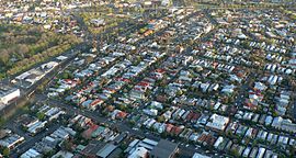
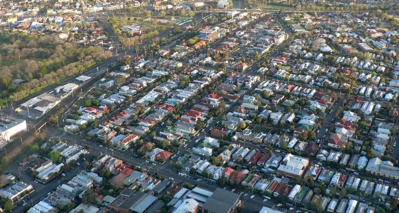
Aerial view of Clifton Hill looking north to Queens Parade and Merri Creek. Hoddle Highway is the main road on the left and Darling Gardens is far left.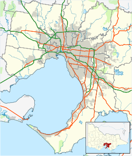
 Clifton Hill
Population: 5386 (2006) [1] Postcode: 3068 Area: 1.7 km² (0.7 sq mi) Location: 5 km (3 mi) from Melbourne LGA: City of Yarra State District: Richmond Federal Division: Batman Suburbs around Clifton Hill: Fitzroy North Northcote Fairfield Fitzroy North Clifton Hill Fairfield Fitzroy Collingwood Abbotsford Clifton Hill is a suburb of Melbourne, Victoria, Australia, 4 km north-east from Melbourne's central business district. The border between Clifton Hill and Fitzroy North is Queens Parade and Smith Street. Merri Creek defines the eastern border of Clifton Hill. Its Local Government Area is the City of Yarra. At the 2006 Census, Clifton Hill had a population of 5386.
Clifton Hill was named after Clifton Farm, one of the first properties in the area. The word "Hill" was added by land developer John Knipe to spruik the new estate. The first subdivision of 64 freehold properties was auctioned by Knipe, George and Co. on 18 September 1871.[2]
For many years a centre of Melbourne's bohemianism, the suburb has undergone rapid gentrification in recent years.
Contents
Geography and Demography
Accommodation in the suburb largely comprise of Victorian and Edwardian era dwellings. Hoddle Street bisects the suburb, dividing it into western and eastern precincts. The suburb is well served by parks and gardens, including Darling Gardens and Mayor's Park (western precinct) and Quarries Park (eastern precinct). An attractive local shopping strip is located along Queens Parade, on the border with Fitzroy North, consisting of mainly Victorian era shopfronts in a reasonable state of preservation. Dwelling density in Clifton Hill is significantly lower than the remainder of the former City of Collingwood, which also included the suburbs of Collingwood and Abbotsford.
Transport
Major road arteries passing through the suburb include Queens Parade, Heidelberg Road, Alexandra Parade and Hoddle Street.
Clifton Hill railway station, located just north of the corner of Hoddle and Ramsden Streets
tram route 86 runs along Queens Parade.
Several bus routes run along Hoddle Street and interchange at the railway station.
Crime
Clifton Hill was the site of the 1987 Hoddle Street massacre.
See also
- City of Collingwood - the former local government area of which Clifton Hill was a part.
- City of Yarra- Current government area of which Clifton Hill is a part.
References
- ^ Australian Bureau of Statistics (25 October 2007). "Clifton Hill (State Suburb)". 2006 Census QuickStats. http://www.censusdata.abs.gov.au/ABSNavigation/prenav/LocationSearch?collection=Census&period=2006&areacode=SSC21177&producttype=QuickStats&breadcrumb=PL&action=401. Retrieved 2007-09-26.
- ^ The Argus 14 September 1871, page 8
External links
Coordinates: 37°47′20″S 144°59′56″E / 37.789°S 144.999°E
Suburbs of the City of Yarra | Melbourne | Victoria Abbotsford · Alphington · Burnley · Carlton North · Clifton Hill · Collingwood · Cremorne · Fairfield · Fitzroy · Fitzroy North · Princes Hill · Richmond ·
Categories:- Suburbs of Melbourne

Wikimedia Foundation. 2010.