- Chott el Djerid
-
Chott el Djerid 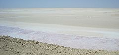
Coordinates 33°42′N 8°26′E / 33.7°N 8.43°ECoordinates: 33°42′N 8°26′E / 33.7°N 8.43°E Lake type salt lake, endorheic Primary inflows groundwater Primary outflows terminal Evaporation Basin countries Tunisia Surface area 7,000 km2 Surface elevation +10-25 m 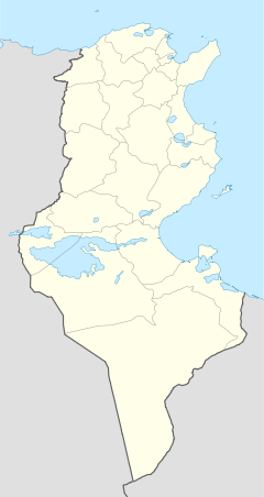
 Chott al-Djarid in Tunisia
Chott el Djerid (Arabic: شط الجريد Šaṭṭ al-Ǧarīd), also spelt Shaţţ al Jarīd, Sciott Gerid, and Shott el Jerid,[1][2][3][4] is a large endorheic salt lake in southern Tunisia.
Contents
Geography
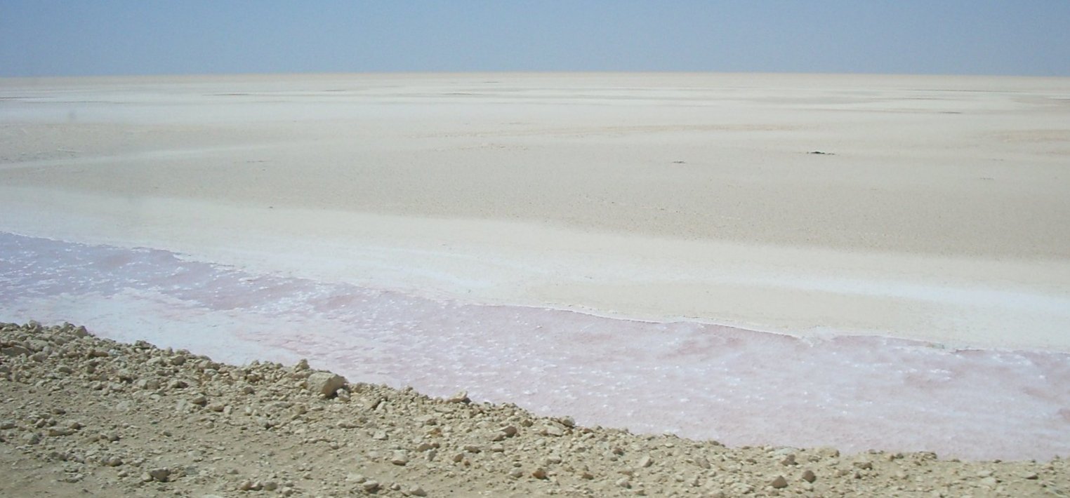
The bottom of Chott el Djerid is located between 10 and 25 meters above sea level[5]. Roughly in the shape of a tadpole, with a width of 20 km (12 mi) at its narrowest point, it reaches 250 km (160 mi) in overall length. At times, parts of it appear in various shades of white, green and purple[6]
It is the largest salt pan of the Sahara with a surface area of over 7,000 km2 (some sources state 5,000 km2). Due to the extreme climate with annual rainfall of only 100 mm and temperatures reaching 50 °C, water evaporates from the lake. In summer Chott el Djerid is almost entirely dried up, and numerous fata morganas occur.
During winter, a small tributary of water can be seen discharging into the lake.[7]
Surrounding area
South of Chott el Djerid, the Grand Erg Oriental desert begins. The towns of Kebili and Douz are also located south of the lake.
Access
The lake can be crossed by foot and even by car, but this is very dangerous since the salt crust is not always firm.
During winter, when the lake is full, it can be crossed by boat. Piles of salt at its edges are collected for salt production processing.[6]
Star Wars film location
Chott el Djerid was used as a filming location for the Star Wars series[8], among others.
References
- ^ "Shaţţ al Jarīd: Tunisia". Geographical Names. http://geographic.org/geographic_names/name.php?uni=-1030236&fid=6152&c=tunisia. Retrieved 2011-05-23.
- ^ "Sciott Gerid: Tunisia". Geographical Names. http://geographic.org/geographic_names/name.php?uni=-1028284&fid=6130&c=tunisia. Retrieved 2011-05-23.
- ^ "Chott el Jerid: Tunisia". Geographical Names. http://geographic.org/geographic_names/name.php?uni=12050&fid=6147&c=tunisia. Retrieved 2011-05-23.
- ^ "Shott el Jerid: Tunisia". Geographical Names. http://geographic.org/geographic_names/name.php?uni=-1030305&fid=6143&c=tunisia. Retrieved 2011-05-23.
- ^ "Flood Maps". NASA et al.. http://flood.firetree.net/. Retrieved 2011-08-20.
- ^ a b "البحيرة شط ايل الجريد - تونس". Tixik.com. http://ar.tixik.com/jezero-chott-el-jerid-2365605.htm. Retrieved 2011-05-23.
- ^ "شـط الجـريد". Al-hakawati. http://www.al-hakawati.net/arabic/environment/env13.asp. Retrieved 2011-05-23.
- ^ "Star Wars Episode IV: A New Hope film locations". The Worldwide Guide to Movie Locations: Exploring film locations around the world. www.movie-locations.com. http://www.movie-locations.com/movies/s/starwars.html. Retrieved 2011-05-23.
External links
Categories:- Lakes of Tunisia
- Endorheic lakes of Africa

Wikimedia Foundation. 2010.