- Syvota
-
Syvota
Σύβοτα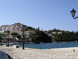
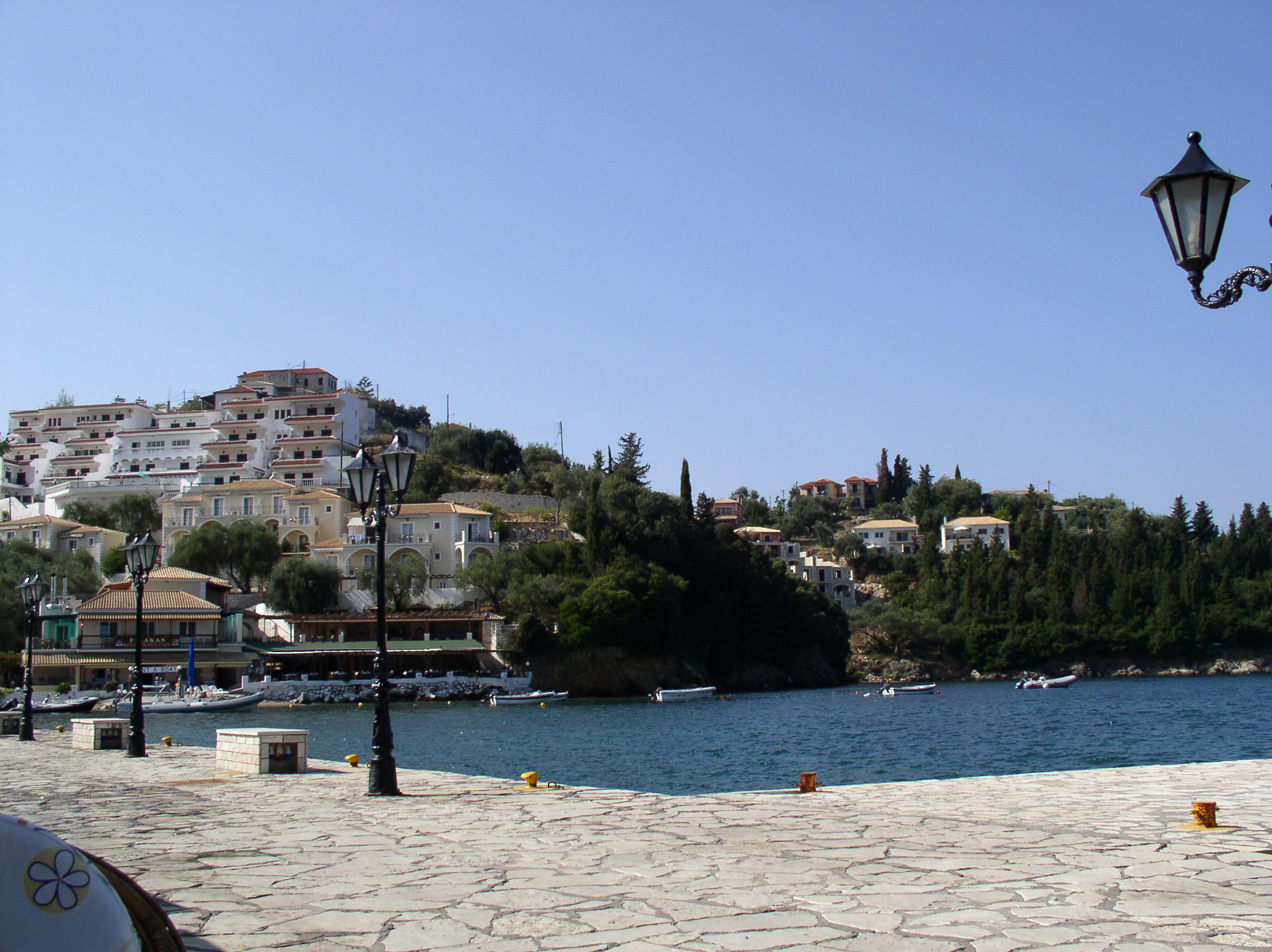
View of Syvota.Location 
 Syvota
Coordinates 39°24′N 20°15′E / 39.4°N 20.25°ECoordinates: 39°24′N 20°15′E / 39.4°N 20.25°E Location within the regional unit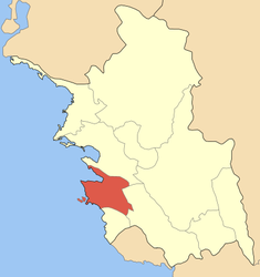
Government Country: Greece Region: Epirus Regional unit: Thesprotia Municipality: Igoumenitsa Population statistics (as of 2001) Municipal unit - Population: 3,010 Other Time zone: EET/EEST (UTC+2/3) Auto: ΗΝ Syvota (Greek: Σύβοτα), formerly Mourtos (Μούρτος) til 1953, is a village and a former municipality in Thesprotia, Epirus, Greece. Since the 2011 local government reform it is part of the municipality Igoumenitsa, of which it is a municipal unit.[1] Population 3,010 (2001 census). The seat of the municipality was in Plataria.
The earliest recorded inhabitants of the region are the Thesprotians, a Greek tribe of Epirus. In antiquity, the location was called Sybota and was the site of the Battle of Sybota.
During the Middle Ages, Syvota, like the rest of Epirus, was part of the Byzantine Empire and the Despotate of Epirus. Under the Turks, it was called Mourtos.
After nearly 500 years of Ottoman rule, Syvota joined Greece in 1913, following the Balkan Wars. The coastal village of Syvota (Albanian: Murto or Vola) was home to Cham Albanians before 1944, when they were expelled for collaborating with the Axis Powers.[2]
Today, Syvota town is a well-developed resort, owing largely to the numerous pristine beaches with clear waters located on several islets immediately offshore.
References
- ^ Kallikratis law Greece Ministry of Interior (Greek)
- ^ Vickers, Miranda and Pettifer, James. The Albanian Question: Reshaping the Balkans. I.B. Tauris, 2007, ISBN 1860649742, p. 238.
Cham Albanians History Pashalik of Janina · Souliotes (Souliote Confederacy · Catastrophe of Zalongo · Albanian Regiment (French Army)
Assembly of Preveza · Albanian Committee of Janina · Chams in the Greco-Turkish population exchange · Party of the ChameriaCham issue Cham Albanian Resistance during World War II · (4th "Ali Demi" Battalion · "Chameria" Battalion)
Axis-Cham Albanian collaboration (Këshilla · Paramythia executions)
Expulsion of Cham Albanians (Paramythia Massacre · Filiates Massacre) · Anti-Fascist Committee of Cham Immigrants
Liberation Army of ChameriaOrganizations Culture Cham Albanian dialect · Cham music (Cham iso-poliphony · Song of Çelo Mezani · Song of Marko Boçari) · Dance of Osman Taka · Dance of Zalongo
Krahu i shqiponjës · Zëri i ÇamërisëMain Settlements Chameria: Konispol · Markat · Paramythia · Filiates · Igoumenitsa · Katavothra · Parapotamos · Sybota · Sagiada
Perdika · Margariti ·Kastri1 · Fanari
Other2: Vlorë · Durrës · Tirana · Himara · Borshi · Erenköy · Kartal · Mudanya · Izmir · Gemlik · Aydin · Ioannina · Preveza · Chicago · Boston · New YorkIndividuals Azis Tahir Ajdonati · Aziz Çami · Hamdi Çami · Muhamet Kyçyku (Çami) · Qamil Çami · Thoma Çami · Refo Çapari · Ali Demi · Musa Demi · Niazi Demi · Rexhep Demi · Tahir Demi · Abedin Dino · Ahmed Dino · Ali Dino · Rasih Dino · Shahin Dino · Veli Gërra · Shpëtim Idrizi · Tahir Muhedini · Aristidh Ruci · Teme Sejko · Hasan Tahsini · Osman Taka · Jakup Veseli · Bilal Xhaferri1Settlements inhabited by communities known as Arvanites, and very rarely characterized as Cham
Categories:- Populated places in Thesprotia
- Ancient Greek cities
- Geography of ancient Epirus
- Epirus geography stubs


Wikimedia Foundation. 2010.