- Makryneia
-
Makryneia
ΜακρυνείαLocation 
 Makryneia
Coordinates 38°32′N 21°32′E / 38.533°N 21.533°ECoordinates: 38°32′N 21°32′E / 38.533°N 21.533°E Location within the peripheral unit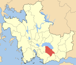
Government Country: Greece Region: West Greece Regional unit: Aetolia-Acarnania Municipality: Agrinio Population statistics (as of 2001) Municipal unit - Population: 5,241 - Area: 149.7 km2 (58 sq mi) - Density: 35 /km2 (91 /sq mi) Other Time zone: EET/EEST (UTC+2/3) Postal: 300 15 Makryneia (Greek: Μακρυνεία) is a former municipality in Aetolia-Acarnania, West Greece, Greece. Since the 2011 local government reform it is part of the municipality Agrinio, of which it is a municipal unit.[1] Population 5,241 (2001). The seat of the municipality was in Gavalou. The municipal unit is located south and southeast of Lake Trichonida.
Contents
Subdivisions
The municipal unit Makryneia is subdivided into the following communities (constituent villages in brackets):
- Agios Andreas (Agios Andreas, Ano Metapa)
- Akres (Akres, Saranti, Varka)
- Dafnias (Dafnias, Palaiozefgaro)
- Gavalou (Gavalou, Kourtelaiika)
- Kato Makrinou
- Kapsorachi (Kapsorachi, Palaiochori)
- Makrinou (Makrinou, Agia Triada, Agioi Apostoloi, Kypseli, Metaxas)
- Mesarista (Mesarista, Kazanaiika, Paradeisi, Tsiligiannaika)
- Potamoula Messolongiou
- Trichonio
Population
Year Population 1991 5,282 2001 5,241 Geography
Its geography includes farmlands within the shoreline and mountains to the south with forests and grasslands.
Transportation
Makryneia is linked with a road linking the GR-5 (Antirrio - Messolongi - Arta - Ioannina) and the eastern half. Makryneia is located south of Karpenisi, WNW of Nafpaktosl, north of Messolongi, ENE of Aitoliko and ESE of Agrinio.
External links
References
- ^ Kallikratis law Greece Ministry of Interior (Greek)
Municipal unit of Agrinio Agios Konstantinos · Agios Nikolaos Trichonidos · Agrinio · Dokimi · Kalyvia · Kamaroula · SkoutesiadaMunicipal unit of Angelokastro Municipal unit of Arakynthos Municipal unit of Makryneia Agios Andreas · Akres · Dafnias · Gavalou · Kato Makrinou · Kapsorachi · Makrinou · Mesarista · Potamoula Messolongiou · TrichonioMunicipal unit of Neapoli Municipal unit of Panaitoliko Agia Varvara · Agia Paraskevi · Kastanoula · Kerasea · Sitomena · SkouteraMunicipal unit of Parakampylia Agalianos · Agios Vlasios · Ampelia · Chouni · Kyparissos · Pentakorfo · Potamoula · Psilovrachos · Sargiada · SidiraMunicipal unit of Paravola Afrato · Kallithea · Kyra Vgena · Lampiri · Neromanna · Palaiokarya · Pantanassa · Paravola · Peristeri · SpartiasMunicipal unit of Stratos Municipal unit of Thestieis Kainourgio · Nea Avorani · Panaitolio · ProsiliaCategories:- Populated places in Aetolia-Acarnania


Wikimedia Foundation. 2010.