- Davis Ford, West Virginia
-
Davis Ford — Unincorporated community — Location within the state of West Virginia
 Davis Ford
Coordinates: 39°11′47″N 78°30′2″W / 39.19639°N 78.50056°WCoordinates: 39°11′47″N 78°30′2″W / 39.19639°N 78.50056°W Country United States State West Virginia County Hampshire Time zone Eastern (EST) (UTC-5) – Summer (DST) EDT (UTC-4) ZIP codes FIPS code GNIS feature ID Davis Ford is an unincorporated community on the Cacapon River in Hampshire County in the U.S. state of West Virginia. It lies primarily on Cacapon River Road (West Virginia Secondary Route 14) at the ford from which it takes its name. The Yellow Spring post office serves the Davis Ford community.
Municipalities and communities of Hampshire County, West Virginia City 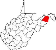
Town CDPs Unincorporated
communitiesAugusta | Barnes Mill | Bloomery | Blues Beach | Bubbling Spring | Capon Lake | Capon Springs | Capon Springs Station | Cold Stream | Creekvale | Davis Ford | Delray | Dillons Run | Donaldson | Forks of Cacapon | Frenchburg | Glebe | Good | Grace | Hainesville | Hanging Rock | Higginsville | High View | Hooks Mills | Hoy | Intermont | Jericho | Junction | Kirby | Largent | Lehew | Levels | Little Cacapon | Loom | Mechanicsburg | Millbrook | Millen | Millesons Mill | Neals Run | Nero | North River Mills | Okonoko | Pancake | Pin Oak | Pleasant Dale | Points | Purgitsville | Rada | Raven Rocks | Ridgedale | Rio | Ruckman | Sector | Sedan | Shanks | Shiloh | Slanesville | South Branch Depot | Three Churches | Vance | Vanderlip | Wappocomo | Wickham | Woodrow | Yellow Spring
Categories:- Hampshire County, West Virginia geography stubs
- Populated places in Hampshire County, West Virginia
- Unincorporated communities in West Virginia


Wikimedia Foundation. 2010.