- Mount Ragang
-
Mount Ragang Location of Mount Ragang in the Philippines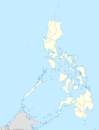
 Mount Ragang
Elevation 2,815 m (9,236 ft) [1] Listing Ultra Location Location Mindanao, Philippines Coordinates 7°41′40″N 124°30′27″E / 7.69444°N 124.5075°ECoordinates: 7°41′40″N 124°30′27″E / 7.69444°N 124.5075°E[1] Geology Type Stratovolcano Last eruption 1916 Mount Ragang, also called Mount Piapayungan and Blue Mountain by the local people, is a stratovolcano on Mindanao island in the Philippines. It is the seventh highest mountain in the Philippines.
Contents
Location
Mount Ragang is located on the boundary of the provinces of Lanao del Sur and Cotabato in the Autonomous Region in Muslim Mindanao.
Physical features
Ragang has an elevation of 2,815 metres (9,236 ft) and a base diameter of 32 km (20 mi).
It is the most active volcano on Mindanao, and is part of a string of volcanoes in what volcanologists call the Central Mindanao Arc.
Eruptions
There is still some confusion on the number of times Ragang erupted. The Philippine Institute of Volcanology and Seismology lists eight eruptions with the last one occurring in July 1916. But the Smithsonian Institution's Global Volcanology Programs, citing the Catalog of Active Volcanoes of the World (Neumann van Padang, 1953), suggests that some eruptions attributed to nearby Makaturing were actually those of Ragang.
Ragang is one of the active volcanos in the Philippines, which are all part of the Pacific ring of fire.
See also
- List of mountains in the Philippines
- List of Southeast Asian mountains
References
- ^ a b "Mount Ragang". Global Volcanism Program, Smithsonian Institution. http://www.volcano.si.edu/world/volcano.cfm?vnum=0701-06.
External links
- Philippine Institute of Volcanology and Seismology (PHIVOLCS) Ragang Volcano Page
- "Ragang". Global Volcanism Program, Smithsonian Institution. http://www.volcano.si.edu/world/volcano.cfm?vnum=0701-06=.
See also
- Active volcanos in the Philippines
- Potentially active volcanos in the Philippines
- Inactive volcanos in the Philippines
- Philippine Institute of Volcanology and Seismology
- Volcano
Mount Apo • Mount Dulang-dulang • Mount Pulag • Mount Kitanglad • Mount Tabayoc • Mount Kalatungan • Mount Ragang • Mount Maagnaw • Mount Singakalsa • Mount AmuyaoCategories:- Active volcanoes
- Mountains of the Philippines
- Stratovolcanoes
- Subduction volcanoes
- Volcanoes of Mindanao
- Cotabato
- Lanao del Sur
- Autonomous Region in Muslim Mindanao
- Active volcanoes of the Philippines

Wikimedia Foundation. 2010.