- Szczecin Lagoon
-
- "Stettin Bay" redirects here, for "Stettin Bay" in Papua New Guinea, see West New Britain Province
Szczecin Lagoon or Bay of Szczecin (German: Stettiner Haff, Polish: Zalew Szczeciński), also Oder lagoon (German: Oderhaff), is a lagoon in the Oder estuary, shared by Germany and Poland. It is separated from the Pomeranian Bay of the Baltic Sea by the islands of Usedom and Wolin. The lagoon is subdivided into the Kleines Haff ("small lagoon") in the West and the Wielki Zalew (German: Großes Haff, "great lagoon") in the East. An ambiguous historical German name was Frisches Haff, which later exclusively referred to the Vistula Lagoon.[1]
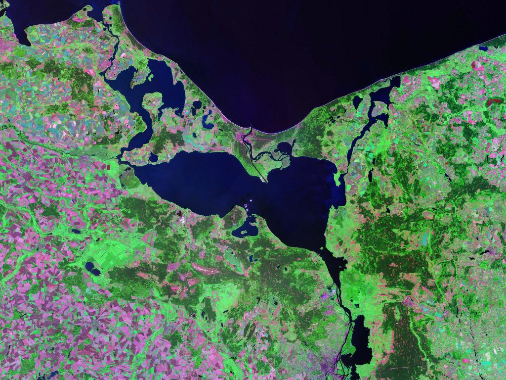
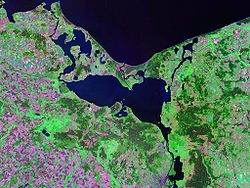 Oder Lagoon - Landsat satellite photo (circa 2000)
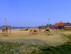
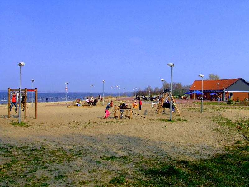
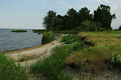 Szczecin Lagoon, view from Polish Island of Karsibór
Contents
Geography
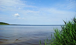 The lagoon
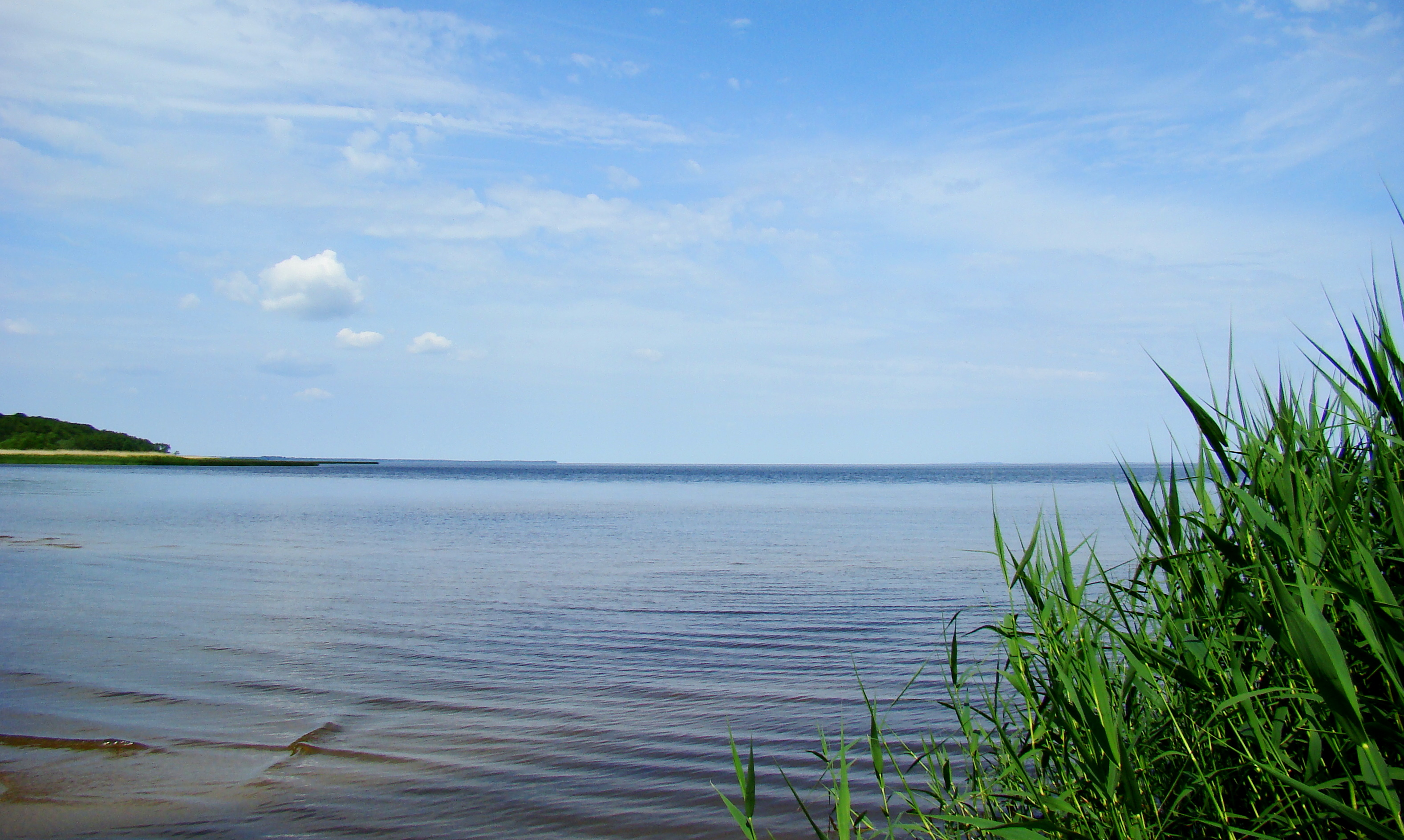
 The lagoon, view from Golm hill (Usedom)
From the South, the lagoon is fed by several arms of the Oder river (Polish: Odra) and smaller rivers like Ziese, Peene, Zarow, Uecker, and Ina (German: Ihna).[2] In the North, the lagoon is connected to the Baltic Sea's Bay of Pomerania with the three straits Peenestrom, Świna (German: Swine) and Dziwna (German: Dievenow), which divide the mainland and the islands of Usedom (Polish: Uznam) and Wolin (German: Wollin).
The lagoon covers an area of 687 km², its natural depth is in average 3.8 meters, and 8.5 meters at maximum.[3] The depth of shipping channels however can exceed 10.5 meters.[3] Thus, the lagoon holds about 2.58 km3 of water.[4] The annual average water temperature is 11°C.[4]
94% of the water loads discharged into the lagoon are from the Oder river and its confluences, amounting for an average annual 17 km3 or 540 m3 per second.[5] All other confluences contribute a combined annual 1 km3.[5] Since no reliable data for an inflow from the Baltic Sea exist, the combined inflow is an estimated 18 km3 from a catchment area of 129,000 km2, residing in the lagoon for an average 55 days before being discharged into the Pomeranian Bay.[4] The nutrients thereby transported into the lagoon have made it hypertrophic to eutrophic.[6] The straits Peenestrom, Świna and Dziwna are responsible for 17%, 69%, and 14% of the discharge, respectively.[7]
The average salinity is between 0.5 and 2 psu, yet at times more salty water penetrates through the Swine locally rising the salinity to 6 psu.[5]
Towns in the area
- Świnoujście (Poland)
- Police (at the Oder River and an estuary of the Oder River - Roztoka Odrzańska) (Poland)
- Ueckermünde (Germany)
- Wolin (town) (Poland)
- Usedom (town) (Germany)
- Nowe Warpno (Poland)
History
 Oder Lagoon area, city of Stettin/Szczecin not included
In 1880, the Kaiserfahrt ("Emperor's passage") channel on Usedom was opened, a water route with a depth of 10 meters connecting the lagoon with the Baltic Sea by bypassing the eastern part of the Swine, allowing large ships to enter the lagoon and the seaport of Stettin quicker and safer.
The canal, approximately 12 km long and 10 meters deep, was dug by the German Empire between 1874 and 1880, during the reign of the first Kaiser Wilhelm (1797–1888) after whom it was named. Also, the work resulted in a new island named Kaseburg (Karsibór) being cut off from Usedom.
After 1945, the areas east of Oder Neisse line became part of Poland, including the former German seaport cities of Stettin (Szczecin) and Swinemünde (Świnoujście) on the western bank of the river Oder was granted to Poland which renamed the canal after the Piast dynasty.
The German-Polish border also divides the bight called Neuwarper See near Rieth.
Economy
The lagoon has served as an important fishing grounds for centuries, as a major transportation pathway since the 18th century, and as a tourist destination since the 20th century.[3]
Recreation
Today the lagoon offers a great selection of passenger ship tours, a wide range of water sports and some notable beaches. Tourists can discover winegrowing, the narrow-gauge railway, museums, castles, many hiking and cycling routes and a small village reviving the life of the former Slavic settlements.
Pollution
The lagoon suffers from heavy pollution, mainly from the Oder river, resulting in eutrophication. High concentrations of aluminium and iron sediments have been found in the river causing rapid algae growth inside the lagoon. However, long-term nutrient concentrations show a high inter-annual variability and have declined during recent years.
See also
Coordinates: 53°48′16″N 14°08′25″E / 53.80444°N 14.14028°E
References
- ^ Erhard Riemann, Alfred Schoenfeldt, Ulrich Tolksdorf, Reinhard Goltz, Akademie der Wissenschaften und der Literatur (Germany), Akademie der Wissenschaften und der Literatur, Mainz, Preussisches Wörterbuch: Deutsche Mundarten Ost- und Westpreussens, 6th edition, Wachholtz, 1974, p.595, ISBN 3529046116
- ^ Gerald Schernewski, Baltic coastal ecosystems: structure, function, and coastal zone management, Springer, 2002, p.79, ISBN 3540429379
- ^ a b c Ulrich Schiewer, Ecology of Baltic coastal waters, Springer, 2008, p.115, ISBN 3540735232
- ^ a b c Ulrich Schiewer, Ecology of Baltic coastal waters, Springer, 2008, p.117, ISBN 3540735232
- ^ a b c Ulrich Schiewer, Ecology of Baltic coastal waters, Springer, 2008, p.116, ISBN 3540735232
- ^ Ulrich Schiewer, Ecology of Baltic coastal waters, Springer, 2008, p.118, ISBN 3540735232
- ^ Ulrich Schiewer, Ecology of Baltic coastal waters, Springer, 2008, p.119, ISBN 3540735232
External links
- Glasby GP, Szefer P, Geldon J, Warzocha J (September 2004). "Heavy-metal pollution of sediments from Szczecin Lagoon and the Gdansk Basin, Poland". Sci. Total Environ. 330 (1-3): 249–69. doi:10.1016/j.scitotenv.2004.04.004. PMID 15325172. http://linkinghub.elsevier.com/retrieve/pii/S0048-9697(04)00282-7.
Geography of Pomerania Regions CurrentVorpommern (Western or Hither Pomerania) · Zachodniopomorskie · Pomerelia (Kashubia) · Pomerania euroregionAdministration Towns ListsList of towns in Vorpommern · List of towns in Farther Pomerania · Pomeranian cities, towns and villages · List of placenames in the Province of Pomerania (A-H · I-P · Q-Z)Largest>100,000>50,000Islands Peninsulae Rivers Lakes Bays, lagoons National parks Categories:- Bays of Germany
- Bays of Poland
- West Pomeranian Voivodeship
- Baltic Sea
- Lagoons
- International lakes of Europe
- Germany–Poland border


Wikimedia Foundation. 2010.