Sakae Krang River

Sakae Krang River

Infobox River
river_name = Sakae Krang River


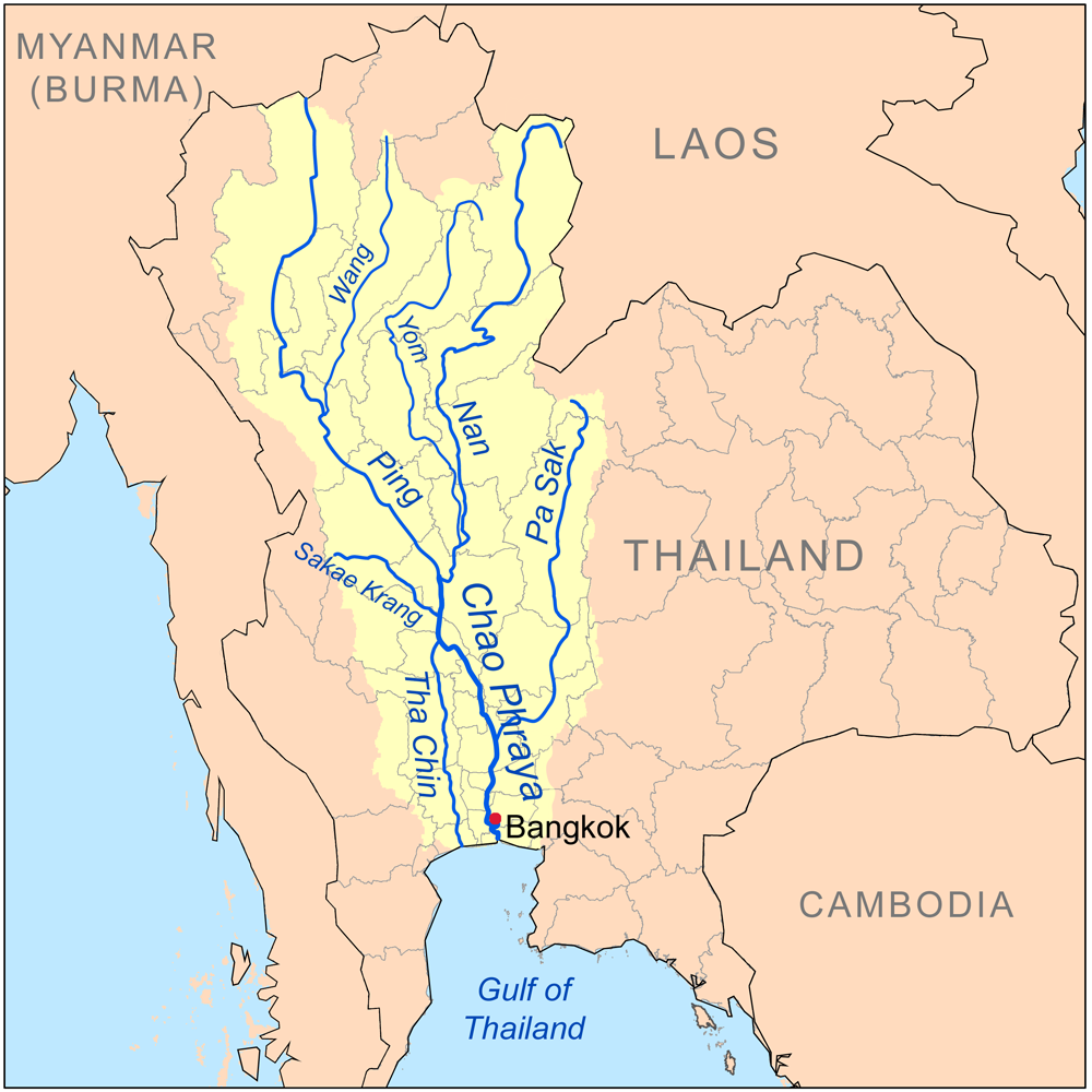
caption = Map of the Chao Phraya River drainage basin showing the Sakae Krang River
origin = Mae Wong National Park, Kamphaeng Phet Province
mouth = Chao Phraya River in Uthai Thani city
basin_countries = Thailand
length =
elevation =
discharge =
watershed = 5,191 km²

The Sakae Krang River ( _th. แม่น้ำสะแกกรัง) is a tributary of the Chao Phraya River. It originates in Mae Wong National Park, Kamphaeng Phet Province. It is 225 km long, with most of its length in Uthai Thani Province. It tributes the Chao Phraya River in Uthai Thani city around Wat Tha Sung (Tha Sung temple).

According to the Tourism Authority of Thailand, the people of Uthai Thani use the Sakae Krang River to grow pandanus and to raise fish in floating baskets, which is the primary occupation of the Uthai Thani people. [cite web | title=Tourism Thailand: Rafts on the Sakae Krang River | publication=Tourism Thailand | url=http://www.tourismthailand.org/attraction/uthaithani-61-4015-1.html | accessdate=2008-02-13]

Tributaries

Tributaries of the Sakae Krang River include the Thap Salao, Wang Ma, Wong, Pho and Tak Daet Rivers.

akae Krang Basin

The Sakae Krang is part of the Chao Phraya Watershed. The total land area drained by the Sakae Krang River is 5,191 square kilometers. [http://en.pwa.co.th/l_basins.htm Basins of Thailand] ]

References


Wikimedia Foundation. 2010.

Игры ⚽ Поможем решить контрольную работу

Look at other dictionaries:

  • Sakae Krang — Caractéristiques Longueur 225 km Bassin 5 191 km2 Bassin collecteur …   Wikipédia en Français

  • River Systems of Thailand — The two principal river systems of Thailand are the Chao Phraya and the Mekong. Together, these rivers support the irrigation for Thailand s agricultural economy. In addition to these two large systems, there are a number of other river systems… …   Wikipedia

  • Tributaries of the Chao Phraya River — The principal tributaries of the Chao Phraya River of Thailand are the Pa Sak River, the Sakae Krang River, the Nan River (along with its principal confluent the Yom River), the Ping River (with its principal confluent the Wang River), and the… …   Wikipedia

  • Chao Phraya River — River Origin of the Chao Phraya River in Nakhon Sawan …   Wikipedia

  • Uthai Thani Province — Infobox Thai Province name = Uthai Thani thai = อุทัยธานี capital = Uthai Thani town area = 6,730.2 arearank = 30th population = 304,122 population as of = 2000 populationrank = 66th density = 45 densityrank = 72nd isocode = TH 61 governor = Udom …   Wikipedia

  • List of Thailand-related articles — Thailand, known officially as the Kingdom of Thailand (IPAEng|ˈtaɪlænd, th. ราชอาณาจักรไทย, IPA2|râːtɕʰa ʔaːnaːtɕɑ #x0300;k tʰɑj) is a country in Southeast Asia. To its east lie Laos and Cambodia; to its south, the Gulf of Thailand and Malaysia;… …   Wikipedia

  • Río Chao Phraya — (แม่น้ำเจ้าพระยา) Una vista del río Chao Phraya en Bangkok. País que atraviesa …   Wikipedia Español

  • Menam — Chao Phraya Chao Phraya La Chao Phraya à Bangkok Caractéristiques Longueur 372 km Bassin 158 000 km …   Wikipédia en Français

  • Menam Chao Phraya — Chao Phraya Chao Phraya La Chao Phraya à Bangkok Caractéristiques Longueur 372 km Bassin 158 000 km …   Wikipédia en Français

  • Ménam — Chao Phraya Chao Phraya La Chao Phraya à Bangkok Caractéristiques Longueur 372 km Bassin 158 000 km …   Wikipédia en Français

Share the article and excerpts

Direct link
Do a right-click on the link above
and select “Copy Link”