- Col de la Bonette
-
Col de la Bonette 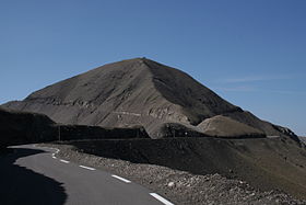
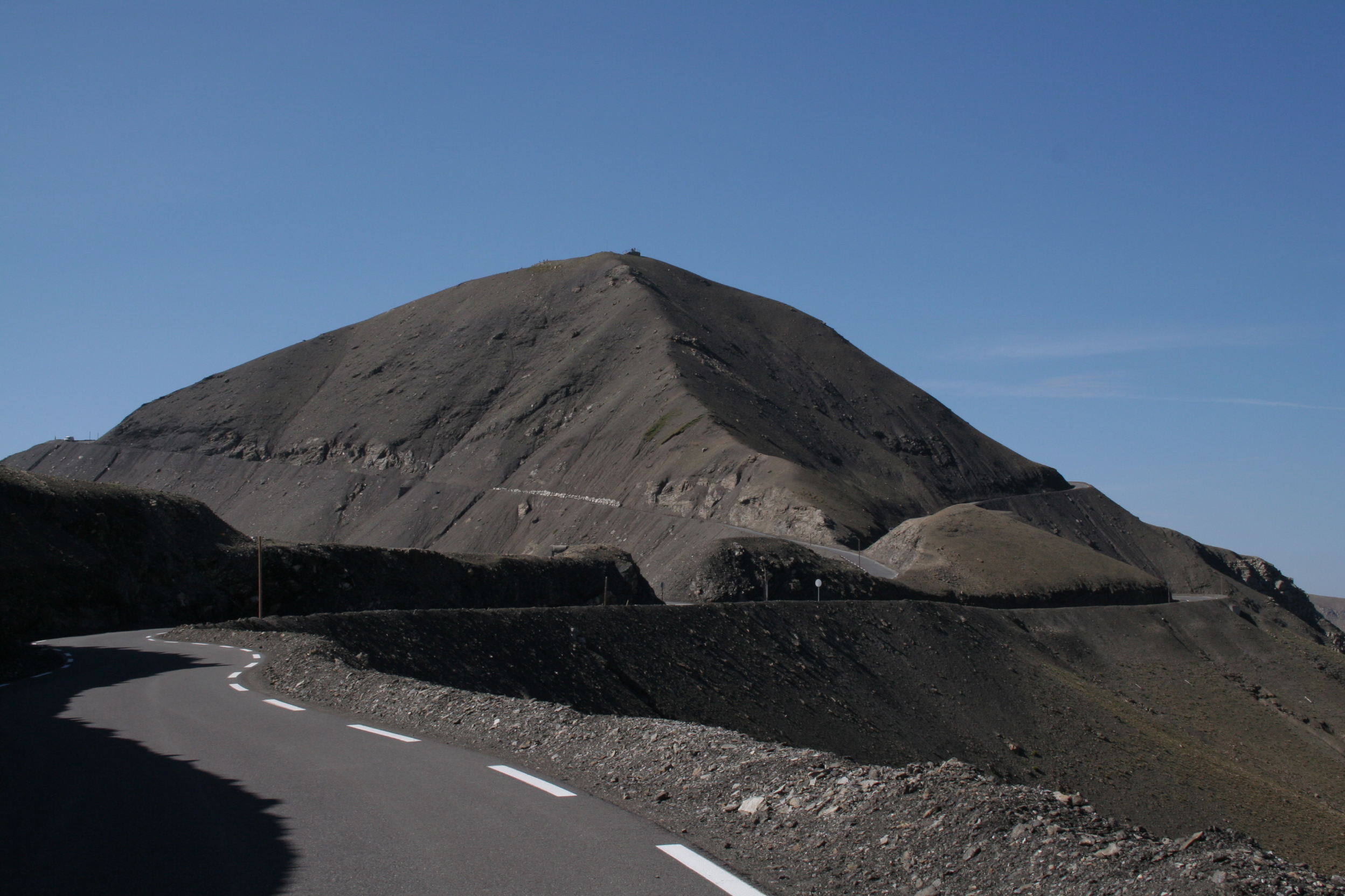
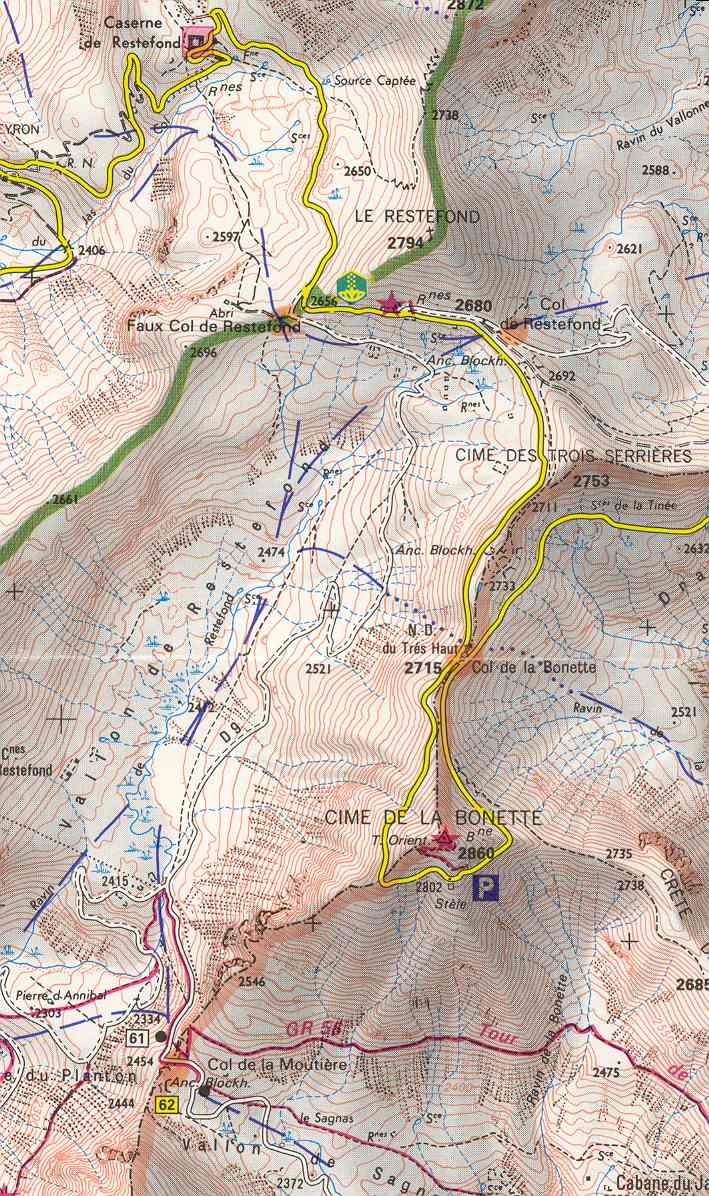
Cime de la Bonette, viewed from the northern ascent from Jausiers. The Col de la Bonette is marked by the gap in the centre of the picture, while the circle road takes a loop up and around the Cime de la Bonette, before joining the col behind the ridge.Elevation 2,715 metres (8,907 ft) or 2,802 metres (9,193 ft) (Cime de la Bonette) Traversed by D64 Location Location of Col de la Bonette
 Col de la Bonette
Location Alpes-Maritimes/Alpes-de-Haute-Provence,  France
Range Alps Coordinates 44°19′37.2″N 06°48′25.2″E / 44.327°N 6.807°ECoordinates: 44°19′37.2″N 06°48′25.2″E / 44.327°N 6.807°E Col de la Bonette (el. 2715 m./8907 ft.) is a high mountain pass in the French Alps, near the border with Italy. It is situated within the Mercantour National Park on the border of the departments of Alpes-Maritimes and Alpes-de-Haute-Provence. The road over the col is the seventh highest paved road in the Alps.
Contents
Col de Restefond
The passage over the Col de la Bonette is often mistakenly referred to as the Col de Restefond, and in the 2008 Tour de France the summit is referred to as the Cime de la Bonette-Restefond. Stage 16 of the tour approaches the summit from Saint-Étienne-de-Tinée (south-east), and after reaching the Col de la Bonette, takes a loop round the Cime de la Bonette reaching the summit of 2802 m, which is the highest point reached by the Tour de France,[1] before re-passing the Col de la Bonette. On the descent to Jausiers, the actual Col de Restefond is then passed on the right approximately 1 km from the summit.
"Highest road in Europe"
The two kilometre long teardrop shaped loop around the Cime de la Bonette peak (2860m) from either side of the pass is the highest paved through route in the Alps.
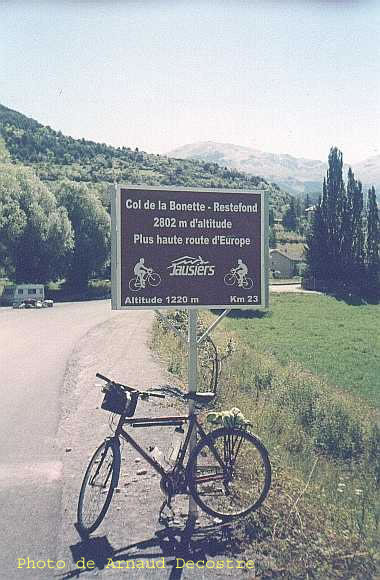
A signpost at the foot of the climb[2] makes the claim "Col de la Bonette - Restefond, 2802 m above sea level, highest road in Europe". This claim is incorrect for various reasons. The actual Col de la Bonette rises to 2715 m, but there are three Alpine road passes whose altitudes are higher: Col de l'Iseran (2770 m), Stelvio Pass (2757 m) and Col Agnel (2744 m). There is also the road to Veleta (Sierra Nevada), Spain (near Granada) which reaches 3392 m[3][4] but it is not a through road. The road around the Cime de la Bonette reaches an altitude of 2802 m, but this is not a "pass", but merely a scenic loop. It is, however, the highest asphalted road in France and is the highest through road in Europe.
Details of the climb
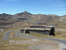 The road from Jausiers passes next to the Casernes de Restefond, an old military building
From the south, the climb starts at Saint-Etienne-de-Tinée and is 26.0 km long. Over this distance, the climb is 1652 m. (an average percentage of 6.4%). On the climb to the actual Col de la Bonette, there is one short section at over 10%, but on the loop around the Cime de la Bonette, the gradient reaches 15%.
From the north, the climb starts at Jausiers and is 24,1 km long. Over this distance, the climb is 1589 m. (an average percentage of 6.6%), with the steepest sections at 9%.
Tour de France
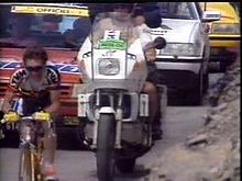
The pass has featured in the Tour de France four times (1962, 1964, 1993 and 2008). In 1962 and 1964, the race was led over the summit in both years by Federico Bahamontes, approaching from the south in 1962 and from the north in 1964. Robert Millar led over the summit (from the north) in 1993. In 2008 John-Lee Augustyn lead over the mountain, before falling on the descent to Jausiers. He did, however, receive 5,000 Euros for the leader over the highest point of the Tour, also known as the "Souvenir Henri Desgrange".[5][6]
Appearances in Tour de France
Year Stage Category Start Finish Leader at the summit 2008 16 HC Cuneo Jausiers John-Lee Augustyn 1993 11 HC Serre-Chevalier Isola 2000 Robert Millar 1964 9 1 Briançon Monaco Federico Bahamontes 1962 18 1 Antibes-Juan-les-Pins Briançon Federico Bahamontes See also
- List of highest paved roads in Europe
- List of mountain passes
References
- ^ Woodland, Les (2003). The Yellow Jersey Companion to the Tour de France. London: Yellow Jersey Press. p. 261. ISBN 0-224063-18-9.
- ^ Panneau « Col de la Bonette - Restefond, 2 802 m d'altitude, plus haute route d'Europe » (Jausiers)
- ^ http://www.planetware.com/sierra-nevada/road-to-the-pico-de-veleta-e-and-picvel.htm
- ^ http://www.climbbybike.com/climb.asp?Col=Pico-de-Veleta&qryMountainID=4755
- ^ "Dessel’s Day After Dramatic Descent!". www.letour.fr. 2008-07-22. http://www.letour.fr/2008/TDF/LIVE/us/1600/journal_etape.html. Retrieved 2008-07-24.
- ^ "Stage 16 - Newsflashes". www.letour.fr. 2008-07-22. http://www.letour.fr/2008/TDF/LIVE/us/1600/depeches.html. Retrieved 2008-07-24.
External links
- Preview of Bonette Stage in 2008 Tour de France
- Profile on climbbybike.com
- Le col ou cime de la Bonette ou col de Restefond dans le Tour de France (French)
- Le col de La Bonette-Restefonds Tour de France details (French)
- Col de la Bonnette by bike
- Col de la Bonette cycling. Pictures and profiles.
- Bike Routes in the Maritime Alps
- Motorbiking in the Alps
- Map of the Col de la Bonette and the Col de Restefond
Categories:- Mountain passes of the Alps
- Alpes-de-Haute-Provence
- Alpes-Maritimes
- Mountain passes of France
- 2008 Tour de France
- Climbs in cycle racing


Wikimedia Foundation. 2010.