- Opheusden
-
Opheusden — Town — 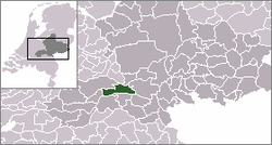 The town centre (red) and the statistical district (light green) of Opheusden in the municipality of Neder-Betuwe.
Coordinates: 51°56′00″N 5°37′47″E / 51.9333333°N 5.62972°ECoordinates: 51°56′00″N 5°37′47″E / 51.9333333°N 5.62972°E Country Netherlands Province Gelderland Municipality Neder-Betuwe Population - Total 6,000 Time zone CET (UTC+1) - Summer (DST) CEST (UTC+2) Postal code Opheusden is a town in the Dutch province of Gelderland. It is a part of the municipality of Neder-Betuwe, and lies about 5 km south of Wageningen.
Opheusden (or "Heusden", as it was known then) was a separate municipality until 1818, when it was merged with Kesteren.[1]
In 2001, the town of Opheusden had 4118 inhabitants. The built-up area of the town was 0.73 km², and contained 1319 residences.[2] The statistical area "Opheusden", which also can include the peripheral parts of the village, as well as the surrounding countryside, has a population of around 5830.[3] Religious life has also traditionally been very important to Opheusden's inhabitants.
 2850-seat church at Opheusden, largest church of the Netherlands
Transportation
- Railway station: Opheusden
References
- ^ Ad van der Meer and Onno Boonstra, Repertorium van Nederlandse gemeenten, KNAW, 2006.
- ^ Statistics Netherlands (CBS), Bevolkingskernen in Nederland 2001. (Statistics are for the continuous built-up area).
- ^ Statistics Netherlands (CBS), Statline: Kerncijfers wijken en buurten 2003-2005. As of 1 January 2005.
External links
- J. Kuyper, Gemeente Atlas van Nederland, 1865-1870, "Opheusden". Map of the former municipality, around 1868.
Categories:- Populated places in Gelderland
- Former municipalities of Gelderland
- Gelderland geography stubs


Wikimedia Foundation. 2010.