- Nyalam Town
-
 10 km outside Nyalam
Nyalam (Chinese: 聂拉木; Pinyin: Nièlāmù), traditionally known as Tsongdu[1] is a small Tibetan town near the Nepal border. It is the county seat of Nyalam County in Xigaze Prefecture (part of the historical Tsang Province of the old Tibet). It is 35 km from Zhangmu town in the same county, which is the point of entry to Nepal.
Nyalam is situated at 3,750 metres (12,300 ft) above sea level. A town of stone buildings and tin roofs, it is nicknamed 'The Gate of Hell' by the Nepalese traders because the old trail between Nyalam and the Nepalese border was so treacherous to negotiate.
Now Nyalam is on China-Nepal Highway between Kathmandu and Lhasa. South of Nyalam the road drops abruptly through the gorge of the Matsang Tsangpo or Sun Kosi as it is known in Nepal. [2][3] The town is 30 km from the Nepalese border in 30 km and 152 km from Kathmandu. Heading north from Nyalam, the highway crosses a succession of passes, finally entering the catchment of the Yarlung Tsangpo (Brahmaputra then reaching Lhasa after 750 km.
Contents
Transport
Footnotes
References
- Dowman, Keith. (1988). The Power-places of Central Tibet: The Pilgrim's Guide, pp. 73-79. Routledge & Kegan Paul. London. ISBN 0-7102-1370-0
- Gyume Dorje. (1999). Footprint Tibet Handbook with Bhutan. Footprint Handbooks, Bath, England. ISBN 0 8442-2190-2.
- Mayhew, Bradley and Kohn, Michael. (2005). Tibet, 6th Edition. Lonely Planet. ISBN 1-74059-523-8.
See also
External links
Xigazê Prefecture, Tibet County-level divisions 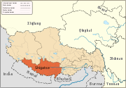
Settlements Landmarks Changmoche Monastery · Lhatse · Chokorgyel Monastery · Daklha Gampo · Donggar Monastery · Dorje Pakmo · Drongtse Monastery · Garju Monastery · Manmogang Monastery · Menri Monastery · Milarepa's Cave · Narthang Monastery · Ngor · Palcho Monastery · Ralung Monastery · Samding Monastery · Sakya Monastery · Ṣalu Monastery · Samding Monastery · Shelkar · Tashilhunpo · Tsi Nesar ·Coordinates: 28°09′38″N 85°58′43″E / 28.16056°N 85.97861°E
Categories:- Xigazê Prefecture geography stubs
- Populated places in the Xigazê Prefecture


Wikimedia Foundation. 2010.