- Oud-Reeuwijk
-
Oud-Reeuwijk — Hamlet — 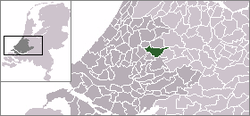 The village centre (dark green) and the statistical district (light green) of Oud-Reeuwijk in the municipality of Reeuwijk.
Coordinates: 52°03′27″N 4°42′53″E / 52.0575°N 4.71472°ECoordinates: 52°03′27″N 4°42′53″E / 52.0575°N 4.71472°E Country Netherlands Province South Holland Municipality Bodegraven-Reeuwijk Population (2007) – Total 110 Time zone CET (UTC+1) – Summer (DST) CEST (UTC+2) Postal code Oud-Reeuwijk is a village in the Dutch province of South Holland. It is a part of the former municipality of Reeuwijk, and lies about 4 km north of Gouda.
The statistical area "Oud-Reeuwijk", which also can include the surrounding countryside, has a population of around 120.[1]
References
- ^ Statistics Netherlands (CBS), Statline: Kerncijfers wijken en buurten 2003-2005. As of 1 January 2005.
Categories:- Populated places in South Holland
- South Holland geography stubs


Wikimedia Foundation. 2010.