- Lake Shore Drive
Infobox road
highway_name = Lake Shore Drive
marker_
alternate_name =
length_mi = 15.83
length_round = 2
length_ref = cite web |author=Illinois Technology Transfer Center |url=http://www.dot.state.il.us/gist2/select.html |title=T2 GIS Data |accessdate=2007-11-08 |date=2006]
direction = North-south
starting_terminus = Marquette Drive (6600 South)
ending_terminus = Hollywood Avenue (5700 North)
cities =Chicago, Illinois
established = built 1937, named 1946
system =United States Numbered Highways Lake Shore Drive (colloquially referred to as LSD or simply Lake Shore or The Drive) is a mostly
freeway -standardexpressway running parallel with and alongside the shoreline ofLake Michigan throughChicago ,Illinois , USA. Except for the portion north of Lawrence Avenue, Lake Shore Drive is designated as part ofU.S. Highway 41 .The downtown part originally opened as
Leif Ericson Drive in 1937 (and was also called Field Boulevard); it was renamed Lake Shore Drive in 1946.History
Lake Shore Drive's origins date back to
Potter Palmer , who coerced the city to build the street adjacent to his lakefront property to enhance its value. Palmer built his "castle" at 1350 N. Lake Shore Drive in 1882. The drive was originally intended for leisurely strolls for the wealthy in their carriages, but as the auto age dawned it took on a different role completely.In 1937, the double-decker
Link Bridge over theChicago River opened, along withviaduct s overrail yard s and other industrial areas connecting to both ends of it. The lower level was intended for a railroad connection, but it was never used until LSD was rebuilt in 1986. At the time the bridge was built, it was the longest and widestbascule bridge in the world. [http://memory.loc.gov/pnp/habshaer/il/il0600/il0619/data/003.gif] [http://memory.loc.gov/pnp/habshaer/il/il0600/il0619/data/005.gif]North of the river, LSD intersected Ohio Street at grade, and then passed over Grand Avenue and Illinois Street on its way to the bridge. South of the river, LSD came from the south on its current alignment, but continued straight at the curve north of Monroe Street, rising onto a viaduct. It intersected Randolph Street at grade and then continued north above the
Illinois Central Railroad 's yard. At the river, it made a sharp turn to the right, and another sharp turn to the left onto the bridge. These curves (actually a pair of 90-degree turns) were known locally as the "S-Curve" or the "S-Turn", and were a bottleneck to drivers for many years until the 1980s reconstruction.Lake Shore Drive was extended from Irving Park Road north to Foster Avenue (5200n) in the 1930s where it terminated until the 1950s when it was extended - first briefly to Bryn Mawr (5600n) & then in 1957 to its present terminus at Hollywood Avenue (5700n). The landfill used for the 1930s extension was mostly dirt, but the 1950s extension included rubble and debris from the destruction of homes razed for the construction of the Congress Expressway (now the
Eisenhower Expressway ). Portions of the drive between Irving Park Road and Foster Avenue still contain the original concrete from the 1930s, but this is scheduled for replacement in the near future.Prior to the extension to Hollywood, traffic was funneled onto Foster, then north onto Sheridan Road, which still remains a wide 4-lane street to this day, though most traffic doesn't rejoin Sheridan until LSD ends at Hollywood Avenue now. Sheridan Road south of Foster narrows to 2 lanes of traffic with street parking on each side as well.When
Wacker Drive was extended east to LSD in the 1970s, its upper level ended at LSD at the west curve (the lower level dead-ended underneath). A new development at the northeast corner of the Randolph Street intersection resulted in an extension of Randolph across LSD.Construction began in 1982 on a realignment of LSD south of the river (along with a reconstruction north of the river). A whole new alignment was built, greatly smoothing the S-curve (later named, in a fortuitous coincidence, for
Chicago Bears founder George S. Halas). The northbound side opened in October 1985, and the southbound side opened in November 1986. [http://www.chipublib.org/004chicago/timeline/scurve.html] A new lower level was built, using the lower level of the bridge, and providing access to the new Wacker Drive and the roads on the north side of the river.The old road south of Randolph became a
Cancer Survivors Plaza ; the east-west part was reconstructed as part ofWacker Drive (which was being rebuilt at the time). The rest, between Randolph and Wacker, was kept for several years as Field Boulevard, but was demolished, with only the southernmost part remaining in 1994, and even that is now gone. Only some old street lighting, sidewalks & fire hydrants remain, marking the former route. All of which look oddly out of place in the park setting. Current plans are for new upper level streets in the area as part of theLakeshore East development.On
November 10 ,1996 , new northbound lanes opened next to the original southbound lanes atSoldier Field , getting rid of the original wide median from 1943. [http://www.chipublib.org/004chicago/timeline/lakeshore_1996.html] Prior to this 1996 reconstruction the northbound lane ran on the east side of Soldier Field while the southbound lane ran on the west side.On
March 20 ,2003 , some 15,000 anti-war protesters marched along Lake Shore Drive the day after the United Statesinvasion of Iraq , stopping all traffic for several hours. The spontaneous direct action occurred after the original protest route through downtown Chicago, as planned by the Chicago Coalition Against War & Racism, was blocked by law enforcement. Approximately 900 marchers were arrested and a City Council investigation was held before all charges were dropped.Plans were made to extend Lake Shore Drive farther north through Rogers Park and into Evanston. Those plans were abandoned as a result of protests against cutting neighborhoods off from the lake. Specifically, Rogers Park and Edgewater voters rejected the extension in a
referendum in November 2004 [ [http://media.www.dailynorthwestern.com/media/storage/paper853/news/2004/11/04/Campus/Rogers.Park.Voters.Strike.Down.Lake.Shore.Drive.Extension.Plan-1915753.shtml B. Gilpatrick, "Rogers Park voters strike down Lake Shore Drive extension plan", The Daily Northwestern, Nov. 4, 2004] . Retrieved on2-1-2008 .] .multiple image
align = left
direction = horizontal
header =Streeterville portion of Lake Shore Drive
header_align = left/right/center
header_background =
footer =
footer_align = left/right/center
footer_background =
width =
width1 = 130
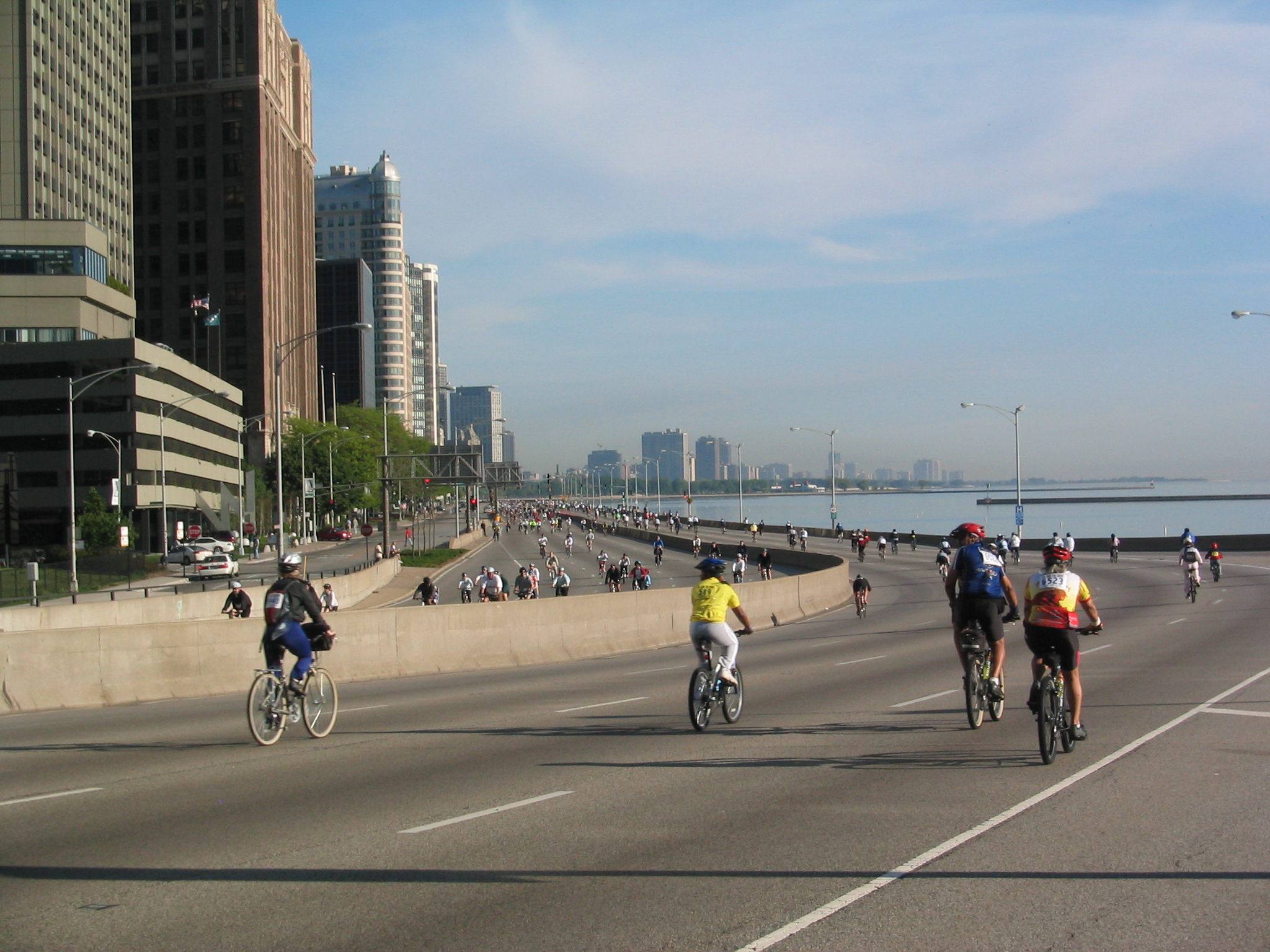
caption1 = from south duringBike The Drive
width2 = 83
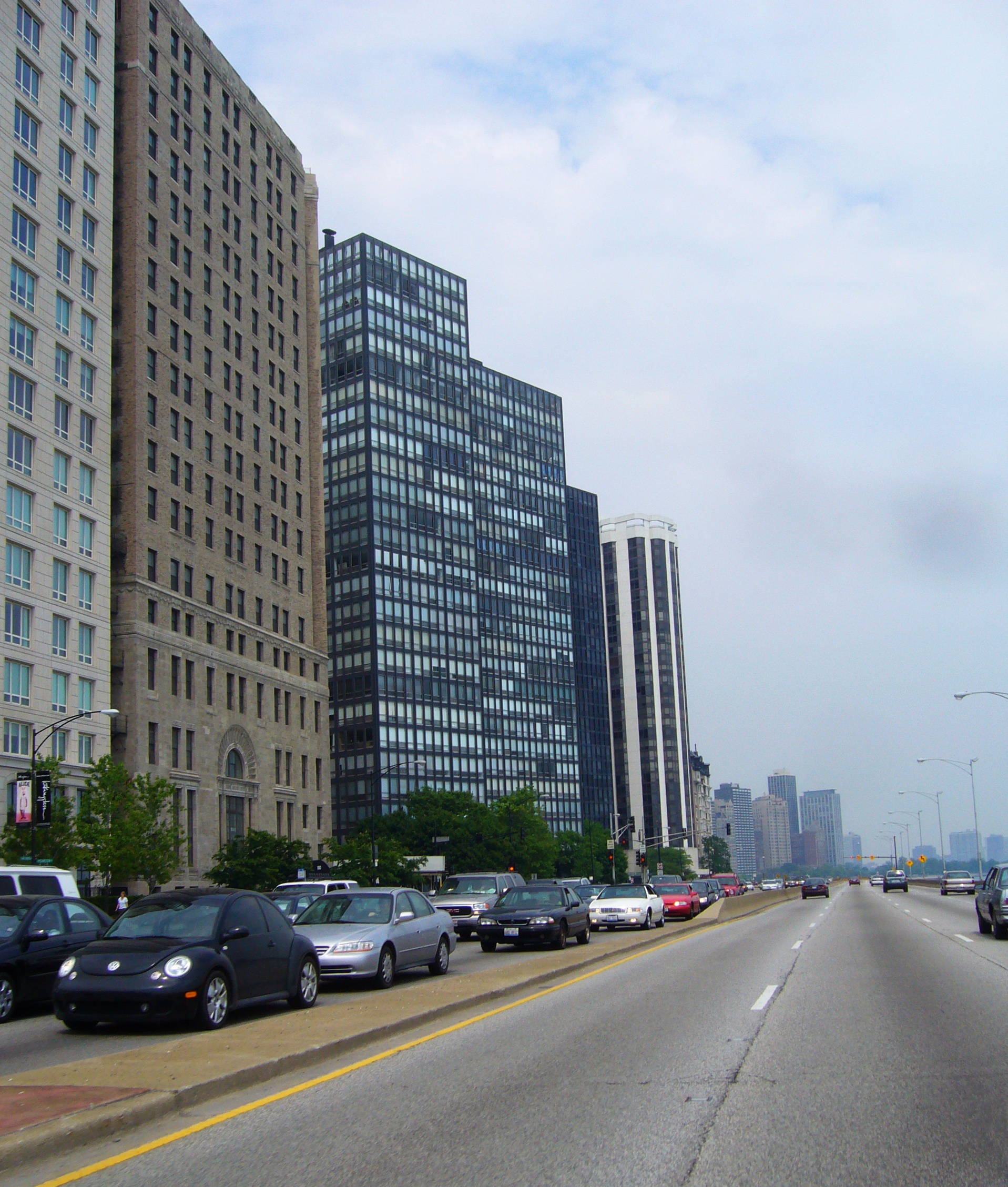
caption2 = from south
width3 = 130
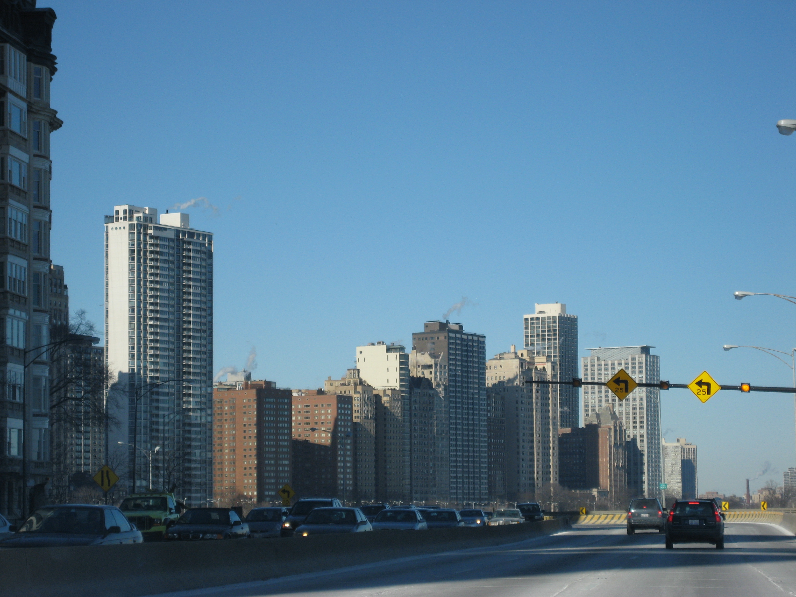
caption3 = Gold Coast fromStreeterville A political moniker
In the 20th century, the tiny neighborhoods near Lake Shore Drive came to be occupied by exclusive high-rise apartment, condominiums and co-op buildings. To the political columnist
Mike Royko , Lake Shore Drive was goo-goo territory, a land occupied by Chicago's wealthy "good-government" types. Royko sometimes used Lake Shore Drive as a political moniker. Though he often agreed with the reformers, he looked upon them with the same cynical eye as his fictional Chicago everyman,Slats Grobnik .Inner/Outer Drive
Lake Shore Drive contains both an inner and an outer drive.
The original inner drive (or local) is used for slower local traffic and is connected to the street grid. The local drive runs from downtown in Streeterville to North Avenue (1600n), (becoming Cannon Drive). Then the inner drive reappears just south of Diversey Parkway (approx. 2700n), continuing north to Irving Park Road (4000n). The portion from Belmont (3200n) to just south of Irving Park (3900n) was previously named Sheridan Road (which can still be seen carved in stone in at least one vintage high-rise).
The outer drive (or express) with limited-access runs from the south side of the city, north to the terminus at Hollywood Avenue (5700n) in the Edgewater neighborhood.
Lake Shore Drive runs both north/south and east/west, like several other major streets in Chicago. East Lake Shore Drive in the Gold Coast neighborhood is one of the most prestigious addresses in the city partly due to its roughly 1-block long length.
Other streets in Chicago that run both north/south and east/west include
Wacker Drive ,Sheridan Road , and Hyde Park Blvd. The Lakefront Bike Trail, an 18 mile bike trails runs to the east of Lake Shore Drive for most of its length.It is used as an exit road from Chicago Bears games, because it runs right next to Soldier Field.
Lake Shore Drive in popular culture
Several
film s based in Chicago feature scenes on Lake Shore Drive, including "love jones ", "Cheaper by the Dozen ", "Ferris Bueller's Day Off ", "The Blues Brothers ", "Risky Business ", "My Best Friend's Wedding ", and "National Lampoon's Vacation ". In "When Harry Met Sally ", the title characters are seen taking Lake Shore Drive in the opposite compass direction to that which their origin point and destination would require. Lake Shore Drive is also seen in AT&T's/"The New Cingular's" "Weight" ad with the ad's protagonist driving south along Lake Shore Drive towards the John Hancock Building. Also, the opening credits of the late 1980s and early 1990s sticomMarried With Children features a flyover of Lake Shore Drive.The 1971 song "Lake Shore Drive" by
Aliotta-Haynes-Jeremiah is a reference to the road and an allusion to its initials,LSD . Styx mentions the road in their 1979 song "Borrowed Time" as well as "Back to Chicago" from 1990. The road is also mentioned in the 2005Kanye West song "Drive Slow", and also in his verse in the Boost Mobile promotional single "Whole City Behind Us". The song "Lake Shore Drive" byArt Porter is also about the famous road.Because of the connection to drugs, it was believed that the US Post Office would not deliver mail to a Lake Shore Drive address if it were abbreviated LSD.Fact|date=February 2007 The Post Office announced in the early 1990s that this practice would be halted, and LSD was an accepted abbreviation.
Exit list
The entire road is in Chicago, Cook County.
Locations of note
*
Chicago Spire (supertall skyscraper currently under construction)
*Chicago Yacht Club
*DuSable Park
*Glass House apartments
*Grant Park
*International Museum of Surgical Science
*Jackson Park
*Lake Point Tower
*Lincoln Park
*McCormick Place
*Museum Campus Chicago :*Adler Planetarium :*Field Museum of Natural History :*Shedd Aquarium
*Museum of Science and Industry
*Navy Pier
*Northerly Island
*Oak Street Beach
*One Museum Park
*Playboy Enterprises
*Soldier Field Neighborhoods of Chicago
*Bronzeville
*Edgewater
*Hyde Park
*Kenwood
*Lakeview
*Lincoln Park
*Gold Coast
*Streeterville
*South Shore
*Uptown
*WoodlawnSee also
*
Bike The Drive
*Boulevard Lakefront Tour References
External Links
* [http://www.forgottenchicago.com/lsd.php Lake Shore Drive Redux] from ForgottenChicago.com
* [http://foreverfreeandclear.org/ The Campaign to Depave Lake Shore Drive]
* [http://www.gcmtravelstats.com/Default.aspx?selLinks1=20 Historic, Current & Average Travel Times For Lake Shore Drive]
Wikimedia Foundation. 2010.