- Moyo Town
-
Moyo Location in Uganda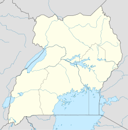
 Moyo
MoyoCoordinates: 03°39′18″N 31°43′12″E / 3.655°N 31.72°E Country  Uganda
Region Northern Uganda Sub-region West Nile sub-region District Moyo District Government – Mayor Elevation 2,690 ft (820 m) Population (2011 Estimate) – Total 23,700 Moyo, is the main municipal, administrative and commercial center of Moyo District in Northern Uganda. The district headquarters are located here. The district is named after the town.
Contents
Location
Moyo is located approximately 455 kilometres (283 mi), by road, northwest of Kampala, Uganda's capital and largest city. [1] It is reached by road from Arua, the largest town in the sub-region, located approximately 140 kilometres (87 mi), by road, southwest of Moyo.[2] There are scheduled flights to Moyo Airport: (IATA: OYG, ICAO: N/A), via Arua Airport, from Entebbe International Airport on Eagle Air. The coordinates of the town are:03 39 18N, 31 43 12E (Latitude 3.6550; Longitude:31.7200). The border with Southern Sudan lies only 7 kilometres (4.3 mi), by road, north of the town.[3]
Population
The 2002 national census estimated the population of Moyo at 12,074 and in 2008, the Uganda Bureau of Statistics (UBOS), estimated the population of the town at 18,800.[4] In 2011, UBOS estimated the mid-year population of Moyo at 23,700.[5]
Landmarks
The following landmarks are located in Moyo Town or close to the town limits:
- The headquarters of Moyo District Administration
- The offices of Moyo Town Council
- Moyo Airport - A civilian airport administered by the Uganda Civil Aviation Authority.
- Moyo Central Market
Other points of interest
Other points of interest in or near Moyo, include the following:
- A branch of Stanbic Bank
- Moyo Hospital - A 176 bed public hospital administered by the Uganda Ministry of Health
- Moyo Campus of Uganda Martyrs University
Photos
See also
References
External links
 Moyo DistrictCapital: Moyo
Towns and
villagesMoyoGeography Albert NileEconomy Stanbic Bank · Gwere-Luzira Power StationNotable
landmarksMoyo Hospital · Moyo AirportCategories:- Populated places in Uganda
- Cities in the Great Rift Valley
- Northern Region, Uganda
- Moyo District

Wikimedia Foundation. 2010.