- Oklahoma State Highway 36
-
State Highway 36
Route information Maintained by ODOT Length: 44.5 mi (71.6 km) Major junctions South end: 

 I-44/US-277/US-281 north of Burkburnett, Texas
North end: I-44/Bailey Tpk/US-277/US-281 south of LawtonHighway system Oklahoma State Highways
Oklahoma turnpike system←  SH-35
SH-35SH-37  →
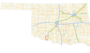
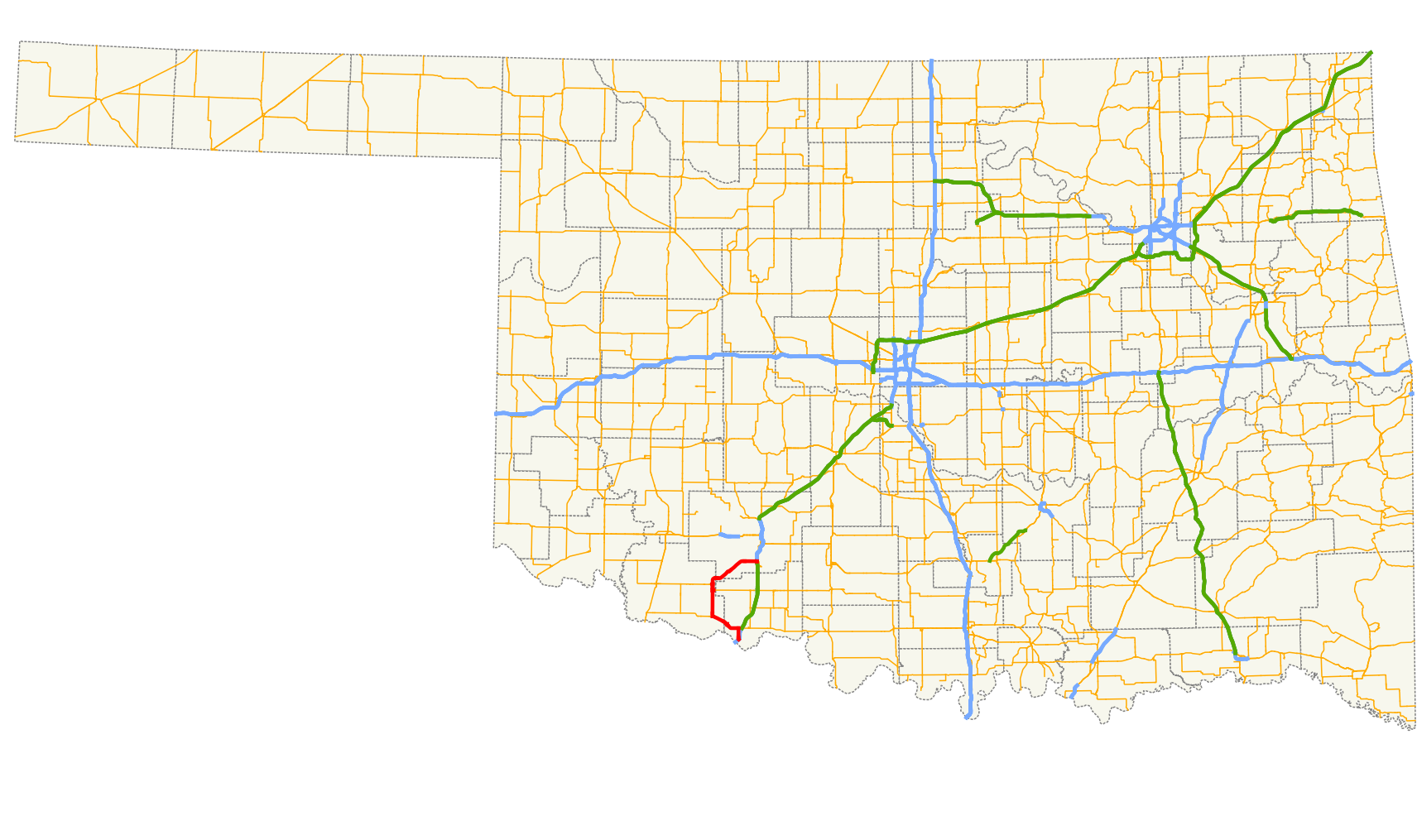
→State Highway 36 (abbreviated SH-36 or OK-36) is a state highway in Oklahoma. It runs for 44.5 mi[1] (71.62 km), forming a western loop route from Interstate 44, which it connects to at both ends. It passes through Cotton Co., Tillman Co., and Comanche Co.. It has no lettered spur routes.
Contents
Route description
SH-36 begins at Exit 1 on Interstate 44 and heads northward to meet U.S. Highway 70, which it then overlaps headed westbound for 9 miles (14.4 km) before splitting off near Grandfield. It heads north from there for 9 more miles, has a 2 mile (3.2 km) concurrency with State Highway 5, after which it turns to the northeast to pass through Chattanooga and Faxon before ending at I-44 six miles (10 km) south of Lawton.
Notes
- Exit 1, the first (or last) exit from I-44 in Oklahoma, is for SH-36.
- The last free exit on I-44 when headed southbound from Lawton is for SH-36, which marks the beginning of the southern portion of the H.E. Bailey Turnpike, which consists of two sections between Oklahoma City and the Red River north of Wichita Falls, Texas. The two sections of the turnpike are linked by the 16-mile (26 km) Pioneer Expressway, a toll-free section of I-44 through the Lawton/Fort Sill area.
References
- ^ Stuve, Eric. "OK-36". OKHighways. http://www.okhighways.com/ok36.html. Retrieved 2006-06-08.
External links
Categories:- State highways in Oklahoma

Wikimedia Foundation. 2010.