- Chartwell, Waikato
-
Chartwell 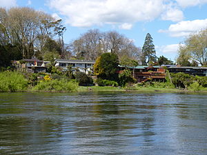
Houses on River Rd, Chartwell along the Waikato RiverBasic information Local authority Hamilton, New Zealand Electoral ward Hamilton East Date established 1962 Facilities Surrounds North Rototuna Northeast Chedworth Park East Fairview Downs South Fairfield Northwest Queenwood Chartwell is a suburb in north-eastern Hamilton, New Zealand. The suburb was named after Chartwell, the country home of Sir Winston Churchill. The area became a part of Hamilton in June 1962 and was officially defined as a suburb in 1974.[1] Most of the housing is private single or 2 level dwellings with little state housing. Streets near the square are used for parking. Private dwellings are being purchased by professionals to be used as business premises close to the square. The streets are well planted with trees.
Contents
Features of Chartwell
Lyndon Court
Chartwell's main shopping area is located on Lyndon Court. Westfield Chartwell, often still called by its original name Chartwell Square, is one of Hamilton's major malls. It has a 6 cinema multiplex as well as 126 retail shops, cafes and restaurants. The [Chartwell Library and the Lyndon Court Mall are located on the other side of the road. Lyndon Court is one of Hamilton's major transport hubs, with bus routes heading into Hamilton Central, Rototuna and the city Orbiter route.
Chartwell Park
Chartwell Park is located in between the suburbs of Chartwell and Queenwood. It features a walkway connecting these two suburbs[2]. Chartwell Park has five football (soccer) fields. These are the home ground playing fields for St. Joseph's Catholic School's football teams.
Education
- Hukanui School is a co-educational contributing primary (years 1-6) school. It has a decile rating of 10 and a roll of 596.[3] The school was the first to win the National Green Gold Enviro Schools Award in May 2006.[4]
- Bankwood School is a co-educational contributing primary (years 1-6) school. It has a decile rating of 2 and a roll of 308 [5]
The nearest secondary school is Fairfield College ,a decile 4, co-educational state secondary school with a roll of about 1100. It is located immediately to the south of Chartwell in the same street as Bankwwod Primary School. Its roll is about 50% Maori as of 2011. Between 2007 and 2010 the school had a new principal. In 2008 a vote of no confidence was taken in the principal and the board of trustees which resulted in student strikes and the beginning of an exodus of 140 staff over the next 3 years. Various enquires were held by the MOE who appointed a limited statutory manager and then a full commissioner. A special enquiry was under taken by an ERO team after official complaints about management practises at the school. A further investigation was undertaken of specific managers which resulted in the sudden departure of 2 deputy principals and shortly after the principal resigned without any public comment. In May 2011 the commissioner stated that the school now had an excellent management team, the finances had now been markedly improved and the staff were feeling more positive. A new principal will be appointed to start in Term 3 2011. St Paul's Collegiate is a private (fee paying) secondary, co-educational (girls year 11 and above ), part boarding school, modelled along the lines of an English public school. It is on the border between Chartwell and Fairfield and its fields adjoin with Fairfield Intermediate. Diocesan School for girls is a private decile 10 boarding college with day students.It has one of the highest NCEA passrates in New Zealand.It is well known for its outstanding rowing achievements and since 2000 has become the premier school for girl's cycling in NZ.It adjoins Fairfield College.
See also
References
- ^ Hamilton Street Name Index, Hamilton Public Library
- ^ "Sport Waikato : Around the region". http://www.sportwaikato.org.nz/main.cfm?id=119&sid=406&id2=407&an_id=406. Retrieved 2007-12-01.
- ^ "Te Kete Ipurangi schools database". http://www.tki.org.nz/e/schools/display_school_info.php?school_id=1749. Retrieved 2008-03-24.
- ^ "Enviroschools". Archived from the original on 2008-05-18. http://web.archive.org/web/20080518001053/http://www.enviroschools.org.nz/news.php?&pg=5. Retrieved 2008-03-24.
- ^ "Te Kete Ipurangi schools database". http://www.tki.org.nz/e/schools/display_school_info.php?school_id=1693. Retrieved 2008-03-24.
Coordinates: 37°45′38.06″S 175°16′34.4″E / 37.7605722°S 175.276222°E
Categories:- Parks in New Zealand
- Suburbs of Hamilton, New Zealand

Wikimedia Foundation. 2010.